Area Overview for SE2 0SH
Photos of SE2 0SH
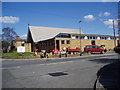
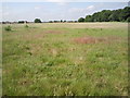
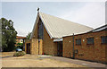
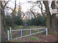
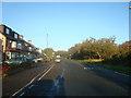
59 photos from this area
Area Information
Key information about the SE2 0SH including its size, population, and administrative classification.
- Area Type
- Postcode
- Area Size
- 9089 m²
- Population
- 1495
- Population Density
- 5669 people/km²
House Prices in SE2 0SH
29
Properties
£255,920
Average Sold Price
£67,500
Lowest Price
£530,000
Highest Price
Showing 29 properties
| Address | Type | Beds | Baths | Last Sale Price | Last Sale Date | |
|---|---|---|---|---|---|---|
| 104 Glenview, London, SE2 0SH | Semi-detached | 4 | 2 | £520,000 | Oct 2024 | |
| 90 Glenview, London, SE2 0SH | Semi-detached | 3 | 1 | £457,000 | Sep 2024 | |
| 126 Glenview, London, SE2 0SH | Semi-detached | 4 | 3 | £530,000 | Aug 2023 | |
| 132 Glenview, London, SE2 0SH | Terraced | 3 | 1 | £380,000 | Apr 2022 | |
| 142 Glenview, London, SE2 0SH | house | - | - | £475,000 | Jan 2020 | |
| 124 Glenview, London, SE2 0SH | Terraced | 3 | 1 | £405,000 | Sep 2018 | |
| 128 Glenview, London, SE2 0SH | house | 3 | 1 | £390,000 | Aug 2018 | |
| 120 Glenview, London, SE2 0SH | house | 3 | - | £372,500 | Aug 2017 | |
| 130 Glenview, London, SE2 0SH | Terraced | 3 | - | £260,000 | Oct 2014 | |
| 106 Glenview, London, SE2 0SH | Semi-detached | 3 | - | £290,000 | Sep 2014 |
Page 1 of 3
Energy Efficiency in SE2 0SH
Amenities
Schools
| Rank | School | Type | Entry gender | Ages |
|---|
Explore more schools in this area
Go to Schools tabDemographics
Household Size
Family (3-5 people)
most common
Accommodation Type
Houses
most common
Tenure
90
majority
Ethnic Group
White
most common
Religion
N/A
most common
Household Composition
N/A
most common
Age
47
median
Adults (30-64 years)
most common
Household Deprivation
N/A
with no deprivation
NS-SEC
31
in Lower managerial occupations
Explore more demographic insights in this area
Go to Demographics tabPlanning
Planning Constraints
- Flood RiskPremium
- Ramsar Wetland SitesPremium
- Area of Outstanding Natural BeautyPremium
- Protected Nature ReservePremium
- Protected WoodlandPremium