Area Overview for SE18 7LE
Photos of SE18 7LE
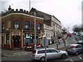
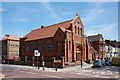
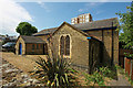
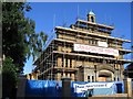


95 photos from this area
Area Information
Key information about the SE18 7LE including its size, population, and administrative classification.
- Area Type
- Postcode
- Area Size
- 4889 m²
- Population
- 2043
- Population Density
- 17734 people/km²
House Prices in SE18 7LE
34
Properties
£215,583
Average Sold Price
£69,995
Lowest Price
£371,000
Highest Price
Showing 34 properties
| Address | Type | Beds | Baths | Last Sale Price | Last Sale Date | |
|---|---|---|---|---|---|---|
| 14 St James Close, Plumstead, SE18 7LE | Terraced | 2 | 1 | £340,000 | Dec 2023 | |
| 21 St James Close, Plumstead, SE18 7LE | Retail | 2 | 1 | £371,000 | Oct 2022 | |
| 13 St James Close, Plumstead, SE18 7LE | Terraced | 2 | - | £290,000 | Oct 2019 | |
| 26 St James Close, Plumstead, SE18 7LE | Terraced | 2 | 1 | £325,000 | Apr 2017 | |
| 27 St James Close, Plumstead, SE18 7LE | Terraced | 2 | - | £265,000 | Sep 2015 | |
| 15 St James Close, Plumstead, SE18 7LE | Terraced | 2 | 1 | £250,000 | Sep 2014 | |
| 11 St James Close, Plumstead, SE18 7LE | house | 2 | - | £185,000 | Jan 2013 | |
| 19 St James Close, Plumstead, SE18 7LE | house | - | - | £156,000 | Jun 2009 | |
| 20 St James Close, Plumstead, SE18 7LE | Semi-detached | - | - | £125,000 | Apr 2007 | |
| 32 St James Close, Plumstead, SE18 7LE | Terraced | - | - | £128,000 | Dec 2002 |
Page 1 of 4
Energy Efficiency in SE18 7LE
Amenities
Schools
| Rank | School | Type | Entry gender | Ages |
|---|
Explore more schools in this area
Go to Schools tabDemographics
Household Size
Family (3-5 people)
most common
Accommodation Type
Flats
most common
Tenure
22
majority
Ethnic Group
White
most common
Religion
N/A
most common
Household Composition
N/A
most common
Age
47
median
Adults (30-64 years)
most common
Household Deprivation
N/A
with no deprivation
NS-SEC
22
in Lower managerial occupations
Explore more demographic insights in this area
Go to Demographics tabPlanning
Planning Constraints
- Flood RiskPremium
- Ramsar Wetland SitesPremium
- Area of Outstanding Natural BeautyPremium
- Protected Nature ReservePremium
- Protected WoodlandPremium