Area Overview for SE18 7HP
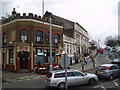
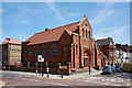
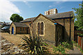
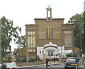
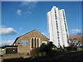
Photos of SE18 7HP


Area Information
Living in SE18 7HP means residing within a specific residential cluster that covers 2,395 square metres. This postcode area accommodates a population of 2,043 people, creating a compact neighbourhood with a population density of 853,104 people per square kilometre. The scale of this area suggests a tightly knit environment where local interactions are frequent due to the high concentration of residents in a small footprint. Daily life here is defined by the proximity of housing to essential services and transport links found across the wider SE18 postcode district. While the data defines this location strictly by its boundaries, the immediate surroundings offer access to Woolwich Arsenal Station, Plumstead Station, and Woolwich Dockyard for rail travel. Residents can also reach Woolwich Arsenal Pier and the Woolwich Ferry North Pier within practical reach, facilitating connections to Greenwich and Island Gardens. The area sits near several retail outlets including Sainsburys Woolwich and various Co-op branches, ensuring that grocery shopping and daily necessities are accessible without lengthy commutes. For those prioritising accessibility, London City Airport is located nearby, providing a strategic advantage for frequent travellers. This postcode represents a functional residential choice where convenience forms the core of the living experience.
- Area Type
- Postcode
- Area Size
- 2395 m²
- Population
- 2043
- Population Density
- 17734 people/km²
The property market in SE18 7HP is defined by a distinct lack of owner-occupation, with only 22% of residents owning their homes. This imbalance indicates that the area functions largely as a rental hub where tenants hold the majority of keys within the local housing stock. Flats constitute the primary accommodation type, a feature consistent with the small area size of 2,395 square metres and the high population density. Prospective buyers looking for freehold properties in this specific postcode may find limited stock compared to the volume of rental units available. The dominance of rented accommodation suggests that the development history of this area likely focused on private renting schemes or apartments designed for workers rather than family buyers seeking to build equity. If you are considering purchasing a home here, you are entering a section of the London market where security of tenure differs significantly from traditional suburban estates. The presence of 2,043 people in such a confined space further emphasises that space is a precious commodity, likely driving up demand for the available flats. Your options may be restricted to the rental ladder rather than long-term ownership in this immediate cluster.
House Prices in SE18 7HP
Showing 39 properties
Energy Efficiency in SE18 7HP
Daily life in SE18 7HP benefits from immediate access to a wide range of retail and transport amenities. For shopping needs, you can visit Co-op Herbert, Co-op Links, and Sainsburys Woolwich, which handle everyday groceries and household essentials. Transport options are extensive, with five notable locations offering rail connections including Woolwich Arsenal Station, Plumstead Station, and Woolwich Dockyard. Ferry services are also prominent, with access to Woolwich Arsenal Pier, Woolwich Ferry North Pier, and Barrier Gardens Pier for crossings across the River Thames. For those who prefer underground travel, five stations provide metro access, including King George V, Gallions Reach Station, and Cyprus. London City Airport serves as the nearest airport facility, offering rapid links to thefinancial district. This diversity of transport modes and retail outlets ensures that you do not need to rely solely on a vehicle for your daily commute or shopping trips. The concentration of these five units in each category creates a convenient neighbourhood where most errands can be completed within a short walk or a brief train ride.
Amenities
Schools
Families moving to SE18 7HP have access to several well-regarded primary schools located nearby. Foxfield Primary School holds a status of being outstanding according to Ofsted ratings, making it one of the most desirable educational options in the vicinity. Another primary school, St Margaret's Church of England Primary School, carries a good Ofsted rating, offering reliable education for children in the age range served by these institutions. Foxfield Infant School also operates within the local catchment area, providing early years education for younger pupils. All listed institutions are primary schools, which means that secondary education options lie further afield and are not contained within the immediate data for this specific postcode cluster. The concentration of primary education facilities reflects the needs of families residing in the surrounding SE18 area, even though the specific postcode of 2,395 square metres hosts very few independent households. When planning your move, you should verify the exact catchment boundaries for Foxfield Primary School and St Margaret's Church of England Primary School, as these specific schools offer the best rated local instruction available to residents.
| Rank | School | Type | Entry gender | Ages |
|---|
Explore more schools in this area
Go to Schools tabDemographics
The community profile for SE18 7HP indicates a mature demographic where the median age is 47 years. The resident population is predominantly comprised of adults aged between 30 and 64 years, reflecting a stable, established neighbourhood rather than one dominated by young families or students. Houses in multiple occupations make up a small portion of the housing stock, which impacts the typical lifestyle and interaction patterns of the people living here. Only 22% of residents own their homes, suggesting that the majority of the population operates within the rental market. This high proportion of private renting often correlates with greater workforce mobility and a transient element compared to owner-occupied districts. Regarding diversity, White British residents form the predominant ethnic group within this specific postcode area. Accommodation types are characterised primarily by flats, which aligns with the smaller footprint of the area and supports the density needs of the 2,043 residents. The age structure and housing tenure point to a resident base likely comprised of professionals, older households, or shared living arrangements common in urban flat developments.
Household Size
Accommodation Type
Tenure
Ethnic Group
Religion
Household Composition
Age
Household Deprivation
NS-SEC
Explore more demographic insights in this area
Go to Demographics tabPlanning
Planning Constraints
- Flood RiskPremium
- Ramsar Wetland SitesPremium
- Area of Outstanding Natural BeautyPremium
- Protected Nature ReservePremium
- Protected WoodlandPremium