Area Overview for SE18 7HN
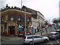
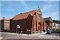
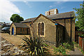
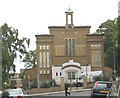
Photos of SE18 7HN


Area Information
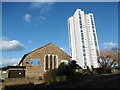
Living in SE18 7HN means residing within a specific residential cluster defined by the postcode, which covers a land area of exactly 1197 square metres. This small footprint supports a population of 2043 people, creating a high density environment at 1.7 million people per square kilometre according to current records. The area functions as a tightly packed neighbourhood where daily life often moves quickly due to the concentration of residents. You are located in a setting where every square metre is utilised, making distances short but the sense of space limited. The character of SE18 7HN is shaped by this compact nature, distinguishing it from sprawling suburbs where homes sit further apart. Residents experience a community where neighbours are inevitably close by, fostering interactions that might be less frequent in larger districts. The identity of this postcode area relies on its status as a defined cluster rather than a broad zone of expansive gardens or wide boulevards. For those considering homes in SE18 7HN, understanding this physical constraint is essential to envisioning every morning commute and evening stroll. The area does not offer vast tracts of land, but it provides a defined boundary for local engagement and community interaction.
- Area Type
- Postcode
- Area Size
- 1197 m²
- Population
- 2043
- Population Density
- 17734 people/km²
The property market in SE18 7HN is defined by a distinct lack of owner-occupiers, with home ownership sitting at just 22 per cent. This statistic creates a market where investors and landlords likely play a significant role alongside tenants seeking secure accommodation. Flats are the predominant accommodation type, meaning you can expect to find a stock of apartments rather than detached houses or semi-detached homes in this specific postcode. This profile suggests a building style suited to urban density and smaller plots of land. Buyers looking for homes in SE18 7HN should anticipate navigating a situation where few residents have purchased their own dwellings. The nature of the area, described as a small residential cluster, aligns perfectly with the dominance of flats over traditional houses. If you are interested in buying a leasehold property or an apartment, the data indicates this is the primary route to ownership here. The low proportion of homeowners implies that the local economy relies heavily on the rental sector. Understanding this balance is crucial for anyone considering a move to this high-density environment.
House Prices in SE18 7HN
Showing 24 properties
Energy Efficiency in SE18 7HN
Residents of SE18 7HN have access to a range of amenities within practical reach for daily shopping and transport. For retail needs, you can visit Co-op Herbert, Co-op Links, or Sainsburys Woolwich, offering five major retail options nearby. Transport links are extensive, with five rail stations including Woolwich Arsenal Station, Plumstead Station, and Woolwich Dockyard just minutes away. Ferry services are also prominent, with five piers accessible such as Woolwich Arsenal Pier, Woolwich Ferry North Pier, and Barrier Gardens Pier. Additionally, five metro stations serve the area, featuring King George V., Gallions Reach Station, and Cyprus. London City Airport stands as the single notable airport facility within the vicinity. This transport density means you do not need a car to function, as buses, trains, ferries, and underground lines are all highly accessible. The proximity of Sainsburys Woolwich and multiple Co-operatives ensures fresh food and daily essentials are always close.
Amenities
Schools
Several educational institutions serve families residing near SE18 7HN, offering a mix of primary level choices. Foxfield Primary School operates as a primary school in the vicinity, providing education for younger children. St Margaret's Church of England Primary School also serves the local community and holds a 'good' Ofsted rating in its latest inspection. Foxfield Infant School is another primary option available to residents in the area. A second entry for Foxfield Primary School in the local dataset lists it as 'outstanding' from an Ofsted perspective, reflecting a high standard of performance. This mix of institutions means you have multiple primary options nearby, though the specific details distinguish between infant and primary phases. For families moving to this area, the presence of these rated schools is a key consideration. St Margaret's maintains its 'good' status, while the outstanding rating for Foxfield Primary School offers an alternative of exceptional quality. These schools form the backbone of the local education landscape for children living in SE18 7HN.
| Rank | School | Type | Entry gender | Ages |
|---|
Explore more schools in this area
Go to Schools tabDemographics
The community in SE18 7HN reflects a mature demographic profile with a median age of 47 years. Adults between the ages of 30 and 64 constitute the most common age range within this population. You will find that housing preferences often align with this established age group, resulting in a stable residential environment. Home ownership stands at exactly 22 per cent, indicating that the majority of residents rent their properties rather than own them outright. Flats form the predominant accommodation type, confirming that high-density living arrangements are the standard feature of the neighbourhood. The predominant ethnic group recorded is White, which shapes the cultural landscape of the area. These figures paint a picture of an area where long-term stability coexists with a rental majority. The concentration of adults in the 30-64 bracket suggests a population that has likely settled in the location to build careers and families. With home ownership at such a low rate, you must consider the implications for buying a freehold property versus navigating the rental market. The demographic data confirms that SE18 7HN is an area of settled living defined by flat living and a significant adult presence.
Household Size
Accommodation Type
Tenure
Ethnic Group
Religion
Household Composition
Age
Household Deprivation
NS-SEC
Explore more demographic insights in this area
Go to Demographics tabPlanning
Planning Constraints
- Flood RiskPremium
- Ramsar Wetland SitesPremium
- Area of Outstanding Natural BeautyPremium
- Protected Nature ReservePremium
- Protected WoodlandPremium