Area Overview for SE18 6NA
Photos of SE18 6NA


Area Information
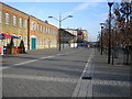
Living in SE18 6NA offers a dense residential experience within a defined cluster covering only 1,146 square metres. This small postcode serves a population of 1,934 people, creating an environment where neighbours are close by and local services are immediately accessible. The area functions as a specific residential pocket rather than a broad district, which means daily journeys often rely on immediate local provisions or rapid transit links to wider Greenwich and London locations. You will find yourself part of a compact community where the rules of engagement are simple: get on and get off, knowing that support networks and transport hubs are just steps away. The concentration of residents in such a small footprint suggests a high intensity of living, where noise and activity are constant companions to your home life. This layout is typical of inner suburban zones that have developed organically over decades.
- Area Type
- Postcode
- Area Size
- 1146 m²
- Population
- 1934
- Population Density
- 8205 people/km²
The property market in SE18 6NA is heavily weighted towards the rental sector, with home ownership sitting at just 28%. This low conversion rate suggests a region where renting remains the primary mode of accommodation for households. Flats constitute the main accommodation type, reflecting a housing stock designed for vertical living rather than sprawling suburban homes. When you look at homes in SE18 6NA, you are likely dealing with modern estates or converted urban blocks rather than post-war terraced streets or traditional villas. The high population density of roughly 1.69 million people per square kilometre implies that land is scarce and every square metre is utilised for housing purposes. Consequently, buyers traditionally looking for larger family houses with private gardens will struggle to find anything here. Instead, the market caters to individuals, couples, or small families who require efficient use of space. Investing or buying here requires an understanding that these flats operate on a shared economy model, where building maintenance and communal areas are central to the cost structure and lifestyle.
House Prices in SE18 6NA
No properties found in this postcode.
Energy Efficiency in SE18 6NA
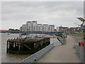
Your daily life in SE18 6NA revolves around convenient access to major retail and transport nodes. You are within practical reach of Iceland Powis, Lidl Woolwich, and Sainsburys Woolwich, offering a comprehensive selection of grocery shopping and daily essentials. For commutes, rail travel is highly accessible with five stations nearby including Woolwich Arsenal Station, Woolwich Dockyard, and Plumstead Station. If you require a connection further afield, the Woolwich Ferry North Pier and Woolwich Arsenal Pier provide ferry services, while the Barriers Gardens Pier offers additional crossing options. London City Airport is also noted as a nearby amenity, providing international travel access. The metro network connects to King George V and Cyprus locations, expanding your horizons beyond the immediate borough. This density of transport options means you can choose between driving onto the bus, catching a train, or taking a ferry based on your schedule. The presence of multiple supermarkets ensures you never have to drive far for basic food needs, making this a practical choice for busy professionals.
Amenities
Schools
Families living in SE18 6NA have several educational options within practical reach. Saint Mary Magdalene Church of England All Through School operates as an all-through institution and currently holds an Ofsted rating of good. This institution serves children through the entire primary and secondary phase. Nearby residential clusters also house Mulgrave Infant and Nursery School, catering specifically to young children during the primary years. For the very young, Cyril Henry Nursery School provides early education for the toddler and nursery age groups. The mix of all-through schools and separate infant nurseries allows parents to choose different educational pathways depending on their preferences. A parent might prefer the continuity of the all-through model at Saint Mary Magdalene or opt for the more specialised focus of Mulgrave for the primary years. These institutions form the backbone of the local education network, ensuring that children in SE18 6NA have immediate access to regulated state education without needing to travel long distances to reach the nearest comprehensive.
| Rank | School | Type | Entry gender | Ages |
|---|
Explore more schools in this area
Go to Schools tabDemographics
The community in SE18 6NA is defined by a mature demographic skew, with a median age of 47 years. Most of your neighbours will be adults, primarily falling within the 30-64 years age range, indicating a settlement that attracts families seeking stability or older residents preparing for retirement. You will find that only 28% of the population are homeowners, meaning the vast majority of residents are sitting on rental agreements or tenancies. Flats dominate the accommodation types here, rather than detached or semi-detached houses, which aligns with the high population density of 1,687,961 people per square kilometre recorded for this specific zone. The predominant ethnic group is White, contributing to a distinct cultural make-up that centres around established Anglo-Saxon traditions. For a single person or a young couple, this age skew might feel slightly older than a university town, but for families with school-aged children, it offers a settled and stable environment where long-term workers and parents coexist.
Household Size
Accommodation Type
Tenure
Ethnic Group
Religion
Household Composition
Age
Household Deprivation
NS-SEC
Explore more demographic insights in this area
Go to Demographics tabPlanning
Planning Constraints
- Flood RiskPremium
- Ramsar Wetland SitesPremium
- Area of Outstanding Natural BeautyPremium
- Protected Nature ReservePremium
- Protected WoodlandPremium