Area Overview for SE18 1RW
Photos of SE18 1RW
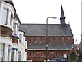
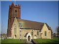
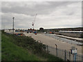
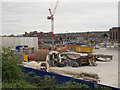
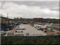
100 photos from this area
Area Information
Key information about the SE18 1RW including its size, population, and administrative classification.
- Area Type
- Postcode
- Area Size
- 7105 m²
- Population
- 1644
- Population Density
- 7799 people/km²
House Prices in SE18 1RW
55
Properties
£291,145
Average Sold Price
£21,002
Lowest Price
£590,000
Highest Price
Showing 55 properties
| Address | Type | Beds | Baths | Last Sale Price | Last Sale Date | |
|---|---|---|---|---|---|---|
| 129 Parkdale Road, Plumstead, SE18 1RW | Terraced | 3 | 2 | £455,000 | Sep 2023 | |
| 169 Parkdale Road, Plumstead, SE18 1RW | Semi-detached | 2 | 1 | £390,000 | Jun 2023 | |
| 159 Parkdale Road, Plumstead, SE18 1RW | Terraced | 2 | 1 | £439,000 | Jun 2023 | |
| 105 Parkdale Road, Plumstead, SE18 1RW | Terraced | 4 | 2 | £450,000 | Jan 2023 | |
| 125 Parkdale Road, Plumstead, SE18 1RW | Terraced | 3 | 1 | £390,000 | Feb 2022 | |
| 119 Parkdale Road, Plumstead, SE18 1RW | Terraced | 3 | 2 | £590,000 | Jun 2021 | |
| 99 Parkdale Road, Plumstead, SE18 1RW | Bungalow | 1 | 1 | £265,000 | May 2021 | |
| 171 Parkdale Road, Plumstead, SE18 1RW | house | - | - | £410,000 | May 2021 | |
| 167 Parkdale Road, Plumstead, SE18 1RW | house | - | - | £360,750 | Apr 2021 | |
| 75 Parkdale Road, Plumstead, SE18 1RW | house | 4 | 2 | £445,000 | Mar 2021 |
Page 1 of 6
Energy Efficiency in SE18 1RW
Amenities
Schools
| Rank | School | Type | Entry gender | Ages |
|---|
Explore more schools in this area
Go to Schools tabDemographics
Household Size
Family (3-5 people)
most common
Accommodation Type
Houses
most common
Tenure
55
majority
Ethnic Group
White
most common
Religion
N/A
most common
Household Composition
N/A
most common
Age
47
median
Adults (30-64 years)
most common
Household Deprivation
N/A
with no deprivation
NS-SEC
34
in Lower managerial occupations
Explore more demographic insights in this area
Go to Demographics tabPlanning
Planning Constraints
- Flood RiskPremium
- Ramsar Wetland SitesPremium
- Area of Outstanding Natural BeautyPremium
- Protected Nature ReservePremium
- Protected WoodlandPremium