Area Overview for SE18 1PZ
Photos of SE18 1PZ
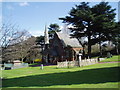

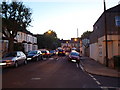
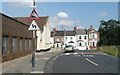
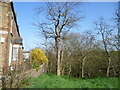
100 photos from this area
Area Information
Key information about the SE18 1PZ including its size, population, and administrative classification.
- Area Type
- Postcode
- Area Size
- 1.1 hectares
- Population
- 1644
- Population Density
- 7799 people/km²
House Prices in SE18 1PZ
73
Properties
£242,174
Average Sold Price
£48,000
Lowest Price
£552,000
Highest Price
Showing 73 properties
| Address | Type | Beds | Baths | Last Sale Price | Last Sale Date | |
|---|---|---|---|---|---|---|
| 77 Roydene Road, Plumstead, SE18 1PZ | Terraced | 2 | 1 | £400,000 | Aug 2024 | |
| 97 Roydene Road, Plumstead, SE18 1PZ | Detached | 2 | 1 | £418,500 | Jul 2024 | |
| 29 Roydene Road, Plumstead, SE18 1PZ | Terraced | 3 | 2 | £310,000 | Mar 2024 | |
| 55 Roydene Road, Plumstead, SE18 1PZ | Terraced | 2 | 1 | £425,000 | Sep 2023 | |
| 113 Roydene Road, Plumstead, SE18 1PZ | Terraced | 2 | 1 | £452,000 | Apr 2023 | |
| 95 Roydene Road, Plumstead, SE18 1PZ | Terraced | 2 | 1 | £400,000 | Feb 2023 | |
| 63 Roydene Road, Plumstead, SE18 1PZ | Terraced | 4 | 2 | £552,000 | Jan 2023 | |
| 21 Roydene Road, Plumstead, SE18 1PZ | Terraced | 3 | 1 | £325,000 | Oct 2022 | |
| 75 Roydene Road, Plumstead, SE18 1PZ | Retail | 3 | 1 | £407,000 | Aug 2022 | |
| 27 Roydene Road, Plumstead, SE18 1PZ | Terraced | 2 | 1 | £316,000 | May 2022 |
Page 1 of 8
Energy Efficiency in SE18 1PZ
Amenities
Schools
| Rank | School | Type | Entry gender | Ages |
|---|
Explore more schools in this area
Go to Schools tabDemographics
Household Size
Family (3-5 people)
most common
Accommodation Type
Houses
most common
Tenure
55
majority
Ethnic Group
White
most common
Religion
N/A
most common
Household Composition
N/A
most common
Age
47
median
Adults (30-64 years)
most common
Household Deprivation
N/A
with no deprivation
NS-SEC
34
in Lower managerial occupations
Explore more demographic insights in this area
Go to Demographics tabPlanning
Planning Constraints
- Flood RiskPremium
- Ramsar Wetland SitesPremium
- Area of Outstanding Natural BeautyPremium
- Protected Nature ReservePremium
- Protected WoodlandPremium