Area Overview for SE18 1ET
Photos of SE18 1ET
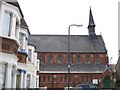

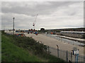
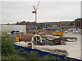
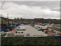
100 photos from this area
Area Information
Key information about the SE18 1ET including its size, population, and administrative classification.
- Area Type
- Postcode
- Area Size
- 5701 m²
- Population
- 2403
- Population Density
- 13771 people/km²
House Prices in SE18 1ET
63
Properties
£180,631
Average Sold Price
£37,500
Lowest Price
£410,000
Highest Price
Showing 63 properties
| Address | Type | Beds | Baths | Last Sale Price | Last Sale Date | |
|---|---|---|---|---|---|---|
| 39A Bannockburn Road, Plumstead, SE18 1ET | Flat | - | - | £265,000 | Oct 2024 | |
| 39 Bannockburn Road, Plumstead, SE18 1ET | Flat | - | - | £275,000 | Oct 2024 | |
| 59 Bannockburn Road, Plumstead, SE18 1ET | Flat | 1 | 1 | £160,000 | Sep 2024 | |
| 45 Bannockburn Road, Plumstead, SE18 1ET | Terraced | 3 | 1 | £410,000 | Jun 2021 | |
| 49 Bannockburn Road, Plumstead, SE18 1ET | house | 3 | - | £290,000 | Mar 2017 | |
| 3 Bannockburn Road, Plumstead, SE18 1ET | Terraced | 1 | 6 | £360,000 | Oct 2016 | |
| 5 Bannockburn Road, Plumstead, SE18 1ET | house | - | - | £193,000 | Oct 2012 | |
| 23 Bannockburn Road, Plumstead, SE18 1ET | house | 2 | 1 | £192,000 | Oct 2010 | |
| 9 Bannockburn Road, Plumstead, SE18 1ET | house | - | - | £205,000 | May 2010 | |
| 51 Bannockburn Road, Plumstead, SE18 1ET | Terraced | 4 | 2 | £200,000 | Oct 2009 |
Page 1 of 7
Energy Efficiency in SE18 1ET
Amenities
Schools
| Rank | School | Type | Entry gender | Ages |
|---|
Explore more schools in this area
Go to Schools tabDemographics
Household Size
One person
most common
Accommodation Type
Flats
most common
Tenure
24
majority
Ethnic Group
asian_total
most common
Religion
N/A
most common
Household Composition
N/A
most common
Age
47
median
Adults (30-64 years)
most common
Household Deprivation
N/A
with no deprivation
NS-SEC
15
in Lower managerial occupations
Explore more demographic insights in this area
Go to Demographics tabPlanning
Planning Constraints
- Flood RiskPremium
- Ramsar Wetland SitesPremium
- Area of Outstanding Natural BeautyPremium
- Protected Nature ReservePremium
- Protected WoodlandPremium