Area Overview for SE15 3JJ
Photos of SE15 3JJ
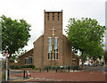
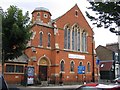
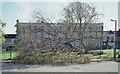
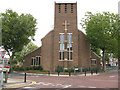
100 photos from this area
Area Information
Key information about the SE15 3JJ including its size, population, and administrative classification.
- Area Type
- Postcode
- Area Size
- 1.1 hectares
- Population
- 1746
- Population Density
- 8917 people/km²
House Prices in SE15 3JJ
33
Properties
£319,591
Average Sold Price
£115,000
Lowest Price
£580,000
Highest Price
Showing 33 properties
| Address | Type | Beds | Baths | Last Sale Price | Last Sale Date | |
|---|---|---|---|---|---|---|
| 39 Torridge Gardens, London, SE15 3JJ | house | - | - | £580,000 | Apr 2024 | |
| 57 Torridge Gardens, London, SE15 3JJ | Terraced | 3 | 1 | £472,500 | Jan 2020 | |
| 35 Torridge Gardens, London, SE15 3JJ | Terraced | 3 | 1 | £540,000 | Nov 2019 | |
| 47 Torridge Gardens, London, SE15 3JJ | Terraced | 3 | - | £500,000 | Apr 2019 | |
| 53 Torridge Gardens, London, SE15 3JJ | Terraced | 3 | - | £321,000 | Mar 2014 | |
| 25 Torridge Gardens, London, SE15 3JJ | house | 3 | - | £225,000 | Jun 2010 | |
| 59 Torridge Gardens, London, SE15 3JJ | Terraced | - | - | £250,000 | Jun 2007 | |
| 29 Torridge Gardens, London, SE15 3JJ | Terraced | - | - | £152,000 | Oct 2004 | |
| 61 Torridge Gardens, London, SE15 3JJ | Terraced | - | - | £230,000 | Aug 2004 | |
| 49 Torridge Gardens, London, SE15 3JJ | Terraced | - | - | £130,000 | Oct 2001 |
Page 1 of 4
Energy Efficiency in SE15 3JJ
Amenities
Schools
| Rank | School | Type | Entry gender | Ages |
|---|
Explore more schools in this area
Go to Schools tabDemographics
Household Size
Family (3-5 people)
most common
Accommodation Type
Flats
most common
Tenure
27
majority
Ethnic Group
black_total
most common
Religion
N/A
most common
Household Composition
N/A
most common
Age
47
median
Adults (30-64 years)
most common
Household Deprivation
N/A
with no deprivation
NS-SEC
32
in Lower managerial occupations
Explore more demographic insights in this area
Go to Demographics tabPlanning
Planning Constraints
- Flood RiskPremium
- Ramsar Wetland SitesPremium
- Area of Outstanding Natural BeautyPremium
- Protected Nature ReservePremium
- Protected WoodlandPremium