Area Overview for SE15 3DB
Photos of SE15 3DB
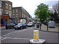
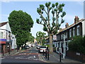
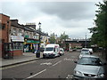
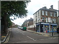
100 photos from this area
Area Information
Key information about the SE15 3DB including its size, population, and administrative classification.
- Area Type
- Postcode
- Area Size
- 1.3 hectares
- Population
- 1704
- Population Density
- 5052 people/km²
House Prices in SE15 3DB
43
Properties
£529,390
Average Sold Price
£109,500
Lowest Price
£1,050,000
Highest Price
Showing 43 properties
| Address | Type | Beds | Baths | Last Sale Price | Last Sale Date | |
|---|---|---|---|---|---|---|
| 6 Lanbury Road, London, SE15 3DB | Semi-detached | 3 | 1 | £695,000 | Feb 2025 | |
| 38 Lanbury Road, London, SE15 3DB | Semi-detached | 3 | 1 | £866,250 | Oct 2024 | |
| 20 Lanbury Road, London, SE15 3DB | house | 2 | 1 | £1,050,000 | Aug 2022 | |
| 16 Lanbury Road, London, SE15 3DB | house | 4 | 2 | £845,000 | Jan 2022 | |
| 36 Lanbury Road, London, SE15 3DB | house | - | - | £725,000 | Oct 2020 | |
| 28 Lanbury Road, London, SE15 3DB | Semi-detached | 3 | - | £785,000 | Jun 2019 | |
| 9 Lanbury Road, London, SE15 3DB | house | 3 | 1 | £640,000 | Nov 2018 | |
| 17 Lanbury Road, London, SE15 3DB | Terraced | 5 | 2 | £765,000 | Oct 2015 | |
| 32 Lanbury Road, London, SE15 3DB | house | 3 | 1 | £400,000 | Oct 2013 | |
| 27 Lanbury Road, London, SE15 3DB | Semi-detached | 4 | 2 | £355,000 | Aug 2011 |
Page 1 of 5
Energy Efficiency in SE15 3DB
Amenities
Schools
| Rank | School | Type | Entry gender | Ages |
|---|
Explore more schools in this area
Go to Schools tabDemographics
Household Size
Family (3-5 people)
most common
Accommodation Type
Houses
most common
Tenure
65
majority
Ethnic Group
White
most common
Religion
N/A
most common
Household Composition
N/A
most common
Age
47
median
Adults (30-64 years)
most common
Household Deprivation
N/A
with no deprivation
NS-SEC
52
in Lower managerial occupations
Explore more demographic insights in this area
Go to Demographics tabPlanning
Planning Constraints
- Flood RiskPremium
- Ramsar Wetland SitesPremium
- Area of Outstanding Natural BeautyPremium
- Protected Nature ReservePremium
- Protected WoodlandPremium