Area Overview for SE15 3BZ
Photos of SE15 3BZ

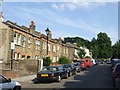
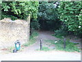
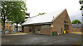
100 photos from this area
Area Information
Key information about the SE15 3BZ including its size, population, and administrative classification.
- Area Type
- Postcode
- Area Size
- 9033 m²
- Population
- 1704
- Population Density
- 5052 people/km²
House Prices in SE15 3BZ
52
Properties
£636,146
Average Sold Price
£75,000
Lowest Price
£1,265,000
Highest Price
Showing 52 properties
| Address | Type | Beds | Baths | Last Sale Price | Last Sale Date | |
|---|---|---|---|---|---|---|
| 56 Harlescott Road, London, SE15 3BZ | Terraced | 3 | 1 | £1,050,000 | May 2024 | |
| 64 Harlescott Road, London, SE15 3BZ | Terraced | 5 | 2 | £1,185,000 | Mar 2024 | |
| 82 Harlescott Road, London, SE15 3BZ | Terraced | 4 | 1 | £1,075,000 | Aug 2023 | |
| 10 Harlescott Road, London, SE15 3BZ | house | - | - | £1,260,000 | Sep 2021 | |
| 38 Harlescott Road, London, SE15 3BZ | house | - | - | £1,171,000 | Jun 2021 | |
| 76 Harlescott Road, London, SE15 3BZ | house | - | - | £1,265,000 | Feb 2021 | |
| 30 Harlescott Road, London, SE15 3BZ | Terraced | 3 | - | £980,000 | Oct 2017 | |
| 48 Harlescott Road, London, SE15 3BZ | Terraced | 3 | 1 | £825,000 | Jul 2015 | |
| 6 Harlescott Road, London, SE15 3BZ | Semi-detached | 3 | - | £780,000 | Aug 2014 | |
| 40 Harlescott Road, London, SE15 3BZ | house | 3 | 1 | £845,000 | Aug 2014 |
Page 1 of 6
Energy Efficiency in SE15 3BZ
Amenities
Schools
| Rank | School | Type | Entry gender | Ages |
|---|
Explore more schools in this area
Go to Schools tabDemographics
Household Size
Family (3-5 people)
most common
Accommodation Type
Houses
most common
Tenure
65
majority
Ethnic Group
White
most common
Religion
N/A
most common
Household Composition
N/A
most common
Age
47
median
Adults (30-64 years)
most common
Household Deprivation
N/A
with no deprivation
NS-SEC
52
in Lower managerial occupations
Explore more demographic insights in this area
Go to Demographics tabPlanning
Planning Constraints
- Flood RiskPremium
- Ramsar Wetland SitesPremium
- Area of Outstanding Natural BeautyPremium
- Protected Nature ReservePremium
- Protected WoodlandPremium