Area Overview for SE14 5PN
Photos of SE14 5PN


Area Information
SE14 5PN is a small, residential postcode cluster covering just 1.7 hectares. This compact area houses 2,067 residents within the SE14 postcode district. You can expect a dense environment, as this specific location records a population density of 120,830 people per square kilometre. Living in SE14 5PN means navigating a high-density urban enclave where every square metre serves a purpose. The area functions as a tight-knit residential pocket rather than a sprawling suburb. Its size suggests a micro-community where neighbours are likely to know each other. The location benefits from proximity to greater South East London while maintaining a distinct residential identity. Prospective buyers appreciate how this postcode avoids the sprawl associated with larger districts. Instead, you find a concentrated zone designed primarily for housing. This density supports efficient public transport connections and places essential services within a short walk. You will find yourself surrounded by other households in this specific square kilometre. The restricted size means that land value remains high and space at a premium. This postcode represents a focused living experience in a busy part of the capital.
- Area Type
- Postcode
- Area Size
- 1.7 hectares
- Population
- 2067
- Population Density
- 11817 people/km²
The housing stock in SE14 5PN is defined by a specific ownership and type split. Only 36 per cent of residents own their homes, indicating a strong rental influence in this 1.7-hectare zone. Flats constitute the majority of available accommodation types. This dominance of flat living naturally drives up demand for rental properties while limiting supply for traditional family houses. You will find mostly multi-occupancy units rather than standalone homes. This market structure shapes the experience of living in SE14 5PN for both buyers and investors. Property prices likely reflect the high population density of 120,830 people per square kilometre. Investors may target this area for rental yields given the low ownership rate. First-time buyers might struggle to find a house given the prevalence of flats. The cluster acts as a micro-market within the wider SE14 postcode region. Competition remains fierce for any available property due to the small total land area available for development. This dynamic creates a market where leasing options often outnumber purchase opportunities. Residents navigate this well by securing flats that suit their need for urban convenience.
House Prices in SE14 5PN
Showing 98 properties
| Address | Type | Beds | Baths | Last Sale Price | Last Sale Date | |
|---|---|---|---|---|---|---|
| 6 Troutbeck Road, London, SE14 5PN | Semi-detached | 4 | 2 | £966,000 | Jul 2024 | |
| 8 Troutbeck Road, London, SE14 5PN | Semi-detached | 4 | 1 | £964,501 | Jun 2024 | |
| 13A Troutbeck Road, London, SE14 5PN | Flat | 2 | 1 | £465,000 | Feb 2024 | |
| 17 Troutbeck Road, London, SE14 5PN | house | 4 | 2 | £710,000 | Jul 2023 | |
| 18 Troutbeck Road, London, SE14 5PN | Flat | - | - | £545,000 | Sep 2019 | |
| 29 Troutbeck Road, London, SE14 5PN | Terraced | 4 | 1 | £885,000 | Nov 2017 | |
| 10 Troutbeck Road, London, SE14 5PN | Terraced | 6 | 2 | £780,000 | Dec 2016 | |
| 1 Troutbeck Road, London, SE14 5PN | house | 4 | - | £785,000 | Jan 2016 | |
| 9 Troutbeck Road, London, SE14 5PN | house | 3 | 1 | £700,000 | Mar 2014 | |
| 4 Troutbeck Road, London, SE14 5PN | Semi-detached | - | - | £499,999 | Jul 2011 |
Energy Efficiency in SE14 5PN
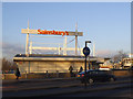
Local amenities in SE14 5PN offer extensive practical convenience for daily life. Retail options include Iceland New, Sainsburys New, and Sainsburys New Cross shops nearby. You can purchase groceries without travelling far from your property. Transport links allow rapid departure from the postcode to other parts of London. Rail services connect you to New Cross Gate ELL Railway Station, New Cross ELL Railway Station, and Nunhead Station within moments of travel. Fifteen key destinations lie within practical reach across various categories. Metro access includes Deptford Bridge, Elverson Road, and Cutty Sark DLR Station. Ferry options such as Masthouse Terrace Pier, Greenland Surrey Quays Pier, and Greenwich Pier remain accessible. For road journeys, the Green Line Coach Station and Victoria Coach Station are nearby points of departure. London City Airport sits within striking distance for business travellers. This diversity of transport means you can choose trains, tubes, boats, or coaches based on your preferred travel mood. No single mode dominates, offering flexibility for your daily commute.
Amenities
Schools
Families living in SE14 5PN have access to Haberdashers Askes School. This institution operates as a primary school and serves local children. No other schools appear in the immediate vicinity of this specific postcode. You must look further afield for secondary education options. The presence of only one primary school in the data suggests that this small area caters to early education before families move further out. Parents in SE14 5PN likely travel to nearby districts for older schooling needs. The limited number of institutions near this 1.7-hectare cluster implies a reliance on the surrounding borough for educational breadth. While Haberdashers Askes School provides initial education funding, the dataframe does not list secondary institutions nearby. This situation may impact housing desirability for those strictly requiring a specific school catchment. You should verify attendance zones independently before purchasing. The data confirms Haberdashers Askes School is the sole named educational facility within practical reach. This scarcity limits the educational self-sufficiency of the immediate neighbourhood.
| Rank | School | Type | Entry gender | Ages |
|---|
Explore more schools in this area
Go to Schools tabDemographics
The community in SE14 5PN reflects a mature demographic profile. The median age stands at 47 years, indicating an area populated by established adults. Most residents fall within the 30 to 64 years age range. This age distribution suggests families with grown children or empty nesters seeking stability. Only 36 per cent of households own their property, meaning the majority of the 2,067 people rent their homes. Flats form the predominant accommodation type across the postcode. This statistic confirms that you will encounter mostly apartment-style living rather than detached houses. The predominant ethnic group identifies as White, aligning with broader neighbourhood trends. This demographic mix creates a diverse yet generally uniform social fabric. The high proportion of renters often points to a population drawn from professionals or those leveraging the local market for short-term stays. You cannot find large family parks or extensive gardens due to the flat-heavy construction and small land footprint. The age structure implies a need for accessible housing solutions rather than ancillary facilities designed for the very young or very old. Safety scores support this stable environment for middle-aged residents seeking secure neighbourhoods.
Household Size
Accommodation Type
Tenure
Ethnic Group
Religion
Household Composition
Age
Household Deprivation
NS-SEC
Explore more demographic insights in this area
Go to Demographics tabPlanning
Planning Constraints
- Flood RiskPremium
- Ramsar Wetland SitesPremium
- Area of Outstanding Natural BeautyPremium
- Protected Nature ReservePremium
- Protected WoodlandPremium