Area Overview for SE14 5SA
Photos of SE14 5SA
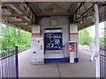
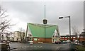
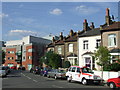
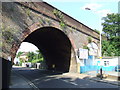
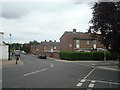
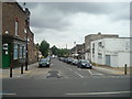
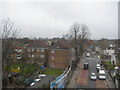
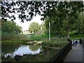
100 photos from this area
Area Information
Key information about the SE14 5SA including its size, population, and administrative classification.
- Area Type
- Postcode
- Area Size
- 1.8 hectares
- Population
- 2067
- Population Density
- 11817 people/km²
House Prices in SE14 5SA
99
Properties
£834,414
Average Sold Price
£180,000
Lowest Price
£1,484,000
Highest Price
Showing 99 properties
| Address | Type | Beds | Baths | Last Sale Price | Last Sale Date | |
|---|---|---|---|---|---|---|
| 59 Pepys Road, London, SE14 5SA | house | - | - | £1,200,000 | Jul 2024 | |
| 35A Pepys Road, London, SE14 5SA | Flat | - | - | £265,512 | Sep 2023 | |
| 37B Pepys Road, London, SE14 5SA | Flat | - | - | £650,000 | Jan 2023 | |
| 61 Pepys Road, London, SE14 5SA | house | 4 | - | £1,484,000 | Jan 2022 | |
| 49 Pepys Road, London, SE14 5SA | house | - | - | £1,192,277 | Mar 2020 | |
| 27B Pepys Road, London, SE14 5SA | Flat | 2 | 1 | £450,000 | Dec 2018 | |
| 57 Pepys Road, London, SE14 5SA | Semi-detached | 3 | - | £800,000 | May 2017 | |
| 41 Pepys Road, London, SE14 5SA | house | - | - | £1,350,000 | Mar 2017 | |
| 9A Pepys Road, London, SE14 5SA | Flat | - | - | £490,000 | Sep 2015 | |
| 3 Pepys Road, London, SE14 5SA | Flat | 5 | 3 | £995,000 | Oct 2014 |
Page 1 of 10
Energy Efficiency in SE14 5SA
Amenities
Schools
| Rank | School | Type | Entry gender | Ages |
|---|
Explore more schools in this area
Go to Schools tabDemographics
Household Size
Two person
most common
Accommodation Type
Flats
most common
Tenure
36
majority
Ethnic Group
White
most common
Religion
N/A
most common
Household Composition
N/A
most common
Age
47
median
Adults (30-64 years)
most common
Household Deprivation
N/A
with no deprivation
NS-SEC
45
in Lower managerial occupations
Explore more demographic insights in this area
Go to Demographics tabPlanning
Planning Constraints
- Flood RiskPremium
- Ramsar Wetland SitesPremium
- Area of Outstanding Natural BeautyPremium
- Protected Nature ReservePremium
- Protected WoodlandPremium