Area Overview for SE13 7GD
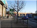
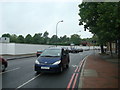
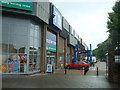
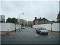
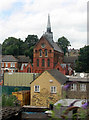
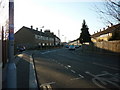
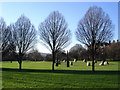
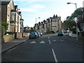
Photos of SE13 7GD


Area Information
SE13 7GD represents a specific residential cluster within the London postcode system. This small postcode covers an area of only 3052 square metres and houses a population of 1695 residents. Living in SE13 7GD means residing within a tightly packed neighbourhood designed primarily for urban density rather than spacious rural living. The location sits at the eastern edge of South East London, offering immediate access to the wider Lewisham and Greenwich networks. You will find yourself surrounded by a mix of transport routes, from rail lines and metro connections to ferry terminals and bus stations. Daily life here is dictated by proximity to major arteries and commercial hubs rather than isolation in the countryside. The area functions as a modern residential zone where convenience is prioritised through dense infrastructure. Residents benefit from being close to significant retail destinations and public transit nodes without needing extensive travel. The compact nature of the postcode ensures that most daily errands are reachable within short distances. This environment suits those who prefer an integrated urban lifestyle with easy access to employment centres and leisure facilities. The small footprint means you are close to neighbours and services, fostering a community defined by proximity to key transport links.
- Area Type
- Postcode
- Area Size
- 3052 m²
- Population
- 1695
- Population Density
- 19505 people/km²
The property market in SE13 7GD is defined by a shortage of owner-occupied properties. With just 17% of homes owned outright, the vast majority of the housing stock is rented. This concentration of rental units aligns with the predominant accommodation type, which consists of flats. You will find more purpose-built apartments than detached or semi-detached family houses within this postcode. The small area size of 3052 square metres reinforces this compact, high-density urban character. Buyers looking for semi-detached homes with large gardens may find few options here, as the planning and built environment favour vertical living. The predominance of flats suggests the area appeals to individuals or couples rather than large families seeking traditional single-family layouts. Investment potential exists for landlords seeking stable rental yields from a mature population where 73% of residents do not own their homes. Tenants benefit from being in a market with widely available accommodation, though competition for the limited flats may be intense. The area represents a typical South East London rental corridor where property values and rents fluctuate based on proximity to transport links and overall London demand.
House Prices in SE13 7GD
Showing 33 properties
| Address | Type | Beds | Baths | Last Sale Price | Last Sale Date | |
|---|---|---|---|---|---|---|
| 115 Elmira Street, London, SE13 7GD | undefined | - | - | - | - | |
| 85 Elmira Street, London, SE13 7GD | Flat | 2 | - | - | - | |
| 83 Elmira Street, London, SE13 7GD | undefined | - | - | - | - | |
| 99 Elmira Street, London, SE13 7GD | undefined | - | - | - | - | |
| 133 Elmira Street, London, SE13 7GD | undefined | - | - | - | - | |
| 87 Elmira Street, London, SE13 7GD | undefined | - | - | - | - | |
| 89 Elmira Street, London, SE13 7GD | undefined | - | - | - | - | |
| 129 Elmira Street, London, SE13 7GD | undefined | - | - | - | - | |
| 131 Elmira Street, London, SE13 7GD | undefined | - | - | - | - | |
| 79 Elmira Street, London, SE13 7GD | undefined | - | - | - | - |
Energy Efficiency in SE13 7GD
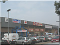
Living in SE13 7GD places you steps away from a vast array of retail, transport, and leisure amenities. Within practical reach are major retailers including Sainsburys Loampit, M&S Lewisham, and Asda Lewisham. Shopping needs are fully covered by these large supermarket and department store presences. Transport options are extensive, with five nearby rail stations including Lewisham Railway Station, Ladywell, and St Johns. You can reach five metro locations such as Elverson Road, Deptford Bridge, and Cutty Sark for Maritime Greenwich. Five ferry terminals like Greenwich Pier and Greenland Surrey Quays Pier offer access to the Thames and Kent. Bus connections are equally plentiful with three major hubs including the London Victoria Coach Station. London City Airport sits nearby for short-haul flights. This density ensures you never lack access to essential services or leisure activities. Daily errands combine easily with social outings thanks to this integrated transport web. The range of venues provides everything from groceries to travel hubs, supporting varied lifestyle needs without long commutes.
Amenities
Schools
Local education resources for families in SE13 7GD are centred around Prendergast Vale School. This institution serves multiple roles within the local education system, operating as both a primary school and an academy. You may encounter the same name listed for different educational functions, reflecting the school's integration into the local academy trust network. The presence of both primary and academy statuses indicates a structured approach to education management in the area. Families with younger children have access to primary education directly within this cluster, reducing the need for cross-town travel. The academy conversion suggests adherence to national educational standards and increased autonomy from local council control. Educational choices are limited to this specific institution listed in immediate proximity, meaning you must evaluate fit carefully before committing. Parents should research the specific curriculum and performance metrics of Prendergast Vale School to ensure it meets their children's needs. The concentration of schools in this postcode means educational infrastructure is localised, but the lack of alternative options may limit flexibility for families with diverse requirements.
| Rank | School | Type | Entry gender | Ages |
|---|
Explore more schools in this area
Go to Schools tabDemographics
The community in SE13 7GD reflects a mature demographic profile with a median age of 47 years. Most residents fall into the 30 to 64 age bracket, indicating a population dominated by adults with established lives and likely careers. Only 17% of households own their homes, suggesting the area operates heavily as a rental market. This low ownership rate is consistent with the predominant accommodation type, which consists of flats. The housing stock is clearly designed for renters rather than owner-occupiers, influencing the type of buildings and community dynamics you will encounter. You will see fewer large family homes compared to traditional detached properties found in more homeownership-heavy suburbs. The area also features a notable proportion of residents from black and other ethnic minority backgrounds, contributing to a diverse social fabric. This demographic mix creates a vibrant environment where different cultural influences intersect. Younger adults and professionals represent a significant portion of the 30 to 64 age group, meaning the local amenities cater to working-age households. The high density of 555416 people per square kilometre further intensifies the sense of community living in close quarters.
Household Size
Accommodation Type
Tenure
Ethnic Group
Religion
Household Composition
Age
Household Deprivation
NS-SEC
Explore more demographic insights in this area
Go to Demographics tabPlanning
Planning Constraints
- Flood RiskPremium
- Ramsar Wetland SitesPremium
- Area of Outstanding Natural BeautyPremium
- Protected Nature ReservePremium
- Protected WoodlandPremium