Area Overview for SE13 7EN
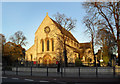
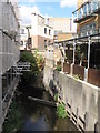
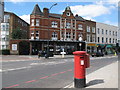
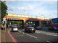
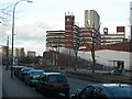
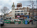
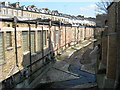
Photos of SE13 7EN


Area Information
Living in SE13 7EN means residing within a compact residential cluster covering exactly 2.0 hectares. This specific postcode area accommodates a population of 1,695 people, creating a densely populated environment where residents rely on immediate access to local services. The small geographical footprint means that daily life is heavily oriented around proximity to transport hubs and shopping centres rather than extensive green spaces. You are part of a community where the majority of neighbours are adults between the ages of 30 and 64, reflecting a mature demographic landscape. Daily routines for those living in SE13 7EN revolve around navigating connections to Lewisham, Greenwich, and Deptford, as the area serves as a residential nucleus for these wider South London networks. The high population density ensures that public transport options are not merely available but are integral to your weekly schedule, given the limited physical space available for personal travel infrastructure. Understanding the character of SE13 7EN requires acknowledging that it functions as a transit-linked sleepers' town rather than a self-contained destination with extensive local employment opportunities.
- Area Type
- Postcode
- Area Size
- 2.0 hectares
- Population
- 1695
- Population Density
- 19505 people/km²
The property market in SE13 7EN is characterised almost entirely by the presence of flats, with no data indicating the existence of standalone houses or semi-detached properties. This configuration means that buyers looking for traditional ground-floor terraced homes or large family houses cannot find them within this specific postcode. With a home ownership rate standing at just 17%, the area operates primarily as a rental sector where landlords and letting agents hold significant influence. You should expect competition between renters and occasional second-home buyers, both targeting the limited supply of available flats. The small area size of 2.0 hectares restricts new development potential within the immediate cluster, keeping the housing stock stable but finite. When searching for homes in SE13 7EN, your inventory will consist of various apartment layouts rather than varied property types found in more suburban districts. This uniformity simplifies the search process but narrows the choices for buyers seeking detached or semi-detached alternatives. The market dynamics here favour those comfortable with flat living and Understand the implications of leasehold ownership common in central London postcodes.
House Prices in SE13 7EN
Showing 52 properties
| Address | Type | Beds | Baths | Last Sale Price | Last Sale Date | |
|---|---|---|---|---|---|---|
| 23 Elmira Street, London, SE13 7EN | undefined | - | - | - | - | |
| 25 Elmira Street, London, SE13 7EN | undefined | - | - | - | - | |
| 3 Elmira Street, London, SE13 7EN | undefined | - | - | - | - | |
| 7 Elmira Street, London, SE13 7EN | undefined | - | - | - | - | |
| 17 Elmira Street, London, SE13 7EN | undefined | - | - | - | - | |
| 5 Elmira Street, London, SE13 7EN | undefined | - | - | - | - | |
| 9 Elmira Street, London, SE13 7EN | undefined | - | - | - | - | |
| 19 Elmira Street, London, SE13 7EN | undefined | - | - | - | - | |
| 21 Elmira Street, London, SE13 7EN | undefined | - | - | - | - | |
| 11 Elmira Street, London, SE13 7EN | undefined | - | - | - | - |
Energy Efficiency in SE13 7EN
Residents of SE13 7EN enjoy immediate access to a wide array of amenities within practical reach. Retail options include Sainsburys Loampit, M&S Lewisham, and Asda Lewisham, all located nearby to afford daily shopping needs. The public transport network is extensive, with five railway stations including Lewisham Railway Station, Ladywell, and St Johns situated close by. Metro users will find Elverson Road, Deptford Bridge, and Cutty Sark for Maritime Greenwich accessible for journeys across Southeast London. Ferry services connect you to Greenwich Pier, Masthouse Terrace Pier, and Greenland Surrey Quays Pier, offering scenic routes along the Thames. Additionally, London City Airport is just one station away, providing rapid access to Europe. Bus connections via Green Line Coach Station and Victoria Coach Station further expand your travel radius. This concentration of services means you can complete errands, check into international airports, and commute to various business districts without leaving the borough. Living in SE13 7EN provides a lifestyle defined by convenience and connectivity rather than quiet isolation or access to countryside walking trails.
Amenities
Schools
Families considering schools near SE13 7EN will find Prendergast Vale School listed as a nearby educational institution. This establishment operates under two distinct designations: it functions as a primary school for younger children and also carries an academy status, indicating its alignment with government-modelled education standards. While specific Ofsted ratings or student performance metrics are not included in the available information for this specific cluster, the presence of an academy-status primary school provides a complete educational solution within the wider Lewisham borough. The dual nature of the institution means students can remain in the same building for primary education while the school structure adapts to broader academic frameworks. There are no secondary schools listed in the immediate vicinity data, so older children will typically transition to facilities further away in the town. You must look beyond the immediate 2.0 hectares of SE13 7EN for high school placements, as the local cluster is best suited for younger pupils attending Prendergast Vale School. The academy designation suggests a focus on accountability and performance consistency, which many parents view favourably when selecting schools for their children.
| Rank | School | Type | Entry gender | Ages |
|---|
Explore more schools in this area
Go to Schools tabDemographics
The community in SE13 7EN is defined by a median age of 47, with adults aged 30 to 64 years constituting the most common age range. This demographic profile suggests a neighbourhood populated by established individuals and multi-generational households rather than young professionals or students. You will find that home ownership is relatively low, with only 17% of residents owning their homes outright, indicating a rental market that dominates the local landscape. This high reliance on tenancy shapes the social fabric, as tenants may possess different priorities regarding property investment or long-term neighbourhood retention compared to owners. The predominant ethnic group identified for this area is Black total, reflecting a diverse population structure that is essential to the area's cultural identity. As you consider homes in SE13 7EN, note that the accommodation type is exclusively flats, which aligns perfectly with the high-density urban living style typical of modern South London. This lack of single-family homes removes the option of garden-backed residences, meaning your living experience will be defined by vertical living arrangements within apartment blocks.
Household Size
Accommodation Type
Tenure
Ethnic Group
Religion
Household Composition
Age
Household Deprivation
NS-SEC
Explore more demographic insights in this area
Go to Demographics tabPlanning
Planning Constraints
- Flood RiskPremium
- Ramsar Wetland SitesPremium
- Area of Outstanding Natural BeautyPremium
- Protected Nature ReservePremium
- Protected WoodlandPremium