Area Overview for SE13 6DL
Photos of SE13 6DL


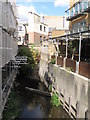
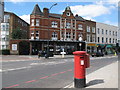

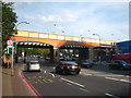
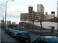
Area Information
Living in SE13 6DL offers a specific postcode experience within a small residential cluster covering 4919 square metres. This compact location serves a population of 1324 people, creating an intimate setting where residents know their neighbours. The area's tight footprint means daily trips are often quick, whether you are heading to local shops or boarding a train. You reside in a defined neighbourhood that functions as a distinct unit rather than a sprawling district. This concentration allows for a quiet domestic life while maintaining easy access to the wider South London transport network. The environment is characterised by its density, with 269,182 people per square kilometre recorded for the immediate vicinity. Such a high figure indicates a built-up urban setting typical of Greater London. You are situated close to major arteries that connect you to Greenwich and central London without the congestion of those central hubs. The character of SE13 6DL is defined by its proximity to these transport links and its concentration of housing. Whether you are returning after work or taking children to schools near SE13 6DL, the surroundings are practical and efficient. The area balances the need for space with the convenience of an urban location. You find yourself in a place where the commute is managed by excellent infrastructure, ensuring that distance does not hinder your connection to the city.
- Area Type
- Postcode
- Area Size
- 4919 m²
- Population
- 1324
- Population Density
- 10376 people/km²
The property market in SE13 6DL is defined by the dominance of flats within a high-density residential cluster. With home ownership standing at just 30%, the majority of properties change hands within the private rental sector or are purchased by investors. You will find that most homes in SE13 6DL are purpose-built or converted apartments designed for urban living rather than traditional detached or semi-detached houses. This housing profile aligns with the accommodation type data showing flats as the primary dwelling. The small area size of 4919 square metres restricts the possibility of extensive suburban-style development. You are looking at a market where price per square foot will be competitive due to the limited land available and high demand from commuters. The low ownership rate suggests that buyers may need to budget for long-term value rather than immediate owner-occupation benefits. Landlords and investors will find significant activity in SE13 6DL given the concentration of flats and the high population living in the area. When assessing homes in this postcode, you must consider the implications of buying in a predominantly rented environment where turnover can be higher. The local market supports a variety of leasehold interests typical of flat developments across London. Your purchase here is an investment in a compact, high-activity zone where supply is naturally constrained by the physical boundaries of the neighbourhood.
House Prices in SE13 6DL
Showing 26 properties
| Address | Type | Beds | Baths | Last Sale Price | Last Sale Date | |
|---|---|---|---|---|---|---|
| 60 Slaithwaite Road, London, SE13 6DL | house | - | - | £445,000 | Dec 2020 | |
| 56 Slaithwaite Road, London, SE13 6DL | Terraced | 3 | 1 | £410,000 | Aug 2020 | |
| 68 Slaithwaite Road, London, SE13 6DL | Terraced | 4 | - | £430,000 | Apr 2019 | |
| 72 Slaithwaite Road, London, SE13 6DL | house | 4 | - | £427,000 | Nov 2018 | |
| 52 Slaithwaite Road, London, SE13 6DL | house | 3 | 2 | £420,000 | Mar 2018 | |
| 74 Slaithwaite Road, London, SE13 6DL | Terraced | 4 | - | £315,000 | Apr 2014 | |
| 80 Slaithwaite Road, London, SE13 6DL | house | 3 | - | £285,000 | Mar 2013 | |
| 30 Slaithwaite Road, London, SE13 6DL | house | 3 | - | £247,500 | Oct 2007 | |
| 36 Slaithwaite Road, London, SE13 6DL | house | 5 | 3 | £233,000 | Sep 2005 | |
| 40 Slaithwaite Road, London, SE13 6DL | house | 3 | 1 | £162,000 | Jul 2002 |
Energy Efficiency in SE13 6DL
The lifestyle available to residents of SE13 6DL is heavily influenced by the extensive transport options located within practical reach. You have access to five railway stations, including Ladywell, Hither Green, and Lewisham Railway Station, providing direct links across the London network. Five metro stations, such as Elverson Road and Deptford Bridge, offer additional flexibility for your daily commute. Five ferry terminals, including Greenwich Pier and Greenland Surrey Quays Pier, allow you to water transport to various parts of the Thames. For business travel, London City Airport is just one airport site away, making high-speed access to foreign connections straightforward. Retail choices are robust, with five notable shops nearby, including Iceland Lewisham 2, Lidl Lewisham, and Sainsburys Lewisham. These venues ensure you can find fresh groceries and household essentials without venturing far. You enjoy a convenient mix of transport and shopping that defines practical urban living. Dining options expand beyond the immediate streets when you travel to nearby hubs like the Cutty Sark for Maritime Greenwich area. The variety of transport modes means you are never trapped by traffic congestion on the road. You can choose trains, metros, ferries, or driving depending on your destination and preference. This network of amenities ensures that every aspect of your daily life is within easy distance.
Amenities
Schools
| Rank | School | Type | Entry gender | Ages |
|---|
Explore more schools in this area
Go to Schools tabDemographics
The community in SE13 6DL reflects the broader adult demographic of modern London, with a median age of 47 years. Most residents fall into the 30 to 64-year-old age range, suggesting a population focused on established careers and family life. You occupy an environment where stability typically outweighs student housing trends. Home ownership stands at 30%, a figure that highlights the prevalence of tenancy in this specific locality. Consequently, many of you will be looking at homes in SE13 6DL as long-term investments or rental opportunities rather than legacy properties passed down through generations. The accommodation type is overwhelmingly dominated by flats, shaping the skyline and street life of the postcode. This building density supports the high population density recorded for the area. While White residents remain the predominant ethnic group, the demographic profile clearly sits within a diverse national context. The age structure indicates that schools near SE13 6DL cater primarily to families with children and adolescents rather than young people seeking their first independent home. Social dynamics in SE13 6DL likely revolve around shared community spaces where adults with children and working professionals interact. The housing stock suits those who prefer flat living arrangements common to inner London boroughs.
Household Size
Accommodation Type
Tenure
Ethnic Group
Religion
Household Composition
Age
Household Deprivation
NS-SEC
Explore more demographic insights in this area
Go to Demographics tabPlanning
Planning Constraints
- Flood RiskPremium
- Ramsar Wetland SitesPremium
- Area of Outstanding Natural BeautyPremium
- Protected Nature ReservePremium
- Protected WoodlandPremium