Area Overview for SE13 5SB
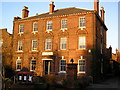
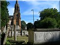
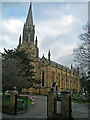
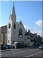
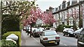
Photos of SE13 5SB


Area Information
SE13 5SB is a tiny residential cluster covering just 5,270 square metres near Lewisham. Despite its compact size, it serves a population of 1,966 people, creating a dense living environment where neighbours are close by. The area functions as a small estate within the broader Lewisham borough, offering immediate access to the larger town centre without requiring extensive travel. Living in this postcode means residing in a specific, well-defined neighbourhood where daily routines are shaped by proximity to local shops and transport links. The high population density suggests a vibrant but tight-knit community, typical of urban pockets in South London. Residents benefit from the convenience of being situated near the A2 munson road corridor, which connects them to wider London destinations. You will find that life here revolves around the practical needs of modern city dwellers, balancing the quiet of a contained estate with the energy of nearby commercial districts. This area represents a straightforward choice for those seeking a defined address with significant connectivity to Greater London's mainline network.
- Area Type
- Postcode
- Area Size
- 5270 m²
- Population
- 1966
- Population Density
- 13266 people/km²
The property market in SE13 5SB is characterised by a substantial rental sector, with home ownership levels recorded at only 28 per cent. Consequently, the housing stock is defined primarily by flats rather than detached or semi-detached houses. This makes the area an attractive option for landlords and prospective tenants rather than first-time buyers seeking to purchase a family home. You are more likely to encounter rental properties and leasehold arrangements when searching for homes in this postcode. The concentration of flats suggests a design suited to urban living, capitalising on the high population density of the 5,270 square metre zone. Buyers looking for ground-floor gardens or large exterior spaces will find this area less suited to their needs. Instead, the property type offers efficient use of space, ideal for singles, couples without children, or investment portfolios seeking yield in a high-demand location. The prevalence of rental accommodation also indicates steady demand from those working in nearby commercial hubs who prefer flexibility. Understanding this market structure is essential before viewing any properties within this specific postcode sector.
House Prices in SE13 5SB
Showing 30 properties
| Address | Type | Beds | Baths | Last Sale Price | Last Sale Date | |
|---|---|---|---|---|---|---|
| 58 Boone Street, London, SE13 5SB | Flat | 1 | 1 | £220,000 | Apr 2022 | |
| 36 Boone Street, London, SE13 5SB | Flat | - | 1 | £185,000 | Jun 2016 | |
| 2-12, 6 Boone Street, London, SE13 5SB | Flat | - | - | £85,000 | Jan 2012 | |
| 60 Boone Street, London, SE13 5SB | Flat | - | - | £83,500 | Mar 2011 | |
| 66 Boone Street, London, SE13 5SB | Maisonette | - | - | £167,000 | Nov 2008 | |
| 28 Boone Street, London, SE13 5SB | Flat | - | 1 | £145,000 | Dec 2006 | |
| 42 Boone Street, London, SE13 5SB | Maisonette | - | - | £147,000 | Jun 2006 | |
| 34 Boone Street, London, SE13 5SB | Flat | - | 1 | £90,000 | Apr 2005 | |
| 2-12, 8 Boone Street, London, SE13 5SB | Maisonette | - | - | £150,500 | Mar 2005 | |
| 56 Boone Street, London, SE13 5SB | Flat | - | - | £139,000 | Feb 2004 |
Energy Efficiency in SE13 5SB
Daily life in SE13 5SB is supported by a diverse array of amenities within practical reach. Retail options are plentiful, with five major stores nearby including M&S Lee Lewisham BP, Sainsburys Lewisham, and Lidl Lewisham. These supermarkets provide essential grocery shopping close to your home. Transport connectivity is a major feature, with five rail stations listed nearby, such as Hither Green and Lewisham Railway Station, offering frequent services to central London. You also have access to five metro stations, including Elverson Road and Cutty Sark for Maritime Greenwich, integrating seamlessly with the Tube network. Water travel is available via five ferry piers, such as Greenwich Pier and Royal Wharf Pier, providing scenic routes across the Thames. One airport nearby is London City Airport, offering direct flights to Europe. This dense network of transport links ensures you can reach work, leisure, and social destinations quickly. Local facilities are concentrated enough that you can complete most daily errands without a car. The variety of retail and transport options means living in SE13 5SB offers genuine independence and convenience for commuters and shoppers alike.
Amenities
Schools
Families moving to SE13 5SB have one highly rated educational option immediately on their doorstep. St Margaret's Lee CofE Primary School is a primary school located in direct proximity to the area. It holds an Ofsted rating of Outstanding, signifying a school of the highest quality according to government inspection standards. As a Church of England institution, it offers a faith-based curriculum alongside the standard National Curriculum. There are no secondary schools listed within the immediate data for this specific postcode, meaning residents without children or those with older children will need to look further afield for secondary education. For parents with primary school-aged children, the presence of an outstanding-rated institution is a significant advantage, reducing commute times and ensuring high-standard teaching. The mix of school types is limited here, as only one primary school is recorded. If you are considering moving for educational purposes, you must verify secondary school catchment areas separately, as they are not included in the immediate vicinity data for SE13 5SB. St Margaret's remains the sole named educational option confirmed for this location.
| Rank | School | Type | Entry gender | Ages |
|---|
Explore more schools in this area
Go to Schools tabDemographics
The community in SE13 5SB is defined by an older demographic, with a median age of 47 years. Most residents fall into the 30 to 64 age range, indicating a neighbourhood dominated by adults in their middle years rather than young families or pensioners. Home ownership stands at 28 per cent, meaning the majority of housing is let rather than owned outright. This high rental proportion often attracts professionals on short-term contracts or those renting for affordability. Flats are the predominant accommodation type, reflecting the vertical nature of housing in such a compact area. The predominant ethnic group is White, aligning with the broader demographic trends of South East London. With a population density of 373,066 people per square kilometre, the space between households is limited, contributing to a fast-paced urban atmosphere. This density ensures that local amenities are always within walking distance, though it also means quieter evenings are less common. The area caters primarily to working-age adults who value location over garden space or single-family homes.
Household Size
Accommodation Type
Tenure
Ethnic Group
Religion
Household Composition
Age
Household Deprivation
NS-SEC
Explore more demographic insights in this area
Go to Demographics tabPlanning
Planning Constraints
- Flood RiskPremium
- Ramsar Wetland SitesPremium
- Area of Outstanding Natural BeautyPremium
- Protected Nature ReservePremium
- Protected WoodlandPremium