Area Overview for SE13 5GB
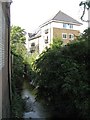
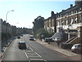
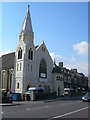
Photos of SE13 5GB


Area Information
SE13 5GB defines a specific residential cluster within London, covering an area of just 398 square metres. This small postcode contains a population of 1,966 people, creating a tightly knit environment where neighbours often know one another. The density of residents here is significant, meaning the local infrastructure supports a concentrated community rather than a sprawling suburb. Life in this postcode revolves around proximity to key transport hubs and established retail parks in Lewisham. You are situated in a location where daily commutes begin with easy access to multiple railway and metro stations. The setting is primarily urban, blending residential comfort with the practicalities of city living. Residents here enjoy a lifestyle defined by accessibility to London City Airport and the extensive network of Thames river ferries. The area functions as a practical base for housing, prioritising connectivity and convenience over vast green spaces. When you choose to live in SE13 5GB, you select an area where the boundaries of home meet the boundaries of immediate service provision. The character of the neighbourhood is shaped by its compact nature and its role as a gateway to central London via various rail links.
- Area Type
- Postcode
- Area Size
- 398 m²
- Population
- 1966
- Population Density
- 13266 people/km²
Housing stock in SE13 5GB is characterised by a high proportion of flats, making it a distinct choice compared to areas dominated by detached or semi-detached houses. With only 28% of residents owning their homes, the market here functions more like a rental ecosystem than a traditional owner-occupier community. This dynamic influences both buying options and rental availability for those looking at the postcode. The compact nature of the 398 square metre area suggests that properties are likely vertical, maximising space in a constrained footprint. Buyers considering the area should expect to navigate a market where investment properties and managed estates play a significant role. The predominance of flats means you will find a range of unit sizes, from studios to larger family apartments, designed for urban efficiency. This housing mix appeals to those seeking low-maintenance living close to transport links. If you are looking for a self-contained unit near major stations, this postcode offers a practical solution. The market conditions reflect a shift towards flexible living arrangements where choice of transport route outweighs the traditional desire for a large garden or separate house.
House Prices in SE13 5GB
Showing 5 properties
| Address | Type | Beds | Baths | Last Sale Price | Last Sale Date | |
|---|---|---|---|---|---|---|
| 2 Merchants Place, Blackheath, London, SE13 5GB | house | - | - | - | - | |
| 4 Merchants Place, Blackheath, London, SE13 5GB | house | - | - | - | - | |
| 1 Merchants Place, Blackheath, London, SE13 5GB | house | - | - | - | - | |
| 3 Merchants Place, Blackheath, London, SE13 5GB | house | - | - | - | - | |
| 5 Merchants Place, Blackheath, London, SE13 5GB | house | - | - | - | - |
Energy Efficiency in SE13 5GB
Living in SE13 5GB places you within practical reach of numerous retail, transport, and leisure facilities. You have direct access to five major retail locations, including M&S Lee Lewisham BP, Sainsburys Lewisham, and Lidl Lewisham, ensuring daily shopping is convenient. Transport choices are extensive, with five rail stations nearby such as Hither Green, Lewisham Railway Station, and Lee station. Beyond trains, five metro lines serve the area, including stops at Elverson Road, Deptford Bridge, and Cutty Sark for Maritime Greenwich. Five ferry terminals are also nearby, offering routes to Greenwich Pier, Masthouse Terrace Pier, and Royal Wharf Pier. Additionally, London City Airport is a single station away, providing rapid access to international flights. This density of amenities creates a lifestyle centred on convenience and variety. You can run errands, travel to work, or take a weekend trip without leaving the immediate vicinity of the postcode. The presence of grocery stores and diverse transport modes means day-to-day life is frictionless and connected to the wider city.
Amenities
Schools
Families considering schools near SE13 5GB will find St Margaret's Lee CofE Primary School nearby. This institution holds an Ofsted rating of outstanding, indicating a high standard of education and care. It is a primary school, serving the foundational years of a child's education. The presence of such a well-rated facility means parents in the area have immediate access to a top-tier educational option. While secondary schools are not listed in the provided data, the proximity to a primary school with the highest rating is a significant asset. This rating often attracts families who prioritise academic excellence for their children's early development. The CofE denomination suggests a faith-based educational environment alongside secular options. For residents in SE13 5GB, this school serves as a key local amenity for young families. The outstanding status provides confidence regarding the quality of teaching and outcomes for students attending the school.
| Rank | School | Type | Entry gender | Ages |
|---|
Explore more schools in this area
Go to Schools tabDemographics
The community profile of SE13 5GB reflects a mature population, with a median age of 47 years. The most common age range among residents is adults aged between 30 and 64 years, indicating a neighbourhood dominated by families and established professionals. Home ownership stands at 28%, which results in a largely rental marketplace. The predominant accommodation type consists of flats, catering to smaller household sizes and diverse living arrangements typical of high-density urban environments. Demographically, the area is predominantly white, aligning with broader north London trends. This age structure suggests a demand for properties that suit those with changing family needs or retirement planning. The lower rate of ownership implies that many residents are either first-time movers, landlords, or those waiting for the right investment opportunity to purchase. You can expect a neighbourhood where long-term tenancies are common, fostering a stable but fluid social fabric. The concentration of adult residents means that local facilities are accessed by a demographic with significant disposable income but potentially varied housing priorities. Understanding this age and ownership split is essential for anyone considering buying homes in SE13 5GB.
Household Size
Accommodation Type
Tenure
Ethnic Group
Religion
Household Composition
Age
Household Deprivation
NS-SEC
Explore more demographic insights in this area
Go to Demographics tabPlanning
Planning Constraints
- Flood RiskPremium
- Ramsar Wetland SitesPremium
- Area of Outstanding Natural BeautyPremium
- Protected Nature ReservePremium
- Protected WoodlandPremium