Area Overview for SE12 9TL
Photos of SE12 9TL
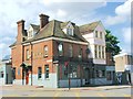
Area Information
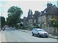
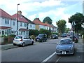
This postcode covers a small residential cluster with a total size of 1,716 square metres. It is home to 1,646 people, creating a compact neighbourhood where daily life revolves around specific local facilities. Living in SE12 9TL means you are in a defined pocket within the wider London market, distinct from the sprawling suburbs often found nearby. The area supports a population density of 959,081 people per square kilometre, a figure calculated based on the total population against the specific land area provided for this code. You will find this postcode describes a tight-knit environment rather than a broad district. Residents benefit from being situated near multiple transport hubs, including Grove Park Station and Sundridge Park Station, which serve the surrounding neighbourhood effectively. The character of the area is defined by its residential focus, with flats forming the predominant accommodation type. Expect a community where proximity to amenities like Sainsburys Lewisham Grove and Tesco Grove is a central part of the daily routine. This specific cluster offers a distinct lifestyle for those choosing homes in SE12 9TL, prioritising location and access over large open spaces.
- Area Type
- Postcode
- Area Size
- 1716 m²
- Population
- 1646
- Population Density
- 7135 people/km²
The property market within SE12 9TL is characterised by a high concentration of flats, which form the main type of accommodation in the area. With a home ownership rate of 41%, the market reflects a significant portion of rented properties alongside private ownership. This mix suggests a dynamic environment where rental tenants and owner-occupiers coexist, often within the same residential buildings. The small total area size of 1,716 square metres restricts the supply of large detached or semi-detached homes, making flats the logical choice for many buyers and renters. Those looking at homes in SE12 9TL should expect a vertical solution to housing needs rather than sprawling suburban estates. The population of 1,646 residents occupies this space tightly, influencing property values and availability. When viewing properties, you will find that the density aligns with the flat-based architecture typical of this specific postcode. The 41% ownership figure indicates a competitive market for those wishing to buy, as the majority of the space is available for rent or lease. Understanding this split helps you evaluate whether to pursue a purchase or the rental market for your lifestyle in this specific residential cluster.
House Prices in SE12 9TL
Showing 12 properties
| Address | Type | Beds | Baths | Last Sale Price | Last Sale Date | |
|---|---|---|---|---|---|---|
| 38 Amblecote Road, London, SE12 9TL | Flat | 2 | 1 | £265,000 | Sep 2025 | |
| 42 Amblecote Road, London, SE12 9TL | Flat | - | - | £182,000 | Nov 2021 | |
| 40 Amblecote Road, London, SE12 9TL | Flat | 2 | 1 | £260,000 | Sep 2021 | |
| 44 Amblecote Road, London, SE12 9TL | Flat | - | - | £242,500 | Feb 2020 | |
| 34 Amblecote Road, London, SE12 9TL | Flat | - | - | £260,000 | Dec 2015 | |
| 30 Amblecote Road, London, SE12 9TL | Flat | - | - | £204,000 | May 2015 | |
| 32 Amblecote Road, London, SE12 9TL | Flat | - | - | £165,000 | Sep 2012 | |
| 36 Amblecote Road, London, SE12 9TL | Flat | 2 | 1 | £132,662 | Dec 2004 | |
| 46 Amblecote Road, London, SE12 9TL | Flat | - | - | £133,000 | Feb 2004 | |
| 26 Amblecote Road, London, SE12 9TL | Flat | - | - | £92,500 | May 2002 |
Energy Efficiency in SE12 9TL
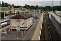
Daily life in SE12 9TL offers immediate access to a variety of retail, rail, metro, and ferry options within practical reach. Residents can buy groceries at Sainsburys Lewisham Grove, Tesco Grove, or Co-op Downham, with five retail locations identified in the immediate vicinity. For commuting, five rail stations are nearby, with Grove Park Station and Sundridge Park Station being the most notable choices for regional travel. Five metro stops provide access to the tram network, including Elverson Road and Beckenham Road Tram Stop, allowing flexible local movement. Five ferry terminals are also accessible, with Greenwich Pier, Masthouse Terrace Pier, and Barrier Gardens Pier available for leisure or transport. London City Airport stands as the single nearby airport option for business or leisure travel. This extensive list of amenities means you do not need to look far for your daily essentials. The presence of these specific venues confirms a convenient lifestyle where shops and transport nodes are integrated into the neighbourhood fabric. Living in SE12 9TL places you close to these five categories of services, ensuring that your routine errands and commutes remain efficient and straightforward.
Amenities
Schools
| Rank | School | Type | Entry gender | Ages |
|---|
Explore more schools in this area
Go to Schools tabDemographics
The community in SE12 9TL is mature, with a median age of 47 years. The most common age range consists of adults between 30 and 64 years old. This demographic profile suggests a area populated by established residents rather than young families or college students. Home ownership stands at 41%, indicating that slightly less than half of the households own their property outright. The remaining 59% of households reside in rented accommodation. Flats are the predominant accommodation type within this postcode, shaping the architectural landscape and household sizes. The predominant ethnic group is White, reflecting the primary composition of the local population. Safety assessments indicate a medium crime risk with a score of 47 out of 100, meaning crime rates are around the average for the region. This warning level suggests that standard security precautions are advisable for residents living in SE12 9TL. There is no protected woodland or nature reserve coverage affecting this specific cluster, and the area does not fall within a Ramsar wetland site or an Area of Outstanding Natural Beauty. These planning constraints all pass assessment, removing significant restrictions from potential development or modification in this compact zone.
Household Size
Accommodation Type
Tenure
Ethnic Group
Religion
Household Composition
Age
Household Deprivation
NS-SEC
Explore more demographic insights in this area
Go to Demographics tabPlanning
Planning Constraints
- Flood RiskPremium
- Ramsar Wetland SitesPremium
- Area of Outstanding Natural BeautyPremium
- Protected Nature ReservePremium
- Protected WoodlandPremium