Area Overview for SE12 9SZ
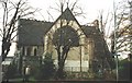
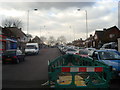
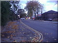
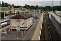
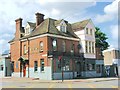
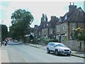
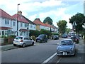
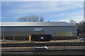
Photos of SE12 9SZ

Area Information
SE12 9SZ is a tightly defined residential cluster covering just 1.2 hectares within Lewisham. This small footprint houses 1,643 people, creating a dense and compact living environment. The area functions as a specific micro-hub where daily life revolves around immediate proximity to key transport links and local retail providers. Residents here experience a neighbourhood character defined by high density rather than expansive green spaces or wide streets. The population mix reflects a community settled into a established home environment, with the majority of the demographic falling into the adult working age range. Living in SE12 9SZ means accepting a high population density that often accompanies postcode areas of this specific size. You are stepping into a defined zone where services and neighbours are close at hand. The area does not feature large parks or extensive open land, focusing instead on efficient urban living within a residential postcode boundary.
- Area Type
- Postcode
- Area Size
- 1.2 hectares
- Population
- 1643
- Population Density
- 7232 people/km²
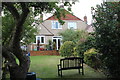
This postcode represents a niche market driven by its classification as a small residential cluster rather than a broad neighbourhood. With 52% home ownership, the area is split evenly between those who own their property and those who rent. The data clearly identifies the accommodation type as houses, meaning buyers will find traditional housing stock rather than high-rise blocks or converted flats. You are looking at a property market where roughly half the residents have invested in the area long term. This balance suggests a stable environment where owner-occupiers have consolidated their presence. The small area size of 1.2 hectares implies limited new development potential, likely keeping the stock fixed. Homes in SE12 9SZ therefore offer a specific product for those seeking standalone dwellings close to transport hubs, rather than the open spaces found in larger suburban postcodes.
House Prices in SE12 9SZ
Showing 22 properties
| Address | Type | Beds | Baths | Last Sale Price | Last Sale Date | |
|---|---|---|---|---|---|---|
| 15 Luffman Road, Grove Park, London, SE12 9SZ | Detached | 3 | 1 | £685,000 | Jul 2024 | |
| 25 Luffman Road, Grove Park, London, SE12 9SZ | Semi-detached | 5 | 2 | £650,000 | Apr 2021 | |
| 5 Luffman Road, Grove Park, London, SE12 9SZ | Terraced | 5 | 3 | £650,000 | Mar 2021 | |
| 1 Luffman Road, Grove Park, London, SE12 9SZ | house | - | - | £485,000 | Sep 2020 | |
| 33 Luffman Road, Grove Park, London, SE12 9SZ | Semi-detached | - | - | £625,000 | Feb 2019 | |
| 3 Luffman Road, Grove Park, London, SE12 9SZ | Terraced | 5 | 2 | £425,000 | Oct 2018 | |
| 37 Luffman Road, Grove Park, London, SE12 9SZ | Semi-detached | 4 | 2 | £438,000 | Oct 2013 | |
| 9 Luffman Road, Grove Park, London, SE12 9SZ | house | 4 | - | £410,000 | May 2007 | |
| 21 Luffman Road, Grove Park, London, SE12 9SZ | Detached | 4 | 2 | £300,000 | Oct 2006 | |
| 7 Luffman Road, Grove Park, London, SE12 9SZ | house | - | - | £220,000 | Dec 2004 |
Energy Efficiency in SE12 9SZ
Daily life in SE12 9SZ is supported by a variety of amenities located within practical reach of every home. Residents have access to five supermarkets, including Tesco Grove, Sainsburys Lewisham Grove, and Co-op Downham, ensuring groceries and household needs are easily met. Transport options are plentiful, with five nearby rail stations such as Grove Park and Mottingham, plus five metro stops like Elverson Road and Deptford Bridge. You can also choose from five ferry locations, including Greenwich Pier and Masthouse Terrace Pier, for crossing the river to the capital. Additionally, London City Airport is available to residents, offering quick access to domestic flights. Living in SE12 9SZ provides unmatched convenience, as you do not need to travel far for basic services or leisure activities. The concentration of retail and transport nodes creates a convenient lifestyle where jobs, shopping, and travel are integrated seamlessly into your routine.
Amenities
Schools
| Rank | School | Type | Entry gender | Ages |
|---|
Explore more schools in this area
Go to Schools tabDemographics
The community in SE12 9SZ presents a mature profile, with a median age of 47 years. This demographic skew indicates that the area is predominantly occupied by adults between the ages of 30 and 64 years. Home ownership stands at exactly 52%, suggesting a balanced split between owners and renters within these specific boundaries. Because the accommodation type is recorded simply as houses, the housing stock consists primarily of detached or semi-detached properties rather than flats or terraces. You are buying into an area where almost half the population has achieved tenure. The predominant ethnic group in SE12 9SZ is White, which points to a significant degree of ethnic homogeneity compared to other parts of London. These statistics confirm that the residents are generally settled, with a higher likelihood of long-term stability found in homes within this small postcode.
Household Size
Accommodation Type
Tenure
Ethnic Group
Religion
Household Composition
Age
Household Deprivation
NS-SEC
Explore more demographic insights in this area
Go to Demographics tabPlanning
Planning Constraints
- Flood RiskPremium
- Ramsar Wetland SitesPremium
- Area of Outstanding Natural BeautyPremium
- Protected Nature ReservePremium
- Protected WoodlandPremium