Area Overview for SE12 9RA
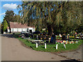
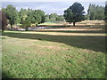
Photos of SE12 9RA


Area Information
SE12 9RA is a compact residential postcode covering just 7529 square metres. This small cluster of homes supports a population of 1721 people, creating a high population density of 228588 per square kilometre. The area is concentrated enough to foster a tight-knit community while remaining close to wider London transport links. Living in SE12 9RA means residing in a defined neighbourhood where daily needs are met by nearby amenities and schools. The location sits near key rail hubs like Grove Park Station and Mottingham Station, which shape the daily routine for residents. It is also reachable via several tram stops including Elverson Road and Avenue Road. For those requiring air travel, London City Airport is within practical reach. This postcode represents a specific residential choice for buyers seeking a defined cluster rather than a vast expanse. The area functions as a small, focused living environment where access to Luton Lane shopping centres and river ferries from Greenwich Pier is a realistic part of life.
- Area Type
- Postcode
- Area Size
- 7529 m²
- Population
- 1721
- Population Density
- 10064 people/km²
The housing stock in this postcode is defined by specific accommodation types and ownership patterns. Houses form the predominant accommodation type for SE12 9RA. The home ownership rate stands at 34%, meaning roughly a third of residents are owners while the rest rent. This split creates a dynamic market with both independent owners and long-term renters. The high population density of 228588 people per square kilometre within 7529 square metres indicates limited physical space for new large-scale construction. Buyers looking at homes in SE12 9RA are entering a mature market characterised by existing stock. The prevalence of houses suggests a preference for traditional home living over flats or complexes. With only 1721 residents, the inventory of properties available is inherently small for such a dense footprint. The 34% ownership figure often correlates with older areas where owner occupancy takes time to grow. Prospective buyers should expect a residential environment focused on house living rather than high-rise apartments.
House Prices in SE12 9RA
Showing 11 properties
| Address | Type | Beds | Baths | Last Sale Price | Last Sale Date | |
|---|---|---|---|---|---|---|
| 63 Riddons Road, Grove Park, London, SE12 9RA | Flat | 3 | 1 | £360,000 | Sep 2019 | |
| 57 Riddons Road, Grove Park, London, SE12 9RA | Terraced | 3 | 1 | £285,000 | Apr 2014 | |
| 61 Riddons Road, Grove Park, London, SE12 9RA | house | - | - | £208,000 | Nov 2007 | |
| 55 Riddons Road, Grove Park, London, SE12 9RA | Terraced | 3 | 1 | £130,000 | Jun 2004 | |
| 45 Riddons Road, Grove Park, London, SE12 9RA | Semi-detached | - | - | £95,000 | Jan 2000 | |
| 47 Riddons Road, Grove Park, London, SE12 9RA | Terraced | 3 | - | - | - | |
| 53 Riddons Road, Grove Park, London, SE12 9RA | Terraced | - | - | - | - | |
| 51 Riddons Road, Grove Park, London, SE12 9RA | Terraced | - | - | - | - | |
| 49 Riddons Road, Grove Park, London, SE12 9RA | house | - | - | - | - | |
| 59 Riddons Road, Grove Park, London, SE12 9RA | house | - | - | - | - |
Energy Efficiency in SE12 9RA
Daily life in SE12 9RA benefits from a dense network of amenities within practical reach. Residents have access to five rail stations, five retail outlets, five tram stops, five ferry points, and one nearby airport. Shopping includes Sainsburys Lewisham Grove, Co-op Mottingham, and Tesco Grove, covering the majority of grocery needs. Leisure and travel opportunities include Park on nearby Greenwich Pier and Barrier Gardens Pier for river views or travel to the Isle of Dogs. Five tram locations such as Elverson Road and Beckenham Road provide local movement options. The area balances convenience with accessibility through these five categories of services. Living in SE12 9RA means you can walk to a Co-op or Tesco without significant travel time. The presence of London City Airport nearby offers quick access to the city centre. Ferry access supports weekend trips across the River Thames. This arrangement of five rail stations and five retail venues ensures households do not need long commutes for basic tasks. Grocery shopping at Sainsburys Lewisham Grove or Co-op Mottingham is easily integrated into a weekly routine.
Amenities
Schools
Education access is a key feature for families living in this postcode. Marvels Lane Primary School serves as a primary option with a Ofsted rating of good. Another option nearby is Marvels Lane Infant School, which caters to younger children before secondary education. Both institutions are situated within practical reach of the 1721 residents in this small cluster. Having two primary options supports a balanced childcare pathway for local children. The presence of a rated school gives parents confidence regarding educational quality close to home. Families with children aged 5 to 11 can choose between these two established primary settings. The concentration of schools in a small area like SE12 9RA ensures no resident is far from educational facilities. While secondary school data is not listed for this specific postcode, the proximity of primary education indicates a family-friendly infrastructure. The good rating of Marvels Lane Primary School places this area within the catchment of verified educational standards.
| Rank | School | Type | Entry gender | Ages |
|---|
Explore more schools in this area
Go to Schools tabDemographics
The community in SE12 9RA is older than the national average. The median age is 47, with the most common age range being adults between 30 and 64 years. This demographic profile suggests an area populated by individuals and families past their early twenties. Household composition reflects this maturity, resulting in a home ownership rate of 34%. This means roughly one in three residents owns their property outright or with a mortgage, while the majority likely rent. The accommodation type is predominantly houses, which aligns with the settled nature of the age group. Ethnically, the predominant group in this postcode is White. The concentration of adults in the 30-64 bracket indicates a stable population less likely to move frequently. The low number of younger children under 30 limits the teenage population within these 1721 residents. Home ownership levels below 40% indicate a mix of owners and renters in a highly dense area.
Household Size
Accommodation Type
Tenure
Ethnic Group
Religion
Household Composition
Age
Household Deprivation
NS-SEC
Explore more demographic insights in this area
Go to Demographics tabPlanning
Planning Constraints
- Flood RiskPremium
- Ramsar Wetland SitesPremium
- Area of Outstanding Natural BeautyPremium
- Protected Nature ReservePremium
- Protected WoodlandPremium