Area Overview for SE12 9PS
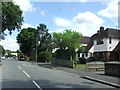
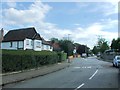
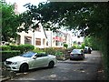
Photos of SE12 9PS
Area Information
SE12 9PS represents a compact residential cluster in South East London, covering an area of 4574 square metres. Approximately 1646 people call this specific postcode their home, creating a densely populated environment where neighbours are likely to be close by. The area functions as a tightly defined neighbourhood rather than a sprawling district, meaning daily routines often rely on short walks to local shops and transport links. Living in SE12 9PS involves navigating a community where space is at a premium due to the high concentration of residents within such a small footprint. The location benefits from proximity to several key transport hubs, including five railway stations such as Grove Park and Mottingham. Local residents also have access to five retail venues like Sainsburys Lewisham Grove and Tesco Grove, ensuring essential shopping needs are met without lengthy commutes. With London City Airport nearby, the area appeals to those seeking quick connections to southern Europe and the City of London. This postcode offers a distinct lifestyle character defined by its density and immediate access to infrastructure, making it a practical choice for commuters who prioritise convenience over expansive garden space.
- Area Type
- Postcode
- Area Size
- 4574 m²
- Population
- 1646
- Population Density
- 7135 people/km²
Homes in SE12 9PS are characterised by a prevalence of flats, confirming the area's density-focused design. With only 41% of residents owning their homes, this postcode functions largely as a rental market rather than a traditional owner-occupied estate. This dynamic implies that prospective buyers should examine both purchase and rent-to-own opportunities if they seek security of tenure. The small physical size of 4574 square metres restricts the variety of properties available, meaning ground-floor units or high-rise flats are likely the norm. For those considering this specific cluster, the low ownership rate suggests a liquid market where properties may move quickly if marketed well. Buyers looking for customisation might find the standardisation of flat living in this area limiting, yet the location offers sufficient amenities to justify shared living spaces. The concentration of accommodation types prevents the market from skirting toward large detached houses, keeping property values aligned with smaller residential units. Understanding this balance is crucial for anyone evaluating homes in SE12 9PS against similar locations in South East London.
House Prices in SE12 9PS
Showing 18 properties
| Address | Type | Beds | Baths | Last Sale Price | Last Sale Date | |
|---|---|---|---|---|---|---|
| 218 Marvels Lane, Grove Park, London, SE12 9PS | Terraced | 3 | - | £437,966 | Feb 2023 | |
| 238 Marvels Lane, Grove Park, London, SE12 9PS | Terraced | 3 | 1 | £330,000 | Oct 2016 | |
| 244 Marvels Lane, Grove Park, London, SE12 9PS | house | 2 | - | £200,000 | Jul 2011 | |
| 212 Marvels Lane, Grove Park, London, SE12 9PS | house | 3 | - | £191,000 | Nov 2006 | |
| 226 Marvels Lane, Grove Park, London, SE12 9PS | house | - | - | £99,500 | Apr 2001 | |
| 240 Marvels Lane, Grove Park, London, SE12 9PS | Terraced | 3 | 1 | - | - | |
| 234 Marvels Lane, Grove Park, London, SE12 9PS | house | - | - | - | - | |
| 220 Marvels Lane, Grove Park, London, SE12 9PS | house | - | - | - | - | |
| 214 Marvels Lane, Grove Park, London, SE12 9PS | house | - | - | - | - | |
| 216 Marvels Lane, Grove Park, London, SE12 9PS | house | - | - | - | - |
Energy Efficiency in SE12 9PS
Living in SE12 9PS offers immediate access to a diverse range of amenities within practical walking distance. Four railway stations, including Mottingham, serve as key employment gateways for residents. Five retail outlets provide everyday necessities, with prominent locations like Sainsburys Lewisham Grove and Co-op Mottingham stocking essential goods. Transport links extend to five tram stops and three ferry terminals, including Masthouse Terrace Pier and Deptford Bridge, creating a flexible travel network. London City Airport sits nearby, offering quick routes to Europe for long-term residents. The area’s compact nature means most daily errands require minimal travel time, fostering a self-contained lifestyle. You can easily reach five local stations, five shops, and multiple ferry piers without needing a car. This concentration of facilities supports a convenience-first approach to daily life, where daily activities like shopping, commuting, and socialising happen within the immediate vicinity of your home.
Amenities
Schools
| Rank | School | Type | Entry gender | Ages |
|---|
Explore more schools in this area
Go to Schools tabDemographics
The community in SE12 9PS is dominated by adults aged between 30 and 64 years, while the median age across the postcode stands at 47. This age profile suggests an area that attracts families and professionals rather than young students or elderly retirees. Accommodation types in this cluster are primarily flats, which aligns with the high-density nature of the 4574 square metre site. Home ownership stands at 41%, indicating that a significant portion of residents rent their homes rather than owning them outright. The predominant ethnic group in SE12 9PS is White, reflecting the demographic makeup of wider South East London. With a population density of 359870 people per square kilometre, residents experience a bustling environment where individual privacy may be less abundant than in suburban settings. This density often correlates with a quicker pace of life and a strong reliance on public services. The housing stock caters specifically to those seeking flat living within a relatively small geographical zone, offering a distinct alternative to traditional house ownership in this part of Lewisham.
Household Size
Accommodation Type
Tenure
Ethnic Group
Religion
Household Composition
Age
Household Deprivation
NS-SEC
Explore more demographic insights in this area
Go to Demographics tabPlanning
Planning Constraints
- Flood RiskPremium
- Ramsar Wetland SitesPremium
- Area of Outstanding Natural BeautyPremium
- Protected Nature ReservePremium
- Protected WoodlandPremium