Area Overview for SE12 9BJ
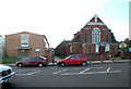
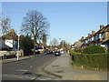
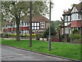
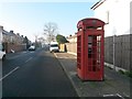
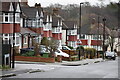
Photos of SE12 9BJ


Area Information
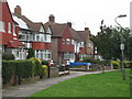
Living in SE12 9BJ offers a distinct experience within a small residential cluster measuring just 1.756 square kilometres. The community supports a population of 1,606 residents, creating a neighbourhood that maintains a residential character without the overwhelming density of central London. This specific postcode area functions as a self-contained environment where daily life revolves around local amenities yet connects seamlessly to broader transport networks. The area provides a settled pace of life, ideal for those seeking a focused community atmosphere. Residents here benefit from proximity to multiple transport hubs, including rail stations like Lee and Grove Park, as well as metro lines at Elverson Road and Deptford Bridge. Ferry options at Greenwich Pier and Barrier Gardens Pier further expand connectivity across the river. The location is practically situated near London City Airport, meaning travel opportunities extend well beyond the immediate locality. You can expect a setting defined by its manageable size and strategic position between suburban comfort and modern transit infrastructure. The environment is practical and well-connected, serving those who value accessible journeys without sacrificing a quiet residential foundation.
- Area Type
- Postcode
- Area Size
- 1756 m²
- Population
- 1606
- Population Density
- 5336 people/km²
You are looking at a housing landscape defined by houses as the primary accommodation type within the SE12 9BJ postcode. The local market reflects a ownership rate of 43 per cent, which positions this area as a blend of owner-occupied homes and rental properties. This mix suggests that while many residents have put down roots, there is also significant turnover potential due to the larger rental sector. The dominance of house stock over flats or maisonettes offers specific advantages related to space and layout for families or those seeking more privacy. Buyers considering this small area will find an environment where single-family dwellings create the prevailing streetscape. The balance of ownership and tenancy indicates a dynamic market where both investment opportunities and family homes coexist. If you prioritise detached or semi-detached living arrangements, the property type data confirms this is the standard offering within these boundaries.
House Prices in SE12 9BJ
Showing 20 properties
| Address | Type | Beds | Baths | Last Sale Price | Last Sale Date | |
|---|---|---|---|---|---|---|
| 151 Gavestone Road, Eltham, SE12 9BJ | Flat | - | - | £270,000 | Nov 2022 | |
| 138 Gavestone Road, Eltham, SE12 9BJ | Flat | - | - | £248,000 | Jun 2021 | |
| 147 Gavestone Road, Eltham, SE12 9BJ | Flat | - | - | £238,000 | Feb 2017 | |
| 153 Gavestone Road, Eltham, SE12 9BJ | Flat | - | - | £191,000 | Mar 2016 | |
| 149 Gavestone Road, Eltham, SE12 9BJ | Flat | - | - | £210,000 | Jan 2016 | |
| 142 Gavestone Road, Eltham, SE12 9BJ | Flat | - | - | £140,000 | Jun 2013 | |
| 145 Gavestone Road, Eltham, SE12 9BJ | Flat | - | - | £135,000 | Sep 2006 | |
| 156 Gavestone Road, Eltham, SE12 9BJ | Flat | - | - | £121,000 | Feb 2004 | |
| 148 Gavestone Road, Eltham, SE12 9BJ | Flat | - | - | - | - | |
| 150 Gavestone Road, Eltham, SE12 9BJ | Terraced | 4 | 2 | - | - |
Energy Efficiency in SE12 9BJ
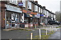
Residents of SE12 9BJ enjoy convenient access to retail and leisure facilities located just minutes away. You can shop at the Co-op Burnt branch or travel slightly further to the Tesco Clifton and Tesco Elvam stores for your weekly necessities. Five railway stations lie within practical reach, including Lee, Grove Park, and Hither Green, offering straightforward trips into central London. The metro network is equally accessible via stops at Elverson Road, Deptford Bridge, and Cutty Sark for Maritime Greenwich. For those living near the river, ferry services operate from Greenwich Pier, Masthouse Terrace Pier, and Barrier Gardens Pier. Air travellers can reach London City Airport with minimal effort from this location. This dense network of amenities means you rarely need to venture far for daily errands or weekend activities. The variety of shopping options and transport links creates a lifestyle where convenience and connectivity drive your daily routine.
Amenities
Schools
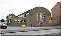
Families in SE12 9BJ have access to Horn Park Primary School, which holds a good Ofsted rating and serves the primary education needs of local children. Another option is Horn Park Infant School, completing the primary education provision nearby. These two institutions provide essential schooling for young residents without requiring a longer commute to educational facilities. The presence of these specific schools supports the area's status as a location where children can access local education. For parents seeking secondary schools, the current data lists only primary options, meaning you may need to look beyond this immediate postcode for comprehensive schooling. The concentration of primary schools indicates that this neighbourhood is a common choice for families with younger children. When considering schools near SE12 9BJ, the availability of rated primary institutions remains a key advantage for householders.
| Rank | School | Type | Entry gender | Ages |
|---|
Explore more schools in this area
Go to Schools tabDemographics
The community in SE12 9BJ reflects a mature demographic profile with a median age of 47 years. Most households consist of adults aged between 30 and 64, forming the core of the local population. This age distribution suggests a neighbourhood established by families and professionals rather than students or recent arrivals. Home ownership stands at 43 per cent, indicating that slightly less than half of the residents own their properties while the remaining majority likely rents. The accommodation type is predominantly houses, which contributes to a family-oriented environment with more private outdoor space than typical high-rise blocks. White residents make up the predominant ethnic group in this area. The combination of home ownership levels and accommodation types points to a stable resident base with long-term ties to the locality. These statistics paint a picture of a conventional residential zone where traditional family housing remains the standard option for most home buyers.
Household Size
Accommodation Type
Tenure
Ethnic Group
Religion
Household Composition
Age
Household Deprivation
NS-SEC
Explore more demographic insights in this area
Go to Demographics tabPlanning
Planning Constraints
- Flood RiskPremium
- Ramsar Wetland SitesPremium
- Area of Outstanding Natural BeautyPremium
- Protected Nature ReservePremium
- Protected WoodlandPremium