Area Overview for SE12 9AT
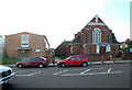
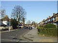
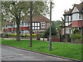
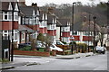
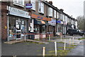
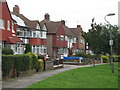
Photos of SE12 9AT


Area Information
SE12 9AT represents a small residential cluster covering just 3237 square metres of land in England. Despite its compact size, the area supports a population of 1559 people, creating a dense neighbourhood where residents know each other well. This postcode sits within South East Greater London, forming a distinct part of the wider SE12 zone known for Clifton. The community here is tightly knit, with a median age of 47 years indicating a mature demographic. Most residents fall into the adult category spanning thirty to sixty-four years, suggesting a family-oriented or established professional settlement. Daily life centres on proximity to local shops, transport links, and green spaces rather than vast expanses of property. The high population density presents as 481605 people per square kilometre, though this figure reflects the specific boundary of the postcode rather than the broader borough. Living in SE12 9AT means accessing the practicalities of urban living within a defined, manageable footprint. You will find yourself surrounded by other households who seek stability and convenience. The area avoids the expansive sprawl of outer London while retaining the connectivity of the capital. Homes here offer a direct connection to the city without the isolation of the suburbs.
- Area Type
- Postcode
- Area Size
- 3237 m²
- Population
- 1559
- Population Density
- 4655 people/km²
The housing stock in SE12 9AT is characterised by a predominance of houses rather than flats or other dwellings. This physical form of accommodation shapes the character of the streets and the potential for future renovations. Forty-nine per cent of residents own their homes outright or with a mortgage, establishing this as a market with significant owner-occupier influence. The remaining households rent their properties, but the high ownership rate suggests stability and a desire for permanent settlement. Because the total area covers only 3237 square metres, the market operates on a micro-scale compared to broader London boroughs. Buyers looking at homes in SE12 9AT should expect to find properties that suit families or those working from home who value space. The accommodation type data confirms that traditional houses are the standard here, rather than the high-density apartment blocks common in central zones. This distinction matters for buyers seeking garden space or dedicated gardens. The property market reflects the needs of the local age group, primarily adults between thirty and sixty-four years. You will find that the demand for these houses remains steady due to the ownership rate. Transactions here are driven by practical considerations and local knowledge.
House Prices in SE12 9AT
Showing 21 properties
| Address | Type | Beds | Baths | Last Sale Price | Last Sale Date | |
|---|---|---|---|---|---|---|
| 1, Mallory Court, 11 Simnel Road, Eltham, SE12 9AT | Flat | 3 | 1 | - | - | |
| 2, Mallory Court, 11 Simnel Road, Eltham, SE12 9AT | Flat | - | - | - | - | |
| 3, Mallory Court, 11 Simnel Road, Eltham, SE12 9AT | house | - | - | - | - | |
| 13, Mallory Court, 11 Simnel Road, Eltham, SE12 9AT | Flat | - | - | - | - | |
| 20, Mallory Court, 11 Simnel Road, Eltham, SE12 9AT | Flat | - | - | - | - | |
| 19, Mallory Court, 11 Simnel Road, Eltham, SE12 9AT | Flat | - | - | - | - | |
| 17, Mallory Court, 11 Simnel Road, Eltham, SE12 9AT | Flat | - | - | - | - | |
| 5, Mallory Court, 11 Simnel Road, Eltham, SE12 9AT | house | - | - | - | - | |
| 12, Mallory Court, 11 Simnel Road, Eltham, SE12 9AT | Flat | - | - | - | - | |
| 9, Mallory Court, 11 Simnel Road, Eltham, SE12 9AT | Flat | - | - | - | - |
Energy Efficiency in SE12 9AT
Residents of SE12 9AT enjoy convenient access to a wide range of amenities within practical reach. For shopping needs, you can visit the Co-op Burnt, Tesco Clifton, or Tesco Elvemon for groceries and daily essentials. Five retail options are situated nearby, ensuring you rarely need to travel far for basic supplies. Transport connectivity is equally impressive, with five rail stations including Lee, Grove Park Station, and Hither Green offering frequent services to central London. The area also boasts five nearby metro stops such as Elverson Road, Deptford Bridge, and Cutty Sark for Maritime Greenwich. If you prefer water travel, ferries are available at Greenwich Pier, Masthouse Terrace Pier, and Barrier Gardens Pier. Furthermore, London City Airport lies close by, providing quick access to domestic flights. This diversity of transport options means you can choose how you reach the city or the wider region. The availability of five rail and metro hubs within reach ensures you are never stranded. Your daily commute becomes a flexible choice rather than a fixed routine.
Amenities
Schools
| Rank | School | Type | Entry gender | Ages |
|---|
Explore more schools in this area
Go to Schools tabDemographics
The community within SE12 9AT is defined by a settled population with a median age of 47 years. The majority of residents are adults between thirty and sixty-four years old, creating a stable community environment. Forty-nine per cent of households own their home, while the remaining fifty-one per cent rent their accommodation. This balance indicates a mix of long-term owners and tenants, yet the sheer volume of data suggests a high rate of homeownership is typical for this cluster. The prevailing form of accommodation consists of houses, which aligns with the preferences of the adult demographic. This housing type supports families and those seeking traditional living arrangements. The predominant ethnic group in the area is White, reflecting the historic character of the neighbourhood. Residents here are likely to connect with a homogenous cultural environment that spans several decades of urban development. The age profile avoids the extremes of a student quarter or a retirement village, focusing instead on the working-age bracket. This demographic structure supports local businesses that cater to families and established professionals. Understanding who lives in this postcode helps prospective buyers gauge the daily rhythm of the neighbourhood. You will find a community that values stability and established routines.
Household Size
Accommodation Type
Tenure
Ethnic Group
Religion
Household Composition
Age
Household Deprivation
NS-SEC
Explore more demographic insights in this area
Go to Demographics tabPlanning
Planning Constraints
- Flood RiskPremium
- Ramsar Wetland SitesPremium
- Area of Outstanding Natural BeautyPremium
- Protected Nature ReservePremium
- Protected WoodlandPremium