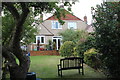
Area Overview for SE12 0UL
Photos of SE12 0UL


Area Information
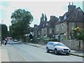
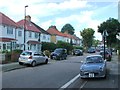
Living in SE12 0UL offers a distinct experience within a very compact residential cluster. This specific postcode covers an area of just 8,372 square metres, creating a high-density environment where neighbours are close by. The population stands at 1,801 people, resulting in an extremely high population density of 215,126 people per square kilometre. You are entering a space defined by its tight boundaries rather than vast open grounds. The layout supports a community-focused lifestyle where daily routines revolve around immediate proximity to local facilities. Residents benefit from rapid access to nearby transport links without needing to navigate long distances across Greater London. This density means that homes in SE12 0UL are situated in an immediate reach of essential services including rail lines, metro stops, and retail outlets. You will find that daily commutes to London City Airport are manageable, given its presence in the immediate vicinity. The area functions efficiently as a small residential node within a larger urban network, offering convenience through location rather than expansive green space.
- Area Type
- Postcode
- Area Size
- 8372 m²
- Population
- 1801
- Population Density
- 5105 people/km²
Flats dominate the housing stock in SE12 0UL, reflecting the physical limitations of the 8,372 square metre area. With only 41% of residents owning their homes, this postcode operates as a hybrid market with significant rental activity alongside owner-occupiers. Buyers should expect properties to be designed for vertical living rather than spacious ground-level homes. The high population density of over 215,000 people per square kilometre means housing units are likely to be efficiently planned to maximise the limited land. This concentration of flats creates a specific buyer market seeking modern or converted residential units rather than period houses. The 41% home ownership rate suggests that many residents acquire their properties through the shared ownership scheme or purchase existing flats on the open market. For those considering homes in SE12 0UL, the lack of detached or semi-detached houses means shared walls are a standard feature of daily life. The area suits investors or buyers interested in urban living modules who prioritise location over floor space. Ownership rates here lag behind the national average of owner-occupied dwellings in similar London suburbs.
House Prices in SE12 0UL
Showing 16 properties
| Address | Type | Beds | Baths | Last Sale Price | Last Sale Date | |
|---|---|---|---|---|---|---|
| 246 Baring Road, London, SE12 0UL | house | - | - | £495,000 | Aug 2025 | |
| 244 Baring Road, London, SE12 0UL | Terraced | 3 | 1 | £365,000 | Sep 2016 | |
| 238 Baring Road, London, SE12 0UL | house | - | - | £330,000 | Sep 2011 | |
| 248 Baring Road, London, SE12 0UL | Terraced | - | - | £197,000 | Mar 2006 | |
| 234A Baring Road, London, SE12 0UL | house | 5 | - | £93,000 | Mar 1997 | |
| 174A Baring Road, London, SE12 0UL | Detached | 3 | 1 | - | - | |
| 236A Baring Road, London, SE12 0UL | Semi-detached | 3 | 1 | - | - | |
| 236 Baring Road, London, SE12 0UL | Semi-detached | 4 | - | - | - | |
| 240 Baring Road, London, SE12 0UL | house | - | - | - | - | |
| 244A Baring Road, London, SE12 0UL | Terraced | 3 | 1 | - | - |
Energy Efficiency in SE12 0UL
Your daily life in SE12 0UL centres on a dense network of amenities within practical reach. Retail options include Tesco Grove, Sainsburys Lewisham Grove, and Budgens Catford, providing immediate access to groceries and essentials. You can shop at these five retail locations without travelling far from your home. Transport convenience is reinforced by five nearby rail stations including Hither Green and five metro stops like Elverson Road. Ferry access at Greenwich Pier, Masthouse Terrace Pier, and Barrier Gardens Pier offers additional routes across the Thames. London City Airport is located just one unit away in the nearest amenities category, making it highly accessible for business travellers or leisure visitors. These six distinct categories of amenities ensure you have services at hand. The concentration of Tesco and Sainsburys means you do not need to leave the borough for daily shopping. This density of services supports a lifestyle where commuting is short and errands are quick. You benefit from the proximity of five rail hubs and multiple pier locations for weekend excursions.
Amenities
Schools
Families living in SE12 0UL have access to specific educational providers within immediate reach. Cooper's Lane Primary School serves local children and holds a 'good' Ofsted rating, providing a confirmed standard for early years education. This specific rating offers reassurance that the primary educational option meets regulatory expectations. The data does not list secondary schools directly adjacent to this postcode, meaning older children may require travel to larger educational complexes beyond the immediate 8,372 square metre boundary. For parents, the presence of a good-rated primary school is a concrete advantage when evaluating homes in SE12 0UL. The reliance on a single primary institution listed in the data suggests that school catchment areas are critical factors when purchasing locally. You must verify secondary school catchment zones independently as they are not detailed in the current property statistics. The mix of school availability means that while early childhood education is locally managed, teenage education relies on proximity to broader borough facilities.
| Rank | School | Type | Entry gender | Ages |
|---|
Explore more schools in this area
Go to Schools tabDemographics
The community in SE12 0UL reflects a mature profile with a median age of 47 years. Most residents fall into the adult age range between 30 and 64 years, indicating a neighbourhood frequented by those established in their careers or raising families. Home ownership stands at 41%, suggesting a balanced mix of owner-occupiers and private renters. This specific level of ownership contrasts with areas where residents have lived for generations, pointing to a dynamic population. Flats constitute the predominant accommodation type, aligning with the high-density physical constraints of the 8,372 square metre parcel. The predominant ethnic group is White, reflecting the historical development of the local cluster. These demographics shape a resident base that generally values proximity to work and established local infrastructure. The concentration of adults between 30 and 64 implies a demand for homes that suit both working professionals and households managing school runs. Safety considerations are a relevant factor for this demographic, as crime risk scores indicate higher than average incidents. The combination of mature age and flat-living suggests a preference for low-maintenance living close to transport hubs.
Household Size
Accommodation Type
Tenure
Ethnic Group
Religion
Household Composition
Age
Household Deprivation
NS-SEC
Explore more demographic insights in this area
Go to Demographics tabPlanning
Planning Constraints
- Flood RiskPremium
- Ramsar Wetland SitesPremium
- Area of Outstanding Natural BeautyPremium
- Protected Nature ReservePremium
- Protected WoodlandPremium