Area Overview for SE12 0PX
Photos of SE12 0PX
Area Information
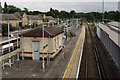
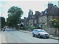
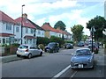
Living in SE12 0PX means residing in a very specific residential cluster within the larger SE12 postcode district. This small area covers just 6744 square metres and houses a population of 1801 people. The density is high at 267056 people per square kilometre, creating an urban feel that contrasts with those seeking spacious gardens. Daily life here revolves around being surrounded by flat developments rather than detached houses. You will find yourself walking to Transport for London network services including Grove Park Station, Hither Green, and Lee. Retail options are within immediate reach at Tesco Grove, Sainsburys Lewisham Grove, and Budgens Catford. The area sits close to major transport hubs such as London City Airport and Greenwich Pier. While the population is compact, the location offers instant access to the wider borough of Lewisham and surrounding transport links. This setting suits those who prioritise connectivity and convenience over rural space. It is a functional hub for commuters and those working remotely, provided you accept the inherent density of such a concentrated postcode sector.
- Area Type
- Postcode
- Area Size
- 6744 m²
- Population
- 1801
- Population Density
- 5105 people/km²
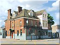
The property market in SE12 0PX is heavily weighted towards flats, as this is the dominant accommodation type listed for the area. With only 41 per cent of residents owning their homes, this indicates a significant presence of landlords and private rental tenants. The remaining majority likely reside in rented properties, reflecting the urban nature of this 6744 square metre cluster. Buyers looking for a home here should expect to compete within a housing stock designed for density rather than standalone living. The high population of 1801 people in such a small area reinforces that detached houses are rare or non-existent. If you wish to purchase, you will likely be looking at a flat within a larger block or development. This market dynamic means price sensitivity is often higher compared to areas with owner-occupied terraced or detached homes. The concentration of flats also implies that service charges and ground rules will play a larger role in budgeting than in suburban zones.
House Prices in SE12 0PX
Showing 16 properties
| Address | Type | Beds | Baths | Last Sale Price | Last Sale Date | |
|---|---|---|---|---|---|---|
| 213D Baring Road, London, SE12 0PX | Flat | - | - | £285,000 | Oct 2021 | |
| 209 Baring Road, London, SE12 0PX | Detached | 5 | 2 | £740,000 | Jan 2021 | |
| 213C Baring Road, London, SE12 0PX | Flat | - | - | £230,000 | Jun 2019 | |
| 205 Baring Road, London, SE12 0PX | house | 4 | - | £350,000 | Dec 2012 | |
| 211 Baring Road, London, SE12 0PX | Detached | - | - | £446,000 | Apr 2008 | |
| 199 Baring Road, London, SE12 0PX | Terraced | - | - | £410,000 | Jul 2007 | |
| 197 Baring Road, London, SE12 0PX | Terraced | - | - | £327,000 | Oct 2004 | |
| 215B Baring Road, London, SE12 0PX | Flat | 2 | 1 | £135,000 | Jul 2003 | |
| 203 Baring Road, London, SE12 0PX | Terraced | - | - | £154,000 | Aug 2001 | |
| 207 Baring Road, London, SE12 0PX | Detached | 4 | 1 | - | - |
Energy Efficiency in SE12 0PX
Lifestyle in SE12 0PX centres on convenience and proximity to major London services. You have immediate access to five retail outlets including Tesco Grove, Sainsburys Lewisham Grove, and Budgens Catford. Transport choices are varied, with five rail options to nearby stations, five metro lines, and ferry access via Greenwich Pier, Masthouse Terrace Pier, and Barrier Gardens Pier. London City Airport is also one of the closest airports to this postcode. This density of transport and retail means most daily errands can be completed on foot or a short stroll. The area offers a range of commuting options without needing a car, which reduces running costs and congestion. However, the reliance on flats means leisure activities often involve nearby entertainment districts rather than private grounds. The character is defined by the interplay of these transport nodes and the quick reach to shopping, creating a fast-paced urban lifestyle.
Amenities
Schools
There is one primary school nearby for families considering SE12 0PX: Cooper's Lane Primary School. It holds a Ofsted rating of good, which is a standard recognition of quality within the British education system. This single listing provides a clear, albeit limited, picture of formal education options immediately adjacent to this specific postcode. Parents should verify bus routes and catchment areas independently, as school admissions can change. The absence of secondary school names in the data highlights that secondary education is managed under broader local authority boundaries rather than immediate proximity. While this data point is singular, the existence of a rated primary school suggests a commitment to local education infrastructure. Families may need to look further afield for secondary options like grammar schools or large state comprehensive colleges that serve the wider SE12 sector.
| Rank | School | Type | Entry gender | Ages |
|---|
Explore more schools in this area
Go to Schools tabDemographics
The community in SE12 0PX is defined by an older demographic with a median age of 47 years. Adults between 30 and 64 years are the most common age range, indicating a settled population likely in their established life stages. This age profile often correlates with higher home ownership rates, yet only 41 per cent of households own their property. The majority of the inhabitants therefore live in rented accommodation, suggesting a mix of professionals, empty nesters, and families. The accommodation type is predominantly flats, which aligns with the high population density and limited land area of the 6744 square metre zone. Predominantly White residents form the largest ethnic group in this cluster. The demographic mix suggests a neighbourhood where long-term residents coexist with those seeking flats close to transport links. This age structure can also influence local businesses and community engagement, although specific data on community activity is not provided. Families with young children may find fewer residents in the typical child-rearing age bracket, yet the area serves as a base for a wide range of households.
Household Size
Accommodation Type
Tenure
Ethnic Group
Religion
Household Composition
Age
Household Deprivation
NS-SEC
Explore more demographic insights in this area
Go to Demographics tabPlanning
Planning Constraints
- Flood RiskPremium
- Ramsar Wetland SitesPremium
- Area of Outstanding Natural BeautyPremium
- Protected Nature ReservePremium
- Protected WoodlandPremium