Area Overview for SE12 0TG
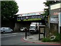
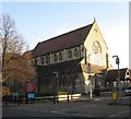
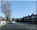
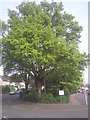
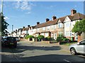
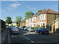
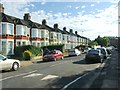
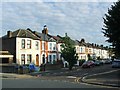
Photos of SE12 0TG


Area Information
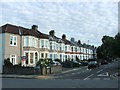
Living in SE12 0TG offers a residential experience defined by a tightly clustered community. This specific postcode covers an area of just 6,028 square metres, housing a resident population of 1,496 people. The high population density of 248,169 people per square kilometre suggests a compact urban environment where neighbours are likely to know one another. You will find yourself in a setting that prioritises established homes over new developments, creating an atmosphere of stability. The area serves as a distinct neighbourhood within a larger district, offering a blend of accessibility and local intimacy. Daily life revolves around proximity to transport hubs while maintaining a focused, contained residential identity. For those moving to SE12 0TG, the immediate surroundings provide a strong sense of place without the sprawl associated with larger districts. The concentration of residents in such a small physical footprint means services and amenities must be accessed slightly further away, but the core living experience remains centred on this specific residential block.
- Area Type
- Postcode
- Area Size
- 6028 m²
- Population
- 1496
- Population Density
- 4313 people/km²
The property market in SE12 0TG is characterised by high levels of stability and traditional housing stock. With 73 per cent of the population owning their homes, this area functions primarily as an owner-occupied zone rather than a rental market. This dynamic means that when you look for homes in SE12 0TG, you are entering a market with many long-term residents who have improved their properties over time. There is a strong prevalence of houses as the main accommodation type, distinguishing it from neighbouring areas that might feature more flats or higher-density apartment blocks. If you are considering buying, you will find a range of properties suited for families and individuals seeking ownership. The market here is less volatile because of the high ownership rate, which often results in a steadier investment environment. Buyers should expect to compete with other owners who are deeply connected to the locality and unwilling to move quickly.
House Prices in SE12 0TG
Showing 17 properties
| Address | Type | Beds | Baths | Last Sale Price | Last Sale Date | |
|---|---|---|---|---|---|---|
| 266 Manor Lane, London, SE12 0TG | Terraced | 3 | 1 | £575,000 | Feb 2025 | |
| 237 Manor Lane, London, SE12 0TG | house | - | - | £626,275 | Aug 2018 | |
| 252 Manor Lane, London, SE12 0TG | house | 5 | - | £650,000 | Aug 2017 | |
| 246 Manor Lane, London, SE12 0TG | Terraced | 3 | 2 | £450,000 | Apr 2015 | |
| 231 Manor Lane, London, SE12 0TG | house | 3 | - | £304,500 | Mar 2012 | |
| 248 Manor Lane, London, SE12 0TG | house | - | - | £290,000 | Sep 2009 | |
| 268 Manor Lane, London, SE12 0TG | Terraced | - | - | £236,000 | Mar 2003 | |
| 260 Manor Lane, London, SE12 0TG | Terraced | - | - | £227,500 | Nov 2002 | |
| 262 Manor Lane, London, SE12 0TG | Terraced | - | - | £190,000 | Nov 2002 | |
| 264 Manor Lane, London, SE12 0TG | house | 4 | - | £179,000 | Jul 2002 |
Energy Efficiency in SE12 0TG
Daily life in SE12 0TG is supported by a diverse range of amenities within practical driving or walking distance of your home. For shopping needs, you have access to five retail locations, including notable venues such as the Co-op Burnt, Tesco Hither, and Sainsburys Hither. These supermarkets provide essential daily goods alongside convenience items. Transport choices are extensive, with five rail stations, five metro stations, and five ferry terminals nearby. You can reach Greenwich Pier, Masthouse Terrace Pier, and Royal Wharf Pier easily for leisure trips or commuting across the Thames. London City Airport is also accessible if your work requires frequent flights. This mix of retail giants and major transport hubs ensures that you can run errands or travel for work without leaving the greater London area. The variety of options caters to both convenience shoppers and those looking for wider leisure activities across the city.
Amenities
Schools
Families moving to SE12 0TG will have access to two specific primary schools within the vicinity. St Winifred's Catholic Junior School operates as a primary institution catering to younger students in the area. A second option is St Winifred's RC Primary School, which currently holds a good Ofsted rating. Both schools are primary institutions, meaning that older children attending secondary schools must travel beyond the immediate envelope of the postcode. The concentration of primary education options suggests the area attracts families with younger children who wish their children to attend state or faith-based primary education locally. The presence of a school with a good Ofsted rating provides reassurance regarding the quality of education available to young children living near SE12 0TG.
| Rank | School | Type | Entry gender | Ages |
|---|
Explore more schools in this area
Go to Schools tabDemographics
The community in SE12 0TG reflects a mature demographic profile with a median age of 47 years. Adults aged between 30 and 64 years constitute the most common age range, indicating a population in the prime working or semi-retirement stages of life. This age profile often correlates with a preference for stability and established surroundings. Home ownership stands at an impressive 73 per cent, suggesting that the majority of residents have purchased their properties rather than renting. This high rate of ownership typically points to a neighbourhood where families and long-term residents have put down roots. The predominant ethnic group is White, which forms the backbone of the local population structure. With houses as the primary accommodation type, the area caters to those seeking standard family living spaces rather than apartment living. You can expect a demographic leaning towards established households who value security and permanence over transient lifestyles.
Household Size
Accommodation Type
Tenure
Ethnic Group
Religion
Household Composition
Age
Household Deprivation
NS-SEC
Explore more demographic insights in this area
Go to Demographics tabPlanning
Planning Constraints
- Flood RiskPremium
- Ramsar Wetland SitesPremium
- Area of Outstanding Natural BeautyPremium
- Protected Nature ReservePremium
- Protected WoodlandPremium