Area Overview for SE11 5UG
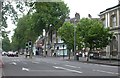
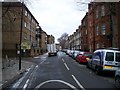
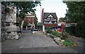
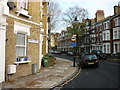
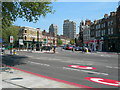
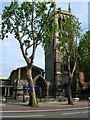
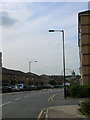
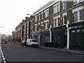
Photos of SE11 5UG


Area Information
SE11 5UG is a very compact postcode covering just 3,694 square metres. You will find 1,851 people living within this specific residential cluster. The high population density of 501,099 people per square kilometre indicates a tightly packed urban environment. This small area serves as a residential hub dominated by flats rather than detached houses. Life here is defined by proximity to major London transport links and central amenities. Residents rely on the intensity of the location rather than local green space or sprawling streets. The area functions as a dense node within the greater Lambeth ward. Buying a home in SE11 5UG means purchasing into a high-energy slice of south London. You are trading spacious gardens for immediate access to jobs and leisure. The neighbourhood is characterised by its small scale and intense usage. This makes the postcode feel very part of the city fabric rather than a separate community. The immediate surroundings include significant transport capacity and retail infrastructure. You can walk to multiple tube and rail stations from your doorstep. The sheer number of people living in such a limited footprint creates a distinct vibe. It is an area where convenience outweighs quietness. For someone seeking a flat close to everything, this postcode delivers that practicality. However, the lack of open space is a definitive feature of this specific location.
- Area Type
- Postcode
- Area Size
- 3694 m²
- Population
- 1851
- Population Density
- 14293 people/km²
The property market in SE11 5UG is defined by a high concentration of flats. Flats constitute the main accommodation type for residents. Only 42% of homes are owner-occupied, indicating a strong rental component. Most buyers looking at homes in SE11 5UG will be competing with landlords and investors. You will find a mix of leasehold properties and some freeholds, given the flat dominance. The small area size restricts the availability of large, traditional family houses. Property searches here focus on interior space and location value. Communal amenities like concierge services or lifts are common expectations in this flat-heavy market. Prices are driven by the immediate access to South and South West London transport hubs. The low home ownership rate suggests that buying into SE11 5UG requires significant capital or a ladder approach to ownership. Rental demand remains high due to the area's connectivity. If you are considering selling a flat in this postcode, speed is a key factor. The small cluster of homes means limited variation in building age and style. Buyers should expect competition for well-maintained units. The market operates within the broader south London context but has its own micro-equilibrium. You cannot assume finding a large garden or garage here.expectations for outdoor space should be adjusted.
House Prices in SE11 5UG
Showing 26 properties
| Address | Type | Beds | Baths | Last Sale Price | Last Sale Date | |
|---|---|---|---|---|---|---|
| 15 Sancroft Street, London, SE11 5UG | Terraced | 4 | 2 | £1,100,000 | Feb 2025 | |
| 27 Sancroft Street, London, SE11 5UG | Terraced | - | - | £685,000 | Jun 2008 | |
| 25 Sancroft Street, London, SE11 5UG | house | - | - | £460,000 | Jul 2006 | |
| 21 Sancroft Street, London, SE11 5UG | Terraced | 3 | 2 | - | - | |
| Flat 5, 51 Sancroft Street, London, SE11 5UG | Flat | 2 | 1 | - | - | |
| 29 Sancroft Street, London, SE11 5UG | Terraced | 4 | 2 | - | - | |
| 3, Havilland House, 13 Sancroft Street, London, SE11 5UG | Flat | - | - | - | - | |
| 19 Sancroft Street, London, SE11 5UG | house | 4 | - | - | - | |
| 17 Sancroft Street, London, SE11 5UG | Flat | 4 | 1 | - | - | |
| Flat 3, 51 Sancroft Street, London, SE11 5UG | Flat | - | - | - | - |
Energy Efficiency in SE11 5UG
Daily life in SE11 5UG revolves around convenience and proximity. Five Tesco supermarkets, including locations at Lambeth and Kennington, are within practical reach. You will not need to travel far for groceries or household needs. Five major metro stations serve the area, offering rapid access to Central, Victoria, and North London lines. The Oval, Kennington, and Pimlico stations provide frequent service. Five railway stations, including Vauxhall and Elephant and Castle, connect you to the national network. Five ferry piers, such as Lambeth and Millbank, offer river crossings. Three significant coach stations, including Victoria and Green Line, handle long-distance travel. This density of transport options gives you total freedom. You can choose the most suitable mode for each journey. Retail choices are robust with multiple major supermarket options nearby. The area feels connected to the wider city yet distinct in its own rhythm. Living here means you never wait long for a bus or tube train. The sheer number of transport choices prevents any feeling of isolation. You can walk to work in central London or shops in south London easily. The lifestyle is urban, active, and efficient. No major parks or open green spaces are listed in the data. Your leisure activities will centre on entertainment, dining, or transport-based exploration. The lifestyle prioritises access over local sprawl.
Amenities
Schools
Only one school appears in the official data for the immediate vicinity of SE11 5UG. That is Aspen House School, which operates as a special school. This designation requires specific provision for students with particular educational needs or disabilities. You will find no primary, secondary, or comprehensive schools listed for this postcode. Families living in SE11 5UG likely rely on schools in neighbouring postcodes. The absence of general education institutions nearby means parents plan their commutes carefully. Special schools play a critical role for a specific subset of the community. If you have a child with special needs, Aspen House School provides essential education. For standard education, you must look at wider areas. Living in SE11 5UG means accepting that the local catchment for mainstream schooling isexternal. Homebuyers should verify catchment zones for properties outside the immediate cluster. Transport links help mitigate the distance to other boroughs where children attend mainstream primary or secondary schools. The presence of a special school reflects the diverse needs of the local population. It confirms that the area supports specialist educational provisions.
| Rank | School | Type | Entry gender | Ages |
|---|
Explore more schools in this area
Go to Schools tabDemographics
The community in SE11 5UG reflects an older, established population. The median age is 47 years, placing the adult (30-64 years) age range as the most common demographic. This suggests you will meet many established residents and retirees. Home ownership stands at 42%, meaning slightly under half of the homes are owner-occupied. The other half represents rental occupancy. Flats form the predominant accommodation type in the area. This aligns with the physical constraints of the land. The resident population is predominantly White. Diversity exists, but the primary ethnic group remains White. Deprivation levels are not explicitly quantified in current data, but the high density supports a mix of income groups typical for London flats. The age profile indicates a stable community with fewer young children raising at home than in suburbs. You will encounter many professionals and older individuals managing their lives from this postcode. The lower home ownership percentage suggests a desire for flexibility or limited capital among buyers. Tenants make up a significant portion of the housing stock. The population density ensures a constant flow of foot traffic. Life here suits those who prefer an urban, mature environment. Family life looks different compared to outer London suburbs. Large households with school-age children are less likely to be the norm. Instead, you see singles, couples, and small families in compact living spaces.
Household Size
Accommodation Type
Tenure
Ethnic Group
Religion
Household Composition
Age
Household Deprivation
NS-SEC
Explore more demographic insights in this area
Go to Demographics tabPlanning
Planning Constraints
- Flood RiskPremium
- Ramsar Wetland SitesPremium
- Area of Outstanding Natural BeautyPremium
- Protected Nature ReservePremium
- Protected WoodlandPremium