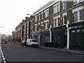
Area Overview for SE11 5PF
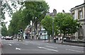
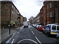
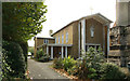
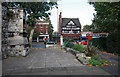
Photos of SE11 5PF


Area Information
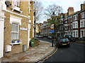
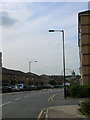
Living in SE11 5PF means residing within a very specific residential cluster that occupies an area of just 5325 square metres. You will find 1851 people calling this postcode their home, resulting in a population density of 347,622 people per square kilometre. This extreme density indicates a highly concentrated urban environment rather than a sprawling suburb. The neighbourhood is entirely defined by its postcode, making it a compact pocket of London life. Daily reality here involves navigating a tight-knit community where proximity to transport hubs and amenities is your primary concern. You are situated in an environment where every square metre is valuable, typical of central London developments. Expect a pace of life dictated by the immediate needs of residents and the efficient use of space. This postcode serves as a distinct residential unit within the broader SE11 postal sector, offering living conditions shaped by its small footprint. Buyers looking at SE11 5PF are entering a market characterised by limited overall space but high connectivity. The area functions as a functional residential zone focused on utility and convenience. You will experience a community built around the needs of a dense urban population.
- Area Type
- Postcode
- Area Size
- 5325 m²
- Population
- 1851
- Population Density
- 14293 people/km²
The housing stock in SE11 5PF is defined almost exclusively by flats, with no mention of detached or semi-detached homes in the provided data. This fact dictates the nature of the property market; you are almost always choosing an apartment when viewing homes in this area. With home ownership recorded at 42%, the market demonstrates a mix of owner-occupiers and private or social renters, rather than being a homogeneous estate. This split suggests a dynamic environment where leasehold apartments hold value alongside rent-to-own opportunities. Buyers seeking single-family houses will not find matches within SE11 5PF itself due to the specific accommodation type listed. The high population density of 347,622 people per square kilometre reinforces the reality that floor space is at a premium. These figures indicate a typical inner-city London market. If you acquire a property in SE11 5PF, you are joining a legacy of urban living where vertical density replaces horizontal spread.
House Prices in SE11 5PF
Showing 26 properties
| Address | Type | Beds | Baths | Last Sale Price | Last Sale Date | |
|---|---|---|---|---|---|---|
| 51 Cardigan Street, London, SE11 5PF | Terraced | 4 | 2 | £990,000 | Jun 2025 | |
| 53 Cardigan Street, London, SE11 5PF | house | - | - | £951,000 | Mar 2025 | |
| 63 Cardigan Street, London, SE11 5PF | Terraced | 2 | 1 | £925,000 | Apr 2024 | |
| 55 Cardigan Street, London, SE11 5PF | Retail | 4 | 2 | £1,050,000 | Dec 2022 | |
| 59 Cardigan Street, London, SE11 5PF | Terraced | 2 | 1 | £890,000 | Jun 2021 | |
| 64 Cardigan Street, London, SE11 5PF | Terraced | - | - | £910,000 | Jun 2021 | |
| 62 Cardigan Street, London, SE11 5PF | Terraced | 2 | 1 | £985,000 | Jul 2020 | |
| 48 Cardigan Street, London, SE11 5PF | house | - | - | £1,050,000 | Feb 2016 | |
| 57 Cardigan Street, London, SE11 5PF | Semi-detached | 2 | 1 | £822,000 | May 2014 | |
| 50 Cardigan Street, London, SE11 5PF | house | 4 | - | £660,000 | Apr 2011 |
Energy Efficiency in SE11 5PF
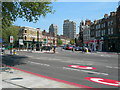
Convenience defines the lifestyle in SE11 5PF, with five retail options including Tesco Lambeth, Tesco Kennington, and Tesco Kennington situated nearby. Grocery shopping, household essentials, and daily provisions are easily accessible within your practical reach. Transport options are extensive, featuring five metro stations such as Kennington Station, Oval, and Nine Elms Underground Station. You also have access to five railway hubs including Vauxhall, Elephant & Castle, and London Waterloo Railway Station. Furthermore, five ferry points like Lambeth Pier and Vauxhall St George Wharf Pier offer river travel. There are three bus stations including the Green Line Coach Station and Victoria Coach Station in your immediate vicinity. This density of amenities means you can walk, tube, train, bus, or boat to your destination without venturing far. Living in SE11 5PF provides immediate access to the full spectrum of London transport.
Amenities
Schools
The nearest educational institution to SE11 5PF is Aspen House School, which operates as a special school. This is the only named school provided in the data for this postcode. The location of a special school indicates that the immediate vicinity may contain areas designated for specific educational needs. Families prioritising primary or secondary academic provisions must look beyond SE11 5PF for standard comprehensive or grammar schools. The presence of a special school in the proximity list shapes the local educational expectation, focusing on inclusive learning environments. You should verify the specific catchment areas for mainstream schools across the wider SE11 sector and neighbouring postcodes, as Aspen House School alone does not cover the full educational spectrum required by general families. The lack of data on standard school ratings means you cannot make judgments on GCSE results or Ofsted ratings without further external research.
| Rank | School | Type | Entry gender | Ages |
|---|
Explore more schools in this area
Go to Schools tabDemographics
The community within SE11 5PF is dominated by adults aged between 30 and 64 years, with a median age of 47. This age profile suggests a neighbourhood settled by professionals, empty-nesters, or long-term residents rather than transient students. Home ownership stands at exactly 42%, meaning more than half of the households are likely renting. Nearly all residential accommodation in this postcode consists of flats, reflecting the high-density nature of the site. The predominant ethnic group is White, giving the area a specific demographic character. There is no data available regarding deprivation indices for this specific postcode, so you cannot gauge financial hardship levels directly from the available figures. However, a home ownership rate of 42% combined with a median age of 47 hints at a market where renting remains a common pathway to living here. You are looking at a stable population of adults living primarily in apartment blocks. The demographic make-up of SE11 5PF is mature, with a clear preference for flat living among the over 1850 residents.
Household Size
Accommodation Type
Tenure
Ethnic Group
Religion
Household Composition
Age
Household Deprivation
NS-SEC
Explore more demographic insights in this area
Go to Demographics tabPlanning
Planning Constraints
- Flood RiskPremium
- Ramsar Wetland SitesPremium
- Area of Outstanding Natural BeautyPremium
- Protected Nature ReservePremium
- Protected WoodlandPremium