Area Overview for SE11 5RR
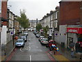
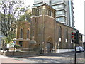
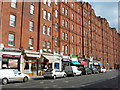
Photos of SE11 5RR


Area Information
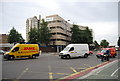
SE11 5RR represents a tightly defined residential cluster in London, covering just 9,987 square metres. Within this compact footprint, 1,432 people make their homes, creating an intense urban environment. The high population density suggests a location where housing is at a premium and space is a finite resource. Living in SE11 5RR means navigating a small cluster where proximity is everything. Residents rely on local footpaths, shared entrances, and immediate connections to wider infrastructure rather than expansive green belts or private grounds. This postcode captures a specific slice of south London life, distinguishing itself from broader suburban areas through its sheer concentration of residents per square kilometre. The area functions as a distinct micro-community within the greater network of NWV Postcode Areas. For those considering this location, you must accept that the high density defines the character of daily life here. The small physical size ensures that foot travel is often the most practical mode of reaching local spots, while also meaning that infrastructure services operate under significant pressure.
- Area Type
- Postcode
- Area Size
- 9987 m²
- Population
- 1432
- Population Density
- 12356 people/km²
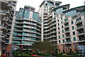
The property market in SE11 5RR is defined by its status as a rental-dominated zone with a 19% home ownership rate. You will find that homes here are primarily flats, a direct reflection of the area's high density and limited land area. This predominant accommodation type means buyers looking for traditional detached properties in SE11 5RR will struggle to find options within this specific small cluster. The low ownership figure indicates that most households are tenants navigating a competitive rental sector rather than owners refining their property portfolio. For those seeking purchase, the nearby wider market in south London may offer more variety, but within SE11 5RR itself, the stock is almost exclusively flat-based. The 9,987 square metre footprint constrains new developments, meaning the existing housing stock represents the primary options for residents. This structure creates a rental-heavy environment where leasehold agreements and service charges are standard considerations. Prospective buyers must approach this postcode with the understanding that it is a pocket of urban living where the primary market mechanism is renting. The market dynamics here favour those willing to adapt to flat living and a tenant-led community.
House Prices in SE11 5RR
Showing 34 properties
| Address | Type | Beds | Baths | Last Sale Price | Last Sale Date | |
|---|---|---|---|---|---|---|
| 1, Morris House, 21 Oval Way, London, SE11 5RR | Flat | 1 | 1 | - | - | |
| Flat 5, Isis House, 23 Oval Way, London, SE11 5RR | Flat | - | 1 | - | - | |
| 5, Morris House, 21 Oval Way, London, SE11 5RR | Flat | - | - | - | - | |
| 4, Matilda House, 25 Oval Way, London, SE11 5RR | Flat | - | - | - | - | |
| 4, Morris House, 21 Oval Way, London, SE11 5RR | Flat | - | - | - | - | |
| 3, Isis House, 23 Oval Way, London, SE11 5RR | Flat | 1 | 1 | - | - | |
| 1, Matilda House, 25 Oval Way, London, SE11 5RR | Flat | - | - | - | - | |
| 3, Matilda House, 25 Oval Way, London, SE11 5RR | Flat | - | - | - | - | |
| 1, Isis House, 23 Oval Way, London, SE11 5RR | Flat | - | - | - | - | |
| 4, Isis House, 23 Oval Way, London, SE11 5RR | Flat | - | - | - | - |
Energy Efficiency in SE11 5RR
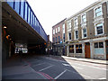
Your lifestyle in SE11 5RR relies on a dense network of amenities within practical reach. Five retail locations host major supermarkets, including Tesco Kennington, Sainsburys Lambeth, and Waitrose Little. These supermarkets allow you to handle daily shopping without travelling far beyond your immediate postcode. Public transport is equally accessible, with five metro stations including Oval, Kennington Station, and Nine Elms Underground Station. Five railway hubs serve longer journeys, such as Vauxhall Railway Station, Elephant & Castle Railway Station, and London Waterloo Railway Station. You can also access five ferry piers, including Vauxhall St George Wharf Pier, Millbank Pier, and Lambeth Pier, for river crossing options. Additionally, three bus stations cover coach connections, featuring Green Line Coach Station and venues at London Victoria Coach Station. This abundance of transport links means you have flexibility in how you move around London. Dining and leisure options cluster around these transport nodes, particularly along High Street corridors. The variety of stations ensures that if one line strikes, you have multiple alternatives. Living in SE11 5RR grants you instant access to the wider retail and transport network of South London.
Amenities
Schools
Families living in SE11 5RR have access to three specific primary schools immediately nearby. Henry Fawcett Junior School operates as a primary institution serving older children within the reach of this postcode. Henry Fawcett Infant School caters to the younger age group, also classified as a primary school. Henry Fawcett Primary School holds a good Ofsted rating, offering a reputable educational foundation for local families. The concentration of primary schools suggests that young children and their parents are a natural demographic within SE11 5RR and the immediate surroundings. You will not find secondary schools listed in the provided data for this specific cluster, meaning families likely commute to neighbouring districts for secondary education. The presence of Henry Fawcett schools provides a consistent educational framework just outside the door. This mix focuses entirely on early childhood and primary education, creating a strong support system for younger children. Parents considering homes in SE11 5RR can rely on these established institutions without needing to travel far for their children's primary schooling. The uniform primary focus ensures that educational needs are met locally before students transition to further areas for ages 11 and above.
| Rank | School | Type | Entry gender | Ages |
|---|
Explore more schools in this area
Go to Schools tabDemographics
The community in SE11 5RR is mature, with a median age of 47 years. Most residents fall into the adult bracket between 30 and 64 years old, indicating a neighbourhood where families and established professionals take root. You will find a higher proportion of adults in their middle years compared to younger households or retirees seeking quiet enclaves. Home ownership stands at 19%, which signals that this remains a predominantly rental market. The vast majority of households occupy flats rather than detached or semi-detached houses. This housing structure aligns with the population density and the flat-based accommodation type dominant in the area. White residents form the predominant ethnic group within this postcode sector. You are looking at a stable, working-age population that relies on the local rental stock for over 80% of residents. The low ownership rate suggests tenants play the central role in the area's social fabric, renting from major landlords or private owners. This demographic profile shapes a neighbourhood where disposable income and tenancy security often dictate lifestyle choices for the typical resident.
Household Size
Accommodation Type
Tenure
Ethnic Group
Religion
Household Composition
Age
Household Deprivation
NS-SEC
Explore more demographic insights in this area
Go to Demographics tabPlanning
Planning Constraints
- Flood RiskPremium
- Ramsar Wetland SitesPremium
- Area of Outstanding Natural BeautyPremium
- Protected Nature ReservePremium
- Protected WoodlandPremium