Area Overview for SE11 5AX
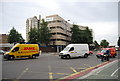
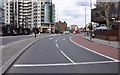
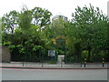
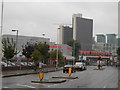
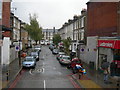
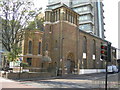
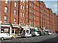
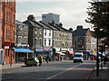
Photos of SE11 5AX
Area Information
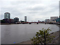
Living in SE11 5AX means residing within a compact residential cluster covering just 1.5 hectares. This small postcode area supports a population of 1,705 residents, resulting in a very high population density of 170,509 people per square kilometre. You will experience a neighbourhood defined by its proximity to major transport hubs and immediate access to the River Thames. The area functions as a micro-community where daily life is heavily influenced by the surrounding urban infrastructure rather than isolated village greenery. Because the land area is so limited, every square metre is utilised for housing, leading to a tightly packed environment. Prospective buyers should view this location as a convenient base for accessing central London, supported by extensive rail, metro, and ferry links. The character of SE11 5AX is dominated by proximity to Vauxhall, Kennington, and Lambeth, rather than internal distinctiveness. Residents benefit from a lifestyle that prioritises accessibility over spacious gardens. The high density indicates a permanent, stable community where separate households share close quarters. Understanding the sheer density is crucial for anyone considering homes in SE11 5AX. It defines the pace of life and the visual landscape you will navigate every day. You are trading private space for convenience and connectivity within this specific postcode.
- Area Type
- Postcode
- Area Size
- 1.5 hectares
- Population
- 1705
- Population Density
- 10271 people/km²
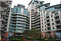
The property market in SE11 5AX is defined by a dominance of flats and a significant reliance on renting rather than ownership. With only 27% of properties owned, you will find that most homes in this postcode are rented accommodations. This statistic signals a market where buy-to-let landlords or social housing providers likely manage a large portion of the stock. For buyers, this presents a specific opportunity to purchase a single unit in a sea of rentals, but it also highlights the area's potential for higher turnover due to tenancy changes. Given that flats are the primary accommodation type, you should expect limited ground-floor access to gardens or private outdoor space. The 1.5-hectare constraint enforces a vertical living model. When searching for homes in SE11 5AX, look for well-maintained blocks that serve a mixture of owners and tenants. The low ownership percentage often correlates with thinner gyroscopic building ages, common in urban river-front zones. You might encounter more shared amenities within the building compared to suburban developments. Understanding this market dynamic helps you navigate the expectations of estate agents and neighbours. The high density and rental majority create a distinct environment from typical London suburbs.
House Prices in SE11 5AX
Showing 37 properties
| Address | Type | Beds | Baths | Last Sale Price | Last Sale Date | |
|---|---|---|---|---|---|---|
| 19 Harleyford Road, London, SE11 5AX | Terraced | - | - | £1,150,000 | Jan 2025 | |
| 21 Harleyford Road, London, SE11 5AX | Terraced | 4 | 2 | £1,037,500 | Apr 2023 | |
| 17 Harleyford Road, London, SE11 5AX | Detached | 2 | 1 | £933,333 | May 2022 | |
| 15 Harleyford Road, London, SE11 5AX | Terraced | 5 | 2 | £925,000 | Jun 2021 | |
| 27 Harleyford Road, London, SE11 5AX | house | - | - | £825,000 | Jun 2018 | |
| 23 Harleyford Road, London, SE11 5AX | Terraced | 2 | - | £525,000 | Aug 2013 | |
| 29 Harleyford Road, London, SE11 5AX | Terraced | 2 | 1 | £405,000 | Dec 2011 | |
| 31 Harleyford Road, London, SE11 5AX | Terraced | 2 | 1 | £430,000 | Nov 2011 | |
| 7 Harleyford Road, London, SE11 5AX | house | - | - | £510,000 | Nov 2011 | |
| 41 Harleyford Road, London, SE11 5AX | Flat | 4 | 2 | £240,000 | Jul 2005 |
Energy Efficiency in SE11 5AX
Your lifestyle in SE11 5AX revolves around immediate access to major retail and leisure hubs. You will find five nearby retail outlets, including Tesco Kennington, Sainsburys Lambeth, and Waitrose Little. This range ensures you can purchase groceries and essentials without needing a vehicle. Five rail stations and five metro stations are located within your practical reach, offering seamless travel to business districts. The area also provides five ferry docks, including Vauxhall St George Wharf Pier and Lambeth Pier, connecting you to Putney and Greenwich. For larger trips, three major coach stations are accessible, such as the Green Line Coach Station and London Victoria Coach Station. The density of these amenities creates a highly convenient daily routine. You can start your day with a coffee from a local venue before heading to work via the nearby Nine Elms Underground Station or London Waterloo Railway Station. Nightlife and dining options are supported by the proximity to Elephant & Castle Railway Station and Kennington Station. Living in SE11 5AX places you at the intersection of retail, transport, and leisure infrastructure. This central positioning means you are always a short walk from significant shopping centres or transport terminals.
Amenities
Schools
SE11 5AX is served by several primary institutions and one special needs college within practical reach. St Mark's Church of England Primary School offers a primary education with a good Ofsted rating. Directly accessible is Lilian Baylis Technology School, which holds an outstanding Ofsted rating and provides a technical educational pathway. St Anne's Catholic Primary School is also available for nearby families, currently holding a satisfactory Ofsted rating. In addition to general education, Five Bridges operates as a special school, catering to specific learning needs. This mix provides choices for families regarding faith-based, technical, and standard primary curricula. The presence of an outstanding-rated technology school suggests strong vocational training options for young children. Parents in SE11 5AX have access to three distinct primary options and one specialist institution. When evaluating schools near SE11 5AX, note the variation in performance ratings. While Lilian Baylis Technology School excels, St Anne's Catholic Primary School currently receives a lower rating. This variety allows you to select an environment that matches your child's specific educational requirements. Access to these schools is a key advantage for residents of this dense postcode area.
| Rank | School | Type | Entry gender | Ages |
|---|
Explore more schools in this area
Go to Schools tabDemographics
The community profile in SE11 5AX reflects a mature demographic, with a median age of 47 years. Over half of the residents fall into the adult category between 30 and 64 years old. This suggests a settlement of established individuals and families rather than a transient population of young professionals. Home ownership stands at 27%, meaning the vast majority of the 1,705 residents rent their accommodations instead of owning them outright. You are entering a primarily rental market where security of tenure may depend on individual tenancy agreements. Flats constitute the predominant accommodation type, aligning with the high-density nature of the 1.5-hectare site. This configuration suits single occupants or couples but limits space for larger families seeking attached land. The resident population is predominantly White, reflecting a specific cultural composition within the local estates. With a population density of 112,041 people per square kilometre, the living environment is intense. The age profile indicates a stable demographic, yet the low ownership rate implies high mobility or financial constraints for many locals. Anyone considering moving to SE11 5AX must accept living in a high-rise or block environment typical of London postcodes. The lack of owner-occupiers often creates a landlord-driven dynamic in the local housing stock.
Household Size
Accommodation Type
Tenure
Ethnic Group
Religion
Household Composition
Age
Household Deprivation
NS-SEC
Explore more demographic insights in this area
Go to Demographics tabPlanning
Planning Constraints
- Flood RiskPremium
- Ramsar Wetland SitesPremium
- Area of Outstanding Natural BeautyPremium
- Protected Nature ReservePremium
- Protected WoodlandPremium