Area Overview for SE11 5RG
Photos of SE11 5RG


Area Information
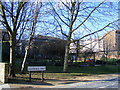
Living in SE11 5RG means residing within a tightly defined residential cluster covering just 1,232 square metres in south London. This small geographical footprint houses a population of 1,325 people, creating a concentrated community where neighbours are often next-door wellings rather than a scattered suburban sprawl. The area sits in the SE11 postcode district, a specific slice of Lambeth that serves as a practical living space rather than a sprawling municipality. Daily life here is characterised by high density and immediate access to major transport arteries, as this postcode lies centrally between hub stations like Vauxhall, Elephant and Castle, and London Waterloo. You are situated in an urban environment where every square metre is utilised, making it distinct from larger London boroughs. The residential nature of the area ensures that your view is likely to be of other homes or immediate street infrastructure rather than expansive green fields. This compact size means local amenities are within a short walk, eliminating the need for lengthy commutes to reach supermarkets or rail stations. The area functions as a self-contained unit where the boundary is clear and the population is well-defined within its intended limits.
- Area Type
- Postcode
- Area Size
- 1232 m²
- Population
- 1325
- Population Density
- 13106 people/km²
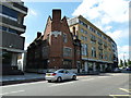
The property market in SE11 5RG is overwhelmingly dominated by the rental sector, with only 17% of residents owning their homes outright. This low ownership figure indicates that prospective buyers will find very few owner-occupied properties within this specific 1,232-square-metre cluster. Instead, you are looking at a market primarily composed of rental stock. The accommodation type is almost exclusively flats, meaning detached or semi-detached houses are virtually non-existent here. If you are considering purchasing a home in SE11 5RG, your search must extend to the wider SE11 postcode area or adjacent districts to find available stock. The local housing stock consists of residential flats designed for the high-density urban lifestyle. Buyers should expect competitive auctions or high-demand rental leases as the local demand exceeds the limited supply of freehold properties. The market reflects the area's status as a fully realised urban asset where urban living takes precedence over traditional home ownership models found in suburban locations.
House Prices in SE11 5RG
Showing 6 properties
| Address | Type | Beds | Baths | Last Sale Price | Last Sale Date | |
|---|---|---|---|---|---|---|
| 2, Eccles Court, 260 Kennington Lane, London, SE11 5RG | Flat | - | - | - | - | |
| 5, Eccles Court, 260 Kennington Lane, London, SE11 5RG | Flat | - | - | - | - | |
| 6, Eccles Court, 260 Kennington Lane, London, SE11 5RG | Flat | 1 | 1 | - | - | |
| 3, Eccles Court, 260 Kennington Lane, London, SE11 5RG | Flat | - | - | - | - | |
| 1, Eccles Court, 260 Kennington Lane, London, SE11 5RG | Flat | - | - | - | - | |
| 4, Eccles Court, 260 Kennington Lane, London, SE11 5RG | Flat | 2 | 1 | - | - |
Energy Efficiency in SE11 5RG
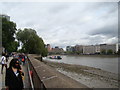
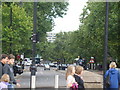
Your daily life in SE11 5RG benefits from an extensive network of amenities located just moments away. Five train stations serve the area, including Vauxhall Railway Station, Elephant and Castle Railway Station, and London Waterloo Railway Station, offering direct links across London. You also have access to five underground stations such as Oval, Kennington Station, and Nine Elms Underground Station for tube travel. For those preferring waterways, five piers including Vauxhall St George Wharf Pier, Millbank Pier, and Lambeth Pier provide ferry connections across the river. Retail options are equally convenient with five major supermarkets nearby, specifically Tesco Kennington, Tesco Lambeth, and Sainsburys Lambeth. Additionally, three bus routes operate close to your home, including connections to the Green Line Coach Station and London Victoria Coach Station. This density of services means you rarely need to leave the immediate vicinity for groceries, leisure, or commuting. The area functions as a well-serviced residential enclave where practical convenience defines the local culture.
Amenities
Schools
| Rank | School | Type | Entry gender | Ages |
|---|
Explore more schools in this area
Go to Schools tabDemographics
The community in SE11 5RG is defined by a mature resident base with a median age of 47 years. The majority of the population falls into the adult age range of 30 to 64 years, suggesting an area settled by those with established careers and families rather than young professionals or retirees. Home ownership stands at a low 17%, indicating that the vast majority of residents rent their properties. This high rental proportion contrasts with typical family neighbourhoods where ownership rates often exceed 60%. Accommodation types in this postcode are predominantly flats, aligning with the urban character of the SE11 district and the limited land space available. The ethnic composition is predominantly White, which forms the core demographic of the 1,325 individuals living in this specific zone. There is no indication of significant minority populations within this small cluster, pointing to a relatively homogenous social structure compared to wider parts of London. The demographic profile suggests a stable environment where long-term tenants and older adults form the backbone of the neighbourhood.
Household Size
Accommodation Type
Tenure
Ethnic Group
Religion
Household Composition
Age
Household Deprivation
NS-SEC
Explore more demographic insights in this area
Go to Demographics tabPlanning
Planning Constraints
- Flood RiskPremium
- Ramsar Wetland SitesPremium
- Area of Outstanding Natural BeautyPremium
- Protected Nature ReservePremium
- Protected WoodlandPremium