Area Overview for SE11 5LN
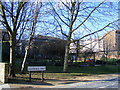
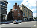
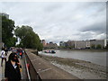
Photos of SE11 5LN


Area Information
This postcode cluster forms a distinct residential zone within South London, covering a specific footprint of 611 square metres. Despite its small size, 611 m², the cluster supports 1,325 residents. This density creates a close-knit environment where you will encounter your neighbours regularly. The area sits near major transport hubs, connecting you quickly to central London and the wider county. Living in SE11 5LN means balancing urban convenience with the constraints of a compact space. You find yourself close to three main rail stations, several underground stops, and multiple river piers. These connections define your daily routine, allowing for quick commutes to offices in Vauxhall or central business districts. The local character is shaped by high-density living rather than sprawling suburbs. You move through a landscape dominated by multi-unit dwellings rather than detached houses. This layout suits those who prefer city proximity over suburban quiet. The small area size means you are never far from public services or major thoroughfares. Your morning walk might take you past a wide selection of retail outlets before catching a train. Daily life here is practical and efficient, driven by the sheer density of people and infrastructure in such a small footprint.
- Area Type
- Postcode
- Area Size
- 611 m²
- Population
- 1325
- Population Density
- 13106 people/km²
The housing stock in SE11 5LN is defined by flats, a fact confirmed by the local accommodation data. This distinction separates the area from suburban zones dominated by detached or semi-detached properties. You are looking at a market where space is a premium asset within a cluster of 611 m². Only 17% of residents own their homes outright, meaning 83% live in rented accommodation. This ratio establishes a landlord-dominated landscape where investment properties thrive. You will find few freehold houses available for purchase within the immediate cluster. Instead, you encounter brick or concrete apartments designed for high-density living near transport links. This market structure benefits tenants who prefer short-term flexibility but challenges first-time buyers seeking to buy a permanent home. The low ownership rate indicates strong rental demand, often driven by city workers commuting from this central location. Agents in the area focus on reassessing building conditions, as older flats may require significant renovation. You must weigh the convenience of living near major rail stations against the potential noise and lack of privacy inherent in flat living. This environment suits investors or commuters who prioritise location over square footage.
House Prices in SE11 5LN
Showing 12 properties
| Address | Type | Beds | Baths | Last Sale Price | Last Sale Date | |
|---|---|---|---|---|---|---|
| 14B Dolland Street, London, SE11 5LN | Flat | - | - | £500,000 | Mar 2012 | |
| 14A Dolland Street, London, SE11 5LN | Retail | 3 | 2 | £307,000 | Feb 2010 | |
| Flat 2, 16 Dolland Street, London, SE11 5LN | Flat | 2 | 1 | - | - | |
| Flat 1, 14 Dolland Street, London, SE11 5LN | Flat | 2 | 1 | - | - | |
| 16A Dolland Street, London, SE11 5LN | Flat | 2 | 2 | - | - | |
| Flat 4, 14 Dolland Street, London, SE11 5LN | Maisonette | 3 | 2 | - | - | |
| Flat 1, 16 Dolland Street, London, SE11 5LN | Flat | - | - | - | - | |
| Flat 3, 14 Dolland Street, London, SE11 5LN | Flat | - | - | - | - | |
| 16B Dolland Street, London, SE11 5LN | Flat | - | - | - | - | |
| Flat 4, 16 Dolland Street, London, SE11 5LN | Maisonette | - | - | - | - |
Energy Efficiency in SE11 5LN
Daily life in SE11 5LN revolves around immediate access to essential services and leisure opportunities. You have five notable retail options within walking distance, including Tesco Kennington, Tesco Lambeth, and Sainsburys Lambeth. These supermarkets handle your weekly shopping needs without requiring a car. Five rail stations act as the primary artery for your lifestyle, linking you to workplaces and entertainment districts. You can step into Vauxhall Railway Station or London Waterloo Railway Station for long-distance or commuter travel. Five metro stations, such as Nine Elms and Kennington, provide rapid transit underground. Additionally, five ferry terminals, like Millbank Pier and Vauxhall St George Wharf Pier, offer unique views and routes across the Thames. You also have access to three major bus stations, including Green Line and Victoria Coach Station Arrivals. These transport nodes double as social hubs, keeping the local environment active throughout the day. Your evening walks might pass near retail clusters or along river paths accessible from nearby piers. The concentration of amenities means you do not need to travel far for groceries, transport, or social outings. This density creates a self-sufficient lifestyle where your daily needs are met within a very short radius.
Amenities
Schools
| Rank | School | Type | Entry gender | Ages |
|---|
Explore more schools in this area
Go to Schools tabDemographics
The community in SE11 5LN consists of 1,325 individuals, with a median age of 47. This figure indicates that families and older adults form the core of the local population. You will find most residents aged between 30 and 64 years, meaning the area attracts mature working professionals or established households. Home ownership stands at 17%, which signals that rentals make up the vast majority of accommodation here. This statistic suggests a market driven by landlords rather than long-term local inheritors of property. Flats dominate the housing stock, aligning with the high proportion of renting residents. You see a concentration of smaller units designed for singles, couples, or small families who cannot afford a house. The predominant ethnic group is White, though the close proximity to transport hubs likely introduces a diverse flow of commuters daily. This demographic profile shapes local businesses, favouring services that cater to older adults and young professionals. With only 17% of homes owned, you face competition in a rental market where vacancies fill and empty quickly. The age structure ensures local services, such as pharmacies and opticians, remain relevant for a settled population rather than a transient student crowd.
Household Size
Accommodation Type
Tenure
Ethnic Group
Religion
Household Composition
Age
Household Deprivation
NS-SEC
Explore more demographic insights in this area
Go to Demographics tabPlanning
Planning Constraints
- Flood RiskPremium
- Ramsar Wetland SitesPremium
- Area of Outstanding Natural BeautyPremium
- Protected Nature ReservePremium
- Protected WoodlandPremium