Area Overview for SE11 4UU
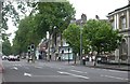
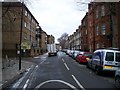
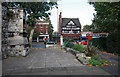
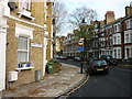
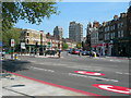
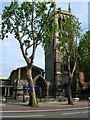
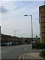
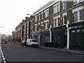
Photos of SE11 4UU


Area Information
Living in SE11 4UU offers a compact residential experience within a small cluster of homes. This postcode area covers just 537 square metres, hosting a population of 2,135 residents. The density suggests a concentrated neighbourhood where streets are closely packed and community boundaries are distinct. You live in an urban environment where daily routes are short and immediate surroundings define your access to essentials. The area functions as a tight-knit residential zone rather than a sprawling district. Proximity to London's major hubs allows for quick commutes while maintaining a focused local footprint. The character of SE11 4UU is shaped by its accommodation mix and the people who call it home. Most residents are adults between 30 and 64 years old, forming a stable community. With 35% home ownership, the balance leans towards rental living, which influences the pace and atmosphere of the streets. You find yourself surrounded by flat dwellings that cater to this demographic's needs. The layout supports a lifestyle where convenience is paramount due to the sheer size of the zone. Daily life in SE11 4UU revolves around accessibility. You are minutes away from key transport links and shops that serve the immediate population. The area avoids planning constraints like protected woodlands or wetlands, allowing for straightforward development or use of land. This openness contrasts with the high density of living units. When you walk through SE11 4UU, you encounter a community built for efficiency and connectivity to the wider city rather than isolated countryside charm.
- Area Type
- Postcode
- Area Size
- 537 m²
- Population
- 2135
- Population Density
- 17941 people/km²
The property market in SE11 4UU is characterised by a dominance of rental properties within a limited physical space. Blood ownership stands at 35%, indicating that 65% of the population rents their homes. This disparity shapes the market dynamics, making it a strong location for landlords or tenant investors. Most accommodation consists of flats, which aligns with the dense urban planning required for such a small 537 square metre zone. You will rarely find large detached houses here; instead, you encounter block living or converted terraced units designed for efficiency. For buyers looking at SE11 4UU, the low home ownership percentage signals that competition focuses on securing specific rental long-let properties or buy-to-let investments. The high density means every square metre counts. Property values are influenced by the demand for transport links and proximity to amenities rather than garden space or luxurious features. The market reflects the needs of the 30-64 age demographic, who require functional, spacious flats rather than sprawling family homes. When you assess the stock in this postcode, you find a unified housing type. Flats dominate the landscape because the land constraints prevent alternative building styles. This uniformity simplifies maintenance and community governance but limits variety in exterior design. Buyers must accept the reality that SE11 4UU offers urban density over suburban leafiness. The market operates quietly, driven by professional buyers and those seeking convenience near major transport hubs rather than lifestyle enclaves.
House Prices in SE11 4UU
Showing 9 properties
| Address | Type | Beds | Baths | Last Sale Price | Last Sale Date | |
|---|---|---|---|---|---|---|
| 5, Restormel House, Chester Way, London, SE11 4UU | Flat | - | - | - | - | |
| 7, Restormel House, Chester Way, London, SE11 4UU | Flat | - | - | - | - | |
| 2, Restormel House, Chester Way, London, SE11 4UU | Flat | - | - | - | - | |
| 4, Restormel House, Chester Way, London, SE11 4UU | Flat | - | - | - | - | |
| 8, Restormel House, Chester Way, London, SE11 4UU | Flat | - | - | - | - | |
| 1, Restormel House, Chester Way, London, SE11 4UU | Flat | - | - | - | - | |
| 3, Restormel House, Chester Way, London, SE11 4UU | Flat | - | - | - | - | |
| 6, Restormel House, Chester Way, London, SE11 4UU | Flat | - | - | - | - | |
| Garage Rear Of Chester House Fronting, Chester Way, London, SE11 4UU | Semi-detached | - | - | - | - |
Energy Efficiency in SE11 4UU
Your daily life in SE11 4UU revolves around immediate convenience and access to major amenities. You are surrounded by five retail options, including Tesco Lambeth and two instances of Tesco Kennington. These supermarkets ensure you have everything you need within walking or cycling distance. For travel, you benefit from five metro and five railway stations in close proximity. Kennington Station and Oval serve as local transit points, while Elephant & Castle and Vauxhall provide access to wider networks. Five ferry piers, such as Lambeth Pier and Vauxhall St George Wharf Pier, offer scenic alternatives for crossing the river. Bus connectivity is supported by access to major coach stations like Victoria Coach Station and the Green Line Coach Station. While these are not local community buses, their proximity highlights the area's central location. You can reach destinations quickly, blending local errands with national travel. Parks and leisure facilities are implied by the density of transport and retail, though specific parks are not named in the data. The lifestyle is urban and efficient. Dining and entertainment options cluster around these transport nodes. You enjoy a mix of high street shopping and local services that cater to the 2,135 residents living in the area. The presence of multiple Tesco branches suggests a commercial strip that serves immediate neighbourhood needs. When you step out, you find yourself in a hub of activity that supports a busy schedule. The area lacks rural retreat or isolated privacy but compensates with the speed and ease of city living.
Amenities
Schools
| Rank | School | Type | Entry gender | Ages |
|---|
Explore more schools in this area
Go to Schools tabDemographics
The community in SE11 4UU is defined by a mature and established age profile. The median age sits at 47 years, with the most common age range falling between 30 and 64 years. This demographic skew indicates a neighbourhood populated by working families and professionals rather than young students or retirees. You will see a population that has likely grown roots here, though the home ownership level provides further context. Only 35% of residents own their homes, meaning two-thirds live in rented accommodation. This statistic highlights a rental-heavy market where tenants make up the majority of the street. Accommodation types in the area are predominantly flats. This housing style suits the smaller footprint of the postcode, which spans just 537 square metres. The physical layout of SE11 4UU restricts large detached houses, forcing a design focused on vertical living spaces. You access your home via apartment blocks or terraced flats that maximise space in a limited area. The predominant ethnic group is White, reflecting the broader London context but maintaining a specific local character. Deprivation levels are not explicitly quantified in the available figures, but the high population density of 3,973,492 people per square kilometre suggests intense urban living. This extreme density figure places the area firmly within the built-up core of London. Expect small individual living spaces and shared community corridors. The combination of older adults and young families in the 30-64 bracket creates a mix where work-life balance is central to daily routines. You navigate streets where neighbours know each other, fostering a sense of stability despite the high turnover of tenancy implied by low ownership rates.
Household Size
Accommodation Type
Tenure
Ethnic Group
Religion
Household Composition
Age
Household Deprivation
NS-SEC
Explore more demographic insights in this area
Go to Demographics tabPlanning
Planning Constraints
- Flood RiskPremium
- Ramsar Wetland SitesPremium
- Area of Outstanding Natural BeautyPremium
- Protected Nature ReservePremium
- Protected WoodlandPremium