Area Overview for SE11 4DW
Photos of SE11 4DW


Area Information
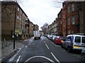
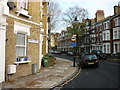
Living in SE11 4DW offers a specific residential experience within a compact footprint. This postcode covers a precise 6024 square metres, housing a population of 1851 people. You are looking at a dense cluster of homes where space is at a premium. The area definition suggests a tight-knit cluster rather than a sprawling suburb, which influences how you interact with your neighbours and the immediate street. Every square metre supports approximately 30,7286 people, creating an environment where privacy may be limited compared to rural or semi-rural locations. Despite the density, the location anchors you in South London, providing proximity to major transport hubs. The character here is defined by its proximity to London's infrastructure rather than expansive green space. You will find a community that is directly impacted by the surrounding city life. Whether you seek proximity to employment or bustling city centres, this small residential unit delivers that convenience. The sheer number of residents per square kilometre means noise levels and traffic could be higher than in less dense areas. You must weigh the benefits of central location against the reality of high population density. This postcode represents a slice of London living where volume takes precedence over volume.
- Area Type
- Postcode
- Area Size
- 6024 m²
- Population
- 1851
- Population Density
- 14293 people/km²
The property market in SE11 4DW is characterised by high-density living and a strong rental sector. Flats are the primary accommodation type found throughout the postcode, meaning you will encounter multi-storey buildings rather than detached houses for the most part. This housing stock suits singles, couples, and small families who prioritise location over garden space. The market data reveals that 42% of residents are homeowners, while the remaining 58% likely rent or live with relatives. This indicates a competitive rental market for those seeking independent tenancies. For buyers, the limited area size of 6024 square metres means supply is constrained. You are dealing with a micro-market where property values may be driven more by proximity to transport and amenities than by intrinsic land value. The prevalence of flats suggests that investment returns in this area often come from letting arrangements or shared ownership models. Potential buyers must inspect buildings for condition, as wear and tear on older flat blocks is common. The high density implies you are buying into a urban environment where amenities define value. Expect a market that reacts quickly to changes in broader London housing trends given its small, concentrated nature.
House Prices in SE11 4DW
Showing 26 properties
| Address | Type | Beds | Baths | Last Sale Price | Last Sale Date | |
|---|---|---|---|---|---|---|
| 2 Cleaver Square, London, SE11 4DW | Terraced | 4 | 2 | £1,800,000 | Mar 2025 | |
| 15 Cleaver Square, London, SE11 4DW | Terraced | 4 | 3 | £1,975,000 | Feb 2023 | |
| 14 Cleaver Square, London, SE11 4DW | Terraced | 4 | 2 | £1,775,000 | May 2022 | |
| 1 Cleaver Square, London, SE11 4DW | Terraced | 4 | 2 | £1,925,000 | Apr 2021 | |
| 21 Cleaver Square, London, SE11 4DW | Terraced | 4 | 3 | £1,595,000 | Aug 2017 | |
| 20 Cleaver Square, London, SE11 4DW | house | - | - | £1,840,000 | Jan 2017 | |
| 7 Cleaver Square, London, SE11 4DW | Terraced | 4 | - | £2,100,000 | Apr 2016 | |
| 22 Cleaver Square, London, SE11 4DW | Terraced | 3 | 2 | £1,872,500 | Feb 2016 | |
| 25 Cleaver Square, London, SE11 4DW | Terraced | 4 | 3 | £2,300,000 | Mar 2015 | |
| 12 Cleaver Square, London, SE11 4DW | house | 4 | - | £1,420,000 | Jul 2012 |
Energy Efficiency in SE11 4DW
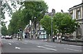
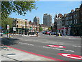
Daily life in SE11 4DW revolves around immediate access to London's major transport and retail hubs. You can find five metro stations nearby, including Kennington Station and Nine Elms Underground Station, ensuring quick access to other parts of the city. Retail options are equally convenient, with five outlets listed within reach. Tesco Lambeth, Tesco Kennington, and the other Tesco branches provide daily shopping needs without requiring long journeys. For those who prefer rail travel, five stations serve the area, including London Waterloo Railway Station and Vauxhall Railway Station. This density of rail links means you can commute from home with ease, often in under ten minutes from the platform. Five ferry terminals, such as Lambeth Pier and Vauxhall St George Wharf Pier, offer alternative routes to cross the Thames or reach the south bank. You also have access to major bus stations including Victoria Coach Station and the Green Line Coach Station. While parks and leisure facilities are not explicitly detailed in the nearby amenities list, the proximity to these transport nodes connects you to Vauxhall and Westminster. The lifestyle here is defined by convenience and speed. You can walk to a shop, catch a train, or hop on a bus immediately. This accessibility allows you to maintain a dynamic routine without spending excessive time travelling.
Amenities
Schools
Educational options for residents of SE11 4DW are currently limited to special education provision in the immediate vicinity. Aspen House School, a special school, is the only institution listed as being near this postcode. The absence of primary or secondary schools in the direct area means families must look elsewhere for standard education. This gap requires parents to commute to schools further away or utilise distance learning for some subjects. The presence of a special school highlights the area's capacity to support specific educational needs, though it does not serve the standard curriculum for most children. families living here likely rely on the wider Lambeth or Southwark council areas for their children's schooling. You must investigate transport links to other schools if you have school-aged children, as the local choice for mainstream education is non-existent in this specific data set. The reliance on a single special school indicates a distinct focus within the local education landscape. Buyers considering this area for children should factor travel time and logistics into their decision-making process.
| Rank | School | Type | Entry gender | Ages |
|---|
Explore more schools in this area
Go to Schools tabDemographics
The community profile of SE11 4DW reflects a mature demographic structure. The median age stands at 47 years, indicating that the majority of residents are middle-aged or older. Most commonly, you will find adults between the ages of 30 and 64 living in this postcode. This age profile suggests a population stable enough to maintain local businesses while potentially lacking a large influx of young professionals who often drive different market trends. Regarding housing tenure, 42% of households own their homes outright or with a mortgage. Consequently, over half of the residents are likely renters or live with family members, shaping the local energy and tenancy rates. Flat-style accommodation is the predominant form of housing in this area. This architectural style aligns with the high density and urban context of the postcode. The predominant ethnic group identified as White reflects the historical and current composition of the neighbourhood. You should expect a settled community where long-term residents are common. The high population density of 30,7286 people per square kilometre suggests a shared, compact living environment. This demographic mix points to an area where practicality and location often outweigh the desire for spacious family homes.
Household Size
Accommodation Type
Tenure
Ethnic Group
Religion
Household Composition
Age
Household Deprivation
NS-SEC
Explore more demographic insights in this area
Go to Demographics tabPlanning
Planning Constraints
- Flood RiskPremium
- Ramsar Wetland SitesPremium
- Area of Outstanding Natural BeautyPremium
- Protected Nature ReservePremium
- Protected WoodlandPremium