Area Overview for SE11 4DJ
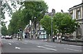
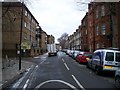
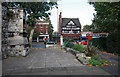
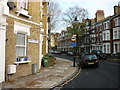
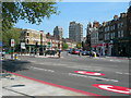
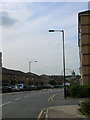
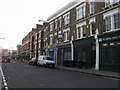
Photos of SE11 4DJ


Area Information
Living in SE11 4DJ offers a distinct residential experience characterised by high density and modern convenience. This specific postcode covers just 1.1 hectares, yet it accommodates a population of 2,135 people. That concentration results in an exceptionally high population density of 192,070 people per square kilometre. You will find this area is defined by a compact footprint where residential clusters sit closely together. Daily life here revolves around immediate access to major London transport hubs and a ready-made community infrastructure. The small size means neighbours are aware of one another, though the sheer number of residents creates a busy urban atmosphere. Prospective buyers should understand that this is not a sprawling suburb but a tight-knit patch of the city. You are stepping into a zone designed for efficiency and proximity. The environment reflects a mature district where every square metre serves a residential or transit purpose. This is a place for those who prioritise location over space and value being steps away from the wider city centre.
- Area Type
- Postcode
- Area Size
- 1.1 hectares
- Population
- 2135
- Population Density
- 17941 people/km²
The property market in SE11 4DJ is heavily weighted towards rental accommodation rather than owner-occupied homes. Only 35% of households own their homes, meaning a substantial majority rent their residences. The entire housing stock within this 1.1 hectare zone consists of flats. You will not find traditional terraced houses or detached bungalows in this specific postcode. This is a market defined by vertical living and smaller, more manageable units suitable for singles, couples, or small professional households. If you are considering buying, you must look beyond these immediate boundaries to find variety. The high density supports good service efficiency but limits independent home lifestyle. This is a rental-heavy environment where buyers should expect competition. The lack of detached homes means your options are fixed to flat layouts within existing apartment blocks.
House Prices in SE11 4DJ
Showing 42 properties
| Address | Type | Beds | Baths | Last Sale Price | Last Sale Date | |
|---|---|---|---|---|---|---|
| 130 Kennington Park Road, London, SE11 4DJ | house | - | - | £1,770,000 | Mar 2021 | |
| 150 Kennington Park Road, London, SE11 4DJ | Terraced | - | - | £368,500 | Jul 2019 | |
| 140 Kennington Park Road, London, SE11 4DJ | house | - | - | £337,960 | Oct 2018 | |
| 146 Kennington Park Road, London, SE11 4DJ | house | - | - | £375,000 | May 2018 | |
| 134 Kennington Park Road, London, SE11 4DJ | Terraced | - | - | £690,000 | Nov 2004 | |
| Flat 3, 158-160 Kennington Park Road, London, SE11 4DJ | Flat | 1 | 1 | - | - | |
| Flat 8, 158-160 Kennington Park Road, London, SE11 4DJ | Flat | 2 | 2 | - | - | |
| 136 Kennington Park Road, London, SE11 4DJ | house | 4 | 3 | - | - | |
| Basement Rear Flat, 128 Kennington Park Road, London, SE11 4DJ | undefined | - | - | - | - | |
| First Floor Flat, 148 Kennington Park Road, London, SE11 4DJ | Flat | - | - | - | - |
Energy Efficiency in SE11 4DJ
Your lifestyle in SE11 4DJ is driven by immediate proximity to essential services and leisure venues. Within practical reach, you will find 5 metro stations and 3 coach stations including the Green Line and London Victoria Coach Station. Retail needs are easily satisfied with 5 nearby supermarkets, including Tesco Kennington and Tesco Lambeth. You do not need to travel far for groceries or essentials. Cultural and leisure transport is supported by 5 ferry piers like Lambeth Pier and Vauxhall St George Wharf Pier. The density of amenities means your weekly shopping and leisure trips are short and frequent. This convenience network allows you to live efficiently while accessing the wider offerings of South London. You are surrounded by the practical infrastructure required for a self-sufficient urban life.
Amenities
Schools
| Rank | School | Type | Entry gender | Ages |
|---|
Explore more schools in this area
Go to Schools tabDemographics
The community in SE11 4DJ reflects a mature and stable demographic profile. Residents in this postcode have a median age of 47 years, with the most common age group falling between 30 and 64 years old. This indicates a neighbourhood dominated by established adults rather than young families or retirees. Accommodation types are exclusively flats, which aligns with the high-rise living style typical of such density. Only 35% of residents own their homes outright. This lower ownership figure suggests a significant proportion of the population likely rents their properties. The predominant ethnic group is White, forming the largest demographic segment within this specific cluster. There is no data available regarding deprivation scores for this area, so you must rely on broader London trends to gauge economic status. The age structure suggests a stable, working-age population that may seek stability from the youngest and oldest age brackets. You are entering an area where long-term residents shape the social fabric.
Household Size
Accommodation Type
Tenure
Ethnic Group
Religion
Household Composition
Age
Household Deprivation
NS-SEC
Explore more demographic insights in this area
Go to Demographics tabPlanning
Planning Constraints
- Flood RiskPremium
- Ramsar Wetland SitesPremium
- Area of Outstanding Natural BeautyPremium
- Protected Nature ReservePremium
- Protected WoodlandPremium