Area Overview for SE10 8UT
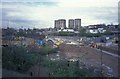
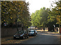
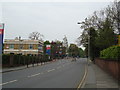
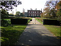
Photos of SE10 8UT


Area Information
Living in SE10 8UT means residing within a specific residential cluster that covers 2459 square metres. This small area serves 1471 people, creating a setting where neighbours are likely to know your name. The density here stands at 598,183 people per square kilometre, a figure that reflects the intensity of urban living in this part of southeast London. You will find a tightly knit community structure where daily routines revolve around the immediate vicinity and nearby transport links. The population size indicates a neighbourhood that blends the convenience of city access with the relative intimacy of a smaller residential pocket. Prospective buyers will discover a locale that prioritises practical connectivity over sprawling land distribution. The area acts as a functional hub where residents access major trade routes and public transit without crossing vast distances. You do not get eco-village isolation here; instead, you gain instant access to the broader opportunities of Greenwich and Lewisham. The sheer number of people living in such a compact footprint ensures that services remain within walking distance while maintaining strong links to wider London infrastructure. This balance defines the everyday experience for anyone choosing this postcode for their home.
- Area Type
- Postcode
- Area Size
- 2459 m²
- Population
- 1471
- Population Density
- 11583 people/km²
The housing market in SE10 8UT is defined by a significant presence of owner-occupied homes. With 47 per cent of the population owning their residences, this area leans heavily towards stability and long-term ownership rather than the transient nature of the private rental sector. Houses serve as the main type of accommodation, meaning you are more likely to find detached or semi-detached structures than purpose-built rental blocks or shared houses. This composition signals a neighbourhood where residents often plan to stay for many years, driving demand for upgrades and maintenance within the housing stock. For buyers looking at homes in SE10 8UT, the stock presents a specific opportunity within the southeast London market. The prevalence of house ownership suggests that the local economy supports value retention and community cohesion. You will not typically find the rapid churn of properties common in high-rent zones, which can actually benefit those seeking a quiet investment or a family home. The high concentration of houses alongside a strong ownership rate indicates that the area has matured beyond a typical commuter dormitory zone. This stability makes the property market here distinct from areas where speculation or short-term tenancies dominate the scene.
House Prices in SE10 8UT
Showing 20 properties
Energy Efficiency in SE10 8UT
Daily life in SE10 8UT offers immediate access to a wide variety of shops, transport hubs, and leisure venues. You can walk to Sainsburys Greenwich and Aldi Greenwich for your weekly groceries, while Tesco Deptford remains within practical reach for bulk shopping. Retail density is high, with five major supermarket options ensuring you never face long queues or travel far for essentials. For leisure, the Cutty Sark for Maritime Greenwich stands nearby, providing cultural and dining experiences right on your doorstep. Five bus stations serve the area, including connections via the Green Line Coach Station and Victoria Coach Station, allowing easy regional travel. Travelers will also encounter five metro stations, such as Lewisham Railway Station, which dovetail with the five designated rail stops to form a comprehensive network. Entertainment options extend across the borough with additional ferry terminals at Greenwich Pier and Masthouse Terrace Pier for those seeking water views. This interconnected network of amenities means you do not need to leave the immediate vicinity for most daily activities. Whether you need to purchase groceries, catch a train, or visit a major attraction, the layout of SE10 8UT places these facilities within comfortable walking or cycling distance.
Amenities
Schools
| Rank | School | Type | Entry gender | Ages |
|---|
Explore more schools in this area
Go to Schools tabDemographics
The community profile in SE10 8UT reflects a mature population centred on adults between 30 and 64 years old. The median age across the area stands at exactly 47, suggesting a neighbourhood dominated by family heads or established professionals seeking stability. With 47 per cent of the population already owning their homes, you see a strong inclination towards long-term residence rather than transient renting. Houses form the predominant form of accommodation, distinguishing this cluster from areas where flats or shared houses dominate the streetscape. The demographic makeup centres predominantly on ethnic group data showing White as the primary demographic, which aligns with the established character of much of southeast London. Nearly half of all residents have achieved home ownership, a metric that often correlates with higher levels of community investment and local participation. The age distribution means you will encounter a settled populace where retail demands reflect a need for family-friendly services and convenience stores rather than nightlife venues. This steady demographic ensures that the local economy supports consistent demand for goods suited to households rather than single occupants.
Household Size
Accommodation Type
Tenure
Ethnic Group
Religion
Household Composition
Age
Household Deprivation
NS-SEC
Explore more demographic insights in this area
Go to Demographics tabPlanning
Planning Constraints
- Flood RiskPremium
- Ramsar Wetland SitesPremium
- Area of Outstanding Natural BeautyPremium
- Protected Nature ReservePremium
- Protected WoodlandPremium