Area Overview for SE10 8UG
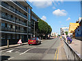
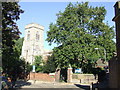
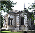
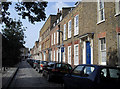
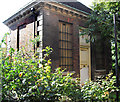
Photos of SE10 8UG


Area Information
SE10 8UG is a defined residential cluster within the London postcode system, covering a precise area of 6,788 square metres. This defined zone contains a total population of 1,471 residents, creating a setting that feels intimate yet remains connected to the wider city. Living in SE10 8UG offers a different experience from the vastness of other London districts due to its compact footprint. The area functions as a small residential pocket rather than a sprawling neighbourhood, which gives it a concentrated character. You are entering a space where the physical boundaries are clear, making it easy to understand exactly what is included in your new home search. The density of people within this specific boundary is significant, though the area size remains small compared to surrounding postcodes. This compactness means that daily routines often involve shorter trips to nearby hubs because everything within a five-minute walk is part of your immediate environment.
- Area Type
- Postcode
- Area Size
- 6788 m²
- Population
- 1471
- Population Density
- 11583 people/km²
Homes in SE10 8UG reflect a market dominated by residential houses rather than high-rise flats or temporary accommodation. With 47 percent home ownership, nearly half of the properties are in private hands, which often stabilises neighbourhood values and reduces turnover rates. The remaining properties are likely let to tenants with similar demographics to the owner-occupiers. Buying homes in SE10 8UG means entering a market where sellers are often motivated by lifestyle changes rather than urgent financial needs. The prevalence of houses suggests you can expect gardens, driveways, and more interior space than in central London apartments. This specific postcode does not contain the high-density rental blocks found near major tube termini; instead, it offers a residential feel typical of suburban London. You are likely competing with other buyers who share the desire for a house in a low-density area. The combination of house types and strong ownership rates creates a market where quality of life often trumps rapid appreciation trends.
House Prices in SE10 8UG
Showing 100 properties
| Address | Type | Beds | Baths | Last Sale Price | Last Sale Date | |
|---|---|---|---|---|---|---|
| 65 Ashburnham Place, Greenwich, SE10 8UG | Terraced | 5 | 2 | £1,382,000 | Mar 2025 | |
| 50 Ashburnham Place, Greenwich, SE10 8UG | house | 5 | 2 | £1,334,000 | May 2024 | |
| 49B Ashburnham Place, Greenwich, SE10 8UG | Flat | 1 | 1 | £400,000 | Feb 2024 | |
| 47 Ashburnham Place, Greenwich, SE10 8UG | Terraced | 3 | 2 | £1,200,000 | Jan 2024 | |
| 69 Ashburnham Place, Greenwich, SE10 8UG | Terraced | 5 | 2 | £965,000 | Sep 2023 | |
| 84 Ashburnham Place, Greenwich, SE10 8UG | Flat | 2 | 1 | £375,000 | Jun 2022 | |
| 49 Ashburnham Place, Greenwich, SE10 8UG | Retail | 2 | 2 | £594,000 | Jun 2022 | |
| 46 Ashburnham Place, Greenwich, SE10 8UG | house | 4 | 2 | £1,115,000 | Jan 2022 | |
| Flat Ground Floor, 52 Ashburnham Place, Greenwich, SE10 8UG | Flat | - | - | £750,000 | Jun 2021 | |
| 90 Ashburnham Place, Greenwich, SE10 8UG | Flat | 2 | 1 | £235,000 | Apr 2021 |
Energy Efficiency in SE10 8UG
Residents of SE10 8UG enjoy immediate access to a wide range of transport links and retail outlets. The area is five minutes away from Greenwich Station, Deptford, and St Johns, providing rail options for day-to-day commutes. You do not need a car to reach Sainsburys Greenwich, Aldi Greenwich, or Tesco Deptford, all of which are within practical walking distance for grocery shopping. Public transport options extend to the metro and ferry networks. You can walk to Deptford Bridge, Cutty Sark for Maritime Greenwich, and Cutty Sark DLR Station for fast city centre access. Ferry services from Greenwich Pier, Masthouse Terrace Pier, and Greenland Surrey Quays Pier offer scenic routes across the Thames. London City Airport is also within easy reach for short-haul flights. The variety of Coach Station choices, including Green Line, Victoria, and London Victoria, ensures flexibility for weekend trips. This density of amenities means you rarely leave the borough for daily needs.
Amenities
Schools
| Rank | School | Type | Entry gender | Ages |
|---|
Explore more schools in this area
Go to Schools tabDemographics
The community within SE10 8UG is defined by a mature population profile, with a median age of 47 years. Most households consist of adults aged between 30 and 64, indicating a neighbourhood where established families and professionals dominate. You will find a high rate of home ownership, with 47 percent of residents owning their property outright or with a mortgage. This statistic contrasts with some London areas where renting is the primary arrangement, suggesting a stable, settled community where people stay long-term. The predominant ethnic group is White, which aligns with the traditional character of much of south-east London. Accommodation is primarily made up of houses, which influences the street layout and availability of outdoor space. This demographic structure means the local shops and services cater to people with disposable income and established family needs. You are looking at an area where the social fabric is woven by long-term residents rather than transient commuters or students.
Household Size
Accommodation Type
Tenure
Ethnic Group
Religion
Household Composition
Age
Household Deprivation
NS-SEC
Explore more demographic insights in this area
Go to Demographics tabPlanning
Planning Constraints
- Flood RiskPremium
- Ramsar Wetland SitesPremium
- Area of Outstanding Natural BeautyPremium
- Protected Nature ReservePremium
- Protected WoodlandPremium