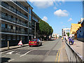
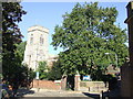
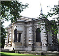
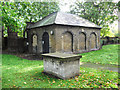
Area Overview for SE10 8JA
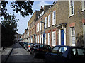
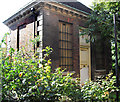
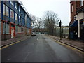
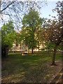
Photos of SE10 8JA


Area Information
SE10 8JA is a small residential cluster covering only 2.0 hectares that sits at the very heart of modern South London living. This compact postcode supports a population of 1,399 people, creating a tight-knit environment where the community is dense. With a population density of 70,848 people per square kilometre, you will find that space is at a premium here. The area sits within the SE10 zone, offering immediate access to the vibrant trade of Greenwich and Deptford. It is a location defined by its connectivity rather than green space, serving as a direct link to the wider Vauxhall, Canary Wharf, and West End corridors. Anyone considering living in SE10 8JA needs to understand that they are stepping into a high-traffic zone where convenience outweighs tranquility. The postcode serves hundreds of households, many looking for flats that suit a fast-paced lifestyle. You will find yourself steps away from major transport hubs, buses, and ferry terminals that serve the entire capital. This is a place for commuters and professionals who prioritise accessibility over private gardens. The sheer number of residents in such a small footprint means the local services move quickly. It is a functional, efficient part of the London landscape where the rhythm of daily life is dictated by the tube and the river.
- Area Type
- Postcode
- Area Size
- 2.0 hectares
- Population
- 1399
- Population Density
- 13962 people/km²
The property market in SE10 8JA is defined by a high demand for flats and a significant rental presence. With only 37% of residents owning their homes, the area leans heavily towards the rental sector. This low ownership rate shapes the local market, making buying competitive and prices likely inflated by investment demand. The accommodation type is almost exclusively Flats, reflecting the density of the 2.0 hectares available for development. If you are looking at homes in SE10 8JA, you should expect to find compact, urban living spaces rather than semi-detached or detached properties. The small size of the postcode cluster means there are few variations in property architecture; most housing follows the same building codes required for high-density living. You will encounter a mix of leasehold flats, which are common in this type of urban environment. The market caters to professionals, investors, and those who cannot secure a mortgage in high-cost boroughs. The low home ownership figure suggests many residents prefer the flexibility of renting while they work in the nearby business districts. The housing stock is optimised for the modern commuter, prioritising transport links over square footage or private outdoor space. Buyers must be prepared to navigate a market where every flat in this small cluster attracts significant interest.
House Prices in SE10 8JA
Showing 46 properties
| Address | Type | Beds | Baths | Last Sale Price | Last Sale Date | |
|---|---|---|---|---|---|---|
| 133A Greenwich High Road, Greenwich, SE10 8JA | Terraced | 4 | 2 | £400,000 | Apr 2006 | |
| 135 Greenwich High Road, Greenwich, SE10 8JA | Maisonette | - | - | £500,000 | Dec 2005 | |
| Flat 6, 139A Greenwich High Road, Greenwich, SE10 8JA | Flat | 2 | 2 | - | - | |
| 193A Greenwich High Road, Greenwich, SE10 8JA | Terraced | 3 | 2 | - | - | |
| Flat 4, 139A Greenwich High Road, Greenwich, SE10 8JA | Flat | 4 | 2 | - | - | |
| D F Long & Co (translations), 1 Prince Of Orange Lane, Greenwich, SE10 8JA | Office | - | - | - | - | |
| 169A Greenwich High Road, Greenwich, SE10 8JA | undefined | - | - | - | - | |
| 189B Greenwich High Road, Greenwich, SE10 8JA | undefined | - | - | - | - | |
| Flat 1, 167 Greenwich High Road, Greenwich, SE10 8JA | Flat | - | - | - | - | |
| Flat 3, 167 Greenwich High Road, Greenwich, SE10 8JA | Flat | - | - | - | - |
Energy Efficiency in SE10 8JA
Your daily lifestyle in SE10 8JA revolves around exceptional convenience and immediate access to major retail and leisure venues. You do not need to travel far to find shops, dining, or entertainment options that serve a major city. There are 5 retail outlets available within practical reach, headed by Sainsburys Greenwich, Aldi Greenwich, and Tesco Cutty. These supermarkets ensure you can stock a weekly shop without extensive planning or long journeys. For leisure, the area boasts 5 metro stations and 5 ferry terminals that double as social and transport hubs. You can start your day at the Cutty Sark for Maritime Greenwich, a notable venue that combines history with transport links. Nearby options like Greenwich Pier, Masthouse Terrace Pier, and Greenland Surrey Quays Pier offer river views and water-based activities. Transport enthusiasts will appreciate the 5 rail stations, including Greenwich Station and Deptford, which connect you to the wider network instantly. If you prefer bus travel, 3 bus stations are located close by, including the Green Line Coach Station and Victoria Coach Station. London City Airport is just one mention away, making weekend breaks and business trips seamless. The combination of these 5+ categories of amenities creates a dense urban experience where everything you need is minutes away. Living in SE10 8JA means prioritising location over local parks or quiet streets. You trade openness for the adrenaline of being steps from the action.
Amenities
Schools
| Rank | School | Type | Entry gender | Ages |
|---|
Explore more schools in this area
Go to Schools tabDemographics
The community in SE10 8JA reflects a mature and established household structure. The median age sits at 47 years, indicating that Adults aged between 30 and 64 years make up the most common age range. This demographic profile suggests a neighbourhood dominated by families with older children, couples, or individuals approaching retirement. You will not find it as a primary hub for young students or twenty-somethings looking for their first home. Home ownership stands at 37%, meaning significant portions of the population rent their accommodation. This relatively low ownership rate aligns with the fact that Flats constitute the predominant type of accommodation in the area. The residential stock is clearly geared towards density rather than detached houses, fitting the small 2.0 hectare footprint perfectly. The predominant ethnic group is White, which remains the largest demographic category within the community statistics. Living in SE10 8JA involves navigating a dynamic mix of long-term residents and renters who value the proximity to central London. The data paints a picture of stability, with a population that is not rapidly shifting. You are looking at an area where families need to adapt to multi-generational living within flat-style housing. The demographic reality is straightforward: this is a settled area where the resident base has a clear connection to this specific slice of South London.
Household Size
Accommodation Type
Tenure
Ethnic Group
Religion
Household Composition
Age
Household Deprivation
NS-SEC
Explore more demographic insights in this area
Go to Demographics tabPlanning
Planning Constraints
- Flood RiskPremium
- Ramsar Wetland SitesPremium
- Area of Outstanding Natural BeautyPremium
- Protected Nature ReservePremium
- Protected WoodlandPremium