Area Overview for SE10 8TB
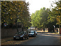
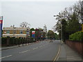
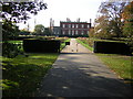
Photos of SE10 8TB


Area Information
Living in SE10 8TB offers a unique postcode experience within the wider London landscape. This specific residential cluster covers a compact footprint of 8,293 square metres and supports a population of 1,471 people. The extremely high population density of 177,370 people per square kilometre indicates a tightly packed neighbourhood where every square metre is utilised. Despite its small physical size, the area provides a distinct community feel with a median age of 47 years. The most common age range consists of adults between 30 and 64 years, suggesting a mature demographic often drawn to established London neighbourhoods. Daily life here is defined by the concentration of homes in close proximity to major transport hubs. Residents benefit from immediate access to five rail stations, including Greenwich Station, St Johns, and Lewisham Railway Station. The area also sits near five DLR metro stops and five ferry terminals, such as Greenwich Pier and Greenland Surrey Quays Pier. This connectivity ensures that commuting to central London or exploring the southeast coast is straightforward. The locality excludes major planning constraints like protected woodlands or wetlands, allowing for straightforward development while maintaining its residential character. For families and professionals seeking a compact address with rapid access to the city, this postcode represents a practical choice supported by robust digital infrastructure and established local amenities.
- Area Type
- Postcode
- Area Size
- 8293 m²
- Population
- 1471
- Population Density
- 11583 people/km²
The property market in SE10 8TB is characterised by its composition of houses and a balanced split between ownership and renting. With 47% home ownership, the area holds a significant portion of owner-occupiers, which often influences local community cohesion and price stability. The accommodation type is listed simply as Houses, meaning buyers should expect single-family or semi-detached properties rather than the block apartments common in central London. This housing stock appeals to those seeking a degree of privacy and green space that is harder to find in postcode areas dominated by flats. For prospective buyers, purchasing a home in SE10 8TB means entering a market with defined limits on physical space. The total area size of 8,293 square metres is tiny by London standards, meaning competition for specific plots is naturally high. The 47% ownership rate suggests that nearly half of the residents may be looking to trade-up or are already invested in their residences. Consequently, sellers could be open to reasonable offers to facilitate a move, but demand from those valuing the house-based layout remains steady. The demographic skew towards adults aged 30 to 64 years further supports a market favouring established housing forms over new-build conversions. This specific postcode offers a rare opportunity to secure a house in a zone so close to major transport links without the density of a city centre block.
House Prices in SE10 8TB
Showing 47 properties
| Address | Type | Beds | Baths | Last Sale Price | Last Sale Date | |
|---|---|---|---|---|---|---|
| 20 Dutton Street, Greenwich, SE10 8TB | Terraced | 2 | 1 | £840,000 | Sep 2025 | |
| 22 Dutton Street, Greenwich, SE10 8TB | Terraced | 3 | 1 | £912,500 | Apr 2024 | |
| 29 Dutton Street, Greenwich, SE10 8TB | Terraced | 2 | 1 | £665,000 | May 2023 | |
| 27 Dutton Street, Greenwich, SE10 8TB | Terraced | 2 | 1 | £745,000 | Oct 2022 | |
| 25 Dutton Street, Greenwich, SE10 8TB | Terraced | 2 | - | £755,000 | Aug 2022 | |
| 39 Dutton Street, Greenwich, SE10 8TB | Semi-detached | 2 | 2 | £770,000 | Jun 2022 | |
| 32 Dutton Street, Greenwich, SE10 8TB | house | - | - | £740,100 | Feb 2022 | |
| 23 Dutton Street, Greenwich, SE10 8TB | Terraced | 2 | - | £620,000 | Feb 2022 | |
| 26 Dutton Street, Greenwich, SE10 8TB | Terraced | 3 | 2 | £850,000 | Mar 2020 | |
| 28 Dutton Street, Greenwich, SE10 8TB | house | - | - | £725,000 | Aug 2017 |
Energy Efficiency in SE10 8TB
Your day-to-day lifestyle in SE10 8TB revolves around a dense concentration of amenities within walking or short driving distance. You have five rail, metro, and ferry hubs at your disposal, making cultural and work trips effortless. For daily shopping, five major retailers serve the neighbourhood, including Sainsburys Greenwich, Tesco Deptford, and Aldi Greenwich. These supermarkets ensure you have all necessities without needing to venture far from your house. Cultural and transport leisure is particularly strong here. Five DLR stations like Cutty Sark for Maritime Greenwich offer panoramic views of the Thames and direct access to the historic peninsula. Five ferry terminals, notably Greenwich Pier and Greenland Surrey Quays Pier, give you multiple entry points to provide activities. London City Airport, located nearby, expands your horizon for business and leisure travel. Local bus services, drawing from Green Line and Victoria Coach Station routes, further integrate the wider southeast London network. While the 8,293 square metre size of the postcode suggests a concentrated living space, the surrounding 30-minute radius offers a wealth of retail and transport options. This layout supports a lifestyle where utility meets ease, allowing you to access London's broader cultural fabric while residing in a compact, high-density block.
Amenities
Schools
| Rank | School | Type | Entry gender | Ages |
|---|
Explore more schools in this area
Go to Schools tabDemographics
The community within SE10 8TB reflects a settled population with distinct demographic characteristics. The median age stands at 47 years, confirming that adults between the ages of 30 and 64 years form the most common age range. This profile typically correlates with house ownership and stability rather than transient renting. Currently, 47% of residents own their homes outright or with a mortgage, indicating nearly half of the neighbourhood has secure landlords. The remaining half likely comprises secure tenants or homeowners with large mortgages fitting the older age profile. Housing in this specific cluster consists almost exclusively of houses, distinguishing it from other postcodes dominated by high-rise flats or terraced Victorian housing. The predominant ethnic group is White, which aligns with the historical settlement patterns of southeast London. With a population of 1,471 people squeezed into such a small space, the social fabric is close-knit yet private due to the house-based accommodation type. The absence of significant planning constraints related to nature reserves or areas of outstanding natural beauty suggests the environment is developed and utilitarian rather than speculative or protected. For buyers analysing the area, these figures paint a picture of a stable, middle-aged community prioritising space and ownership within a high-density urban envelope.
Household Size
Accommodation Type
Tenure
Ethnic Group
Religion
Household Composition
Age
Household Deprivation
NS-SEC
Explore more demographic insights in this area
Go to Demographics tabPlanning
Planning Constraints
- Flood RiskPremium
- Ramsar Wetland SitesPremium
- Area of Outstanding Natural BeautyPremium
- Protected Nature ReservePremium
- Protected WoodlandPremium