Area Overview for SE10 8NY
Photos of SE10 8NY


Area Information
Living in SE10 8NY offers a compact residential experience within a specific postcode cluster measuring 1,774 square metres. This small area supports a population of 1,471 people, creating a dense lived environment where neighbours are close by. The locality embodies a residential focus, defined by its precise boundaries and dedicated housing footprint. Prospective buyers seeking a distinct, tightly defined living space should recognise the scale of this cluster immediately. The demographic profile suggests a community grounded in long-term stability, with most residents falling into the adult age bracket between thirty and sixty-four years. You will find a settling rhythm here that balances density with private living quarters. The area represents a specific slice of Greater London where the character is shaped by high population density within a limited geographical square. This concentration ensures that daily errands and community interactions happen at a manageable distance. When you consider homes in SE10 8NY, you are entering a zone where the physical environment prioritises residential function over expansive commercial zones. The area size dictates a neighbourhood feel, reinforcing close proximity to local services and creating a lived-in atmosphere.
- Area Type
- Postcode
- Area Size
- 1774 m²
- Population
- 1471
- Population Density
- 11583 people/km²
The property market in SE10 8NY is characterised by a strong preference for houses over flats. Specifically, houses form the predominant accommodation type in this postcode, catering to residents who require larger living spaces. Home ownership stands at 47 per cent, indicating nearly half of the 1,471 residents have purchased their property outright or via mortgage. This ownership level suggests a stable market where established residents hold a long-term stake in the area. When you consider homes in SE10 8NY, the primary offering aligns with family needs rather than urban dwelling constraints. The area size of 1,774 square metres limits the total number of available properties, making each home a significant asset. You will primarily encounter houses within this small residential cluster, unlike mixed-use neighbourhoods where flats dominate the skyline. This concentration of house types creates a uniform streetscape defined by traditional residential features. Buyers seeking independent living in a specific postcode will find the stock here matches that requirement. The 47 per cent ownership figure reflects a community of people who have chosen to settle rather than transient residents.
House Prices in SE10 8NY
Showing 16 properties
| Address | Type | Beds | Baths | Last Sale Price | Last Sale Date | |
|---|---|---|---|---|---|---|
| 12 Lindsell Street, Greenwich, SE10 8NY | Terraced | 2 | 2 | £685,000 | Feb 2025 | |
| 8 Lindsell Street, Greenwich, SE10 8NY | house | - | - | £640,000 | Dec 2020 | |
| 4 Lindsell Street, Greenwich, SE10 8NY | Terraced | 2 | 2 | £475,000 | Jun 2014 | |
| 2 Lindsell Street, Greenwich, SE10 8NY | Detached | 2 | 1 | £295,000 | Mar 2005 | |
| 10 Lindsell Street, Greenwich, SE10 8NY | Terraced | 2 | - | £132,000 | Nov 1998 | |
| Flat 204, 1 Lindsell Street, Greenwich, SE10 8NY | Flat | 1 | 1 | - | - | |
| Flat 103, 1 Lindsell Street, Greenwich, SE10 8NY | Flat | 2 | 1 | - | - | |
| Flat 105, 1 Lindsell Street, Greenwich, SE10 8NY | Flat | 3 | 3 | - | - | |
| Flat 203, 1 Lindsell Street, Greenwich, SE10 8NY | Flat | 2 | 1 | - | - | |
| Flat 104, 1 Lindsell Street, Greenwich, SE10 8NY | Flat | 1 | 1 | - | - |
Energy Efficiency in SE10 8NY
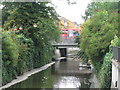
Residents of SE10 8NY benefit from access to five major transport hubs within practical reach. Nearby rail links include Greenwich Station, St Johns, and Lewisham Railway Station, facilitating easy city centre access. Public transport options also encompass five metro stops such as Elverson Road, Deptford Bridge, and the Cutty Sark for Maritime Greenwich stop. Five ferry terminals, including Greenwich Pier and Masthouse Terrace Pier, provide alternative river crossings for leisure commuters. Retail convenience is high, with five nearby shopping locations including Tesco Deptford, Co-op London, and Sainsburys Greenwich. These facilities allow you to complete daily grocery shopping without travelling further. One airport option, London City Airport, is also within reasonable distance of the area. Three bus stations, including the Green Line Coach Station and Victoria Coach Station, offer further regional connectivity. Living in SE10 8NY means you have multiple ways to travel, whether you prefer trains, boats, or buses. The proximity to Tesco and Co-op ensures your weekly shop is located within easy walking or short driving distance. This blend of rail, rail, ferry, bus, and retail options creates a well-connected lifestyle.
Amenities
Schools
| Rank | School | Type | Entry gender | Ages |
|---|
Explore more schools in this area
Go to Schools tabDemographics
The community in SE10 8NY reflects a mature household structure, with a median age of forty-seven years. Adults aged between thirty and sixty-four years constitute the most common age range, indicating a population focused on family stability or career consolidation. Forty-seven per cent of homes in this postcode are owner-occupied, suggesting a significant number of residents have invested in their local property rather than renting. The predominant accommodation type is houses, which aligns with the demographic tendency towards family living. Predominant ethnic composition is White, reflecting the established character of this residential cluster. You will find that the majority of people living in SE10 8NY are part of the working-age adult demographic, likely seeking a settled environment away from the chaotic energy of central London. This age profile influences the local services, as the demand centres on resources suitable for adults and older children rather than younger students. The home ownership rate provides a clear indicator of financial stability within the neighbourhood. High housing density, noted at 829,393 people per square kilometre, means the community is tight-knit. When you look at the people in SE10 8NY, you see a settled group prioritising established lifestyles.
Household Size
Accommodation Type
Tenure
Ethnic Group
Religion
Household Composition
Age
Household Deprivation
NS-SEC
Explore more demographic insights in this area
Go to Demographics tabPlanning
Planning Constraints
- Flood RiskPremium
- Ramsar Wetland SitesPremium
- Area of Outstanding Natural BeautyPremium
- Protected Nature ReservePremium
- Protected WoodlandPremium