Area Overview for SE10 8NB
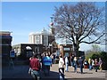
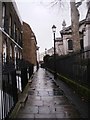
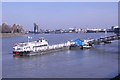
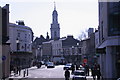
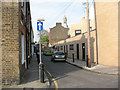
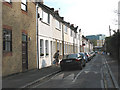
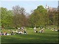
Photos of SE10 8NB

Area Information
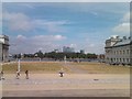
Living in SE10 8NB offers a dense urban experience within a compact residential cluster that spans just 1.5 hectares. This specific postcode serves a concentrated population of 1,866 residents, creating an environment where neighbours are often within sight of each other. The high density of more than 122,000 people per square kilometre shapes daily life, meaning noise and activity are constant features of the streetscape. You will find that this area operates distinctly from suburban sprawl, offering immediate access to the broader opportunities of Southeast London rather than isolation. The sheer concentration of households in such a small footprint defines the character of SE10 8NB, where every block holds significant weight in the local community fabric. Prospective buyers should understand that life here is fast-paced and tightly woven into the surrounding urban tapestry. While space is limited within the postcode itself, the location provides a strategic foothold for accessing major transport hubs and city amenities without travelling far. This area represents a specific slice of London real estate where proximity to the city centre and immediate infrastructure are the primary selling points.
- Area Type
- Postcode
- Area Size
- 1.5 hectares
- Population
- 1866
- Population Density
- 5024 people/km²
The property market in SE10 8NB is characterised by a balanced split between owners and renters. With 40 per cent home ownership, the area attracts individuals seeking stability and long-term residence. However, the fact that flats are the predominant accommodation type suggests that first-time buyers or investors often find situations here suited to vertical living. A buyer looking for a house in SE10 8NB faces a narrow selection compared to larger suburbs, but the market does offer established flats and apartments. The compact nature of the 1.5 hectare cluster means that turnover can be rapid as new residents move into existing blocks. This high density often drives up demand for well-maintained residential clusters in close proximity to transport links. Prospective purchasers should note that while only four in ten residents own their homes, the limited stock means competition for available flats can be fierce. The market其它的 dynamics reflect the broader Greenwich peninsula, where access to the Thames and rail services commands premiums. You will find that properties here are priced according to their proximity to stations rather than traditional garden space, as outdoor areas are scarce within this postcode.
House Prices in SE10 8NB
Showing 47 properties
| Address | Type | Beds | Baths | Last Sale Price | Last Sale Date | |
|---|---|---|---|---|---|---|
| 211 Greenwich High Road, Greenwich, SE10 8NB | Semi-detached | 4 | 2 | £1,595,000 | Nov 2023 | |
| Unit 1, 275A Greenwich High Road, Greenwich, SE10 8NB | Flat | - | - | £130,000 | Nov 2020 | |
| 199 Greenwich High Road, Greenwich, SE10 8NB | Semi-detached | 4 | 2 | £1,175,000 | Jun 2020 | |
| 215 Greenwich High Road, Greenwich, SE10 8NB | house | 2 | 1 | £375,000 | Feb 2007 | |
| 213 Greenwich High Road, Greenwich, SE10 8NB | Semi-detached | - | - | £640,000 | Mar 2006 | |
| 209 Greenwich High Road, Greenwich, SE10 8NB | house | - | - | £620,000 | Feb 2006 | |
| 203 Greenwich High Road, Greenwich, SE10 8NB | house | 5 | - | £361,000 | May 2001 | |
| Flat 9, 265 Greenwich High Road, Greenwich, SE10 8NB | Flat | 2 | 1 | - | - | |
| Flat 1, 221A Greenwich High Road, Greenwich, SE10 8NB | Flat | 2 | 1 | - | - | |
| 205 Greenwich High Road, Greenwich, SE10 8NB | house | 5 | - | - | - |
Energy Efficiency in SE10 8NB
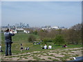
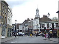
Residents of SE10 8NB enjoy immediate access to a wide array of retail and leisure amenities. Five supermarkets operate within practical reach, including Sainsburys Greenwich, Aldi Greenwich, and Tesco Cutty, ensuring that grocery shopping requires no significant travel. Five rail stations, including Greenwich Station, Deptford, and Maze Hill Railway Station, provide frequent train services to destinations across London. Five metro stations, such as Cutty Sark for Maritime Greenwich and Deptford Bridge, offer Tube access to the network. Additionally, five ferry stops like Greenwich Pier and Greenland Surrey Quays Pier enable river crossings and coastal access. London City Airport lies just one notable airport away, facilitating international travel from your doorstep. Three bus stops, including the Green Line Coach Station and Victoria Coach Station, connect you to regional coach networks. This density of transport and retail options means you can run errands, commute, or catch a boat without planning your route in advance. The sheer number of choices makes daily life convenient, as every essential service is located within a short journey. You will find that dining, shopping, and travel are all integrated into the immediate vicinity of your home in SE10 8NB.
Amenities
Schools
Families living in SE10 8NB have access to two primary educational facilities within a short distance. James Wolfe Junior School serves as the secondary stage for local children, offering a continuation of primary education in the same catchment area. James Wolfe Infant School caters to younger pupils, providing the foundational years of formal learning before transition. Both institutions share the same name, creating a consistent educational brand and potentially streamlined admissions pathways for residents. While Ofsted ratings are not currently listed in the available data, the presence of these two schools indicates a structured local system rather than a reliance on distant academies. This arrangement reduces travel time for children attending education in SE10 8NB, allowing more time for local community engagement. The mix of infant and junior education on your doorstep means that parents remain connected to their local schools throughout their children's academic years. Teachers and staff from both schools will likely know many residents personally, fostering a strong sense of accountability and community. You do not need to commute to other boroughs for primary education, as these two schools are situated practically near the homes most people own in this postcode.
| Rank | School | Type | Entry gender | Ages |
|---|
Explore more schools in this area
Go to Schools tabDemographics
The community in SE10 8NB reflects a mature profile, with a median age of 47 years. Adults aged between 30 and 64 form the most common age range, indicating a neighbourhood dominated by working professionals and older households. Housing ownership accounts for 40 per cent of residents, meaning the remaining 60 per cent are likely renters or licensee tenants. Flats represent the predominant accommodation type, aligning with the limited land availability and the need for vertical living solutions in such a dense setting. The area is ethnically diverse yet predominantly White, though specific minority percentages are not detailed in current reports. With over two-thirds of residents being owners, the area maintains stability despite the high rental population. The high population density of 122,003 people per square kilometre contributes to a bustling atmosphere where community bonds often develop rapidly. You will encounter a young professional demographic in your 30s and a settled group in their 40s and 50s sharing the same flats and streets. This mix creates a dynamic environment where varied lifestyles coexist within the constraints of high-density urban planning.
Household Size
Accommodation Type
Tenure
Ethnic Group
Religion
Household Composition
Age
Household Deprivation
NS-SEC
Explore more demographic insights in this area
Go to Demographics tabPlanning
Planning Constraints
- Flood RiskPremium
- Ramsar Wetland SitesPremium
- Area of Outstanding Natural BeautyPremium
- Protected Nature ReservePremium
- Protected WoodlandPremium