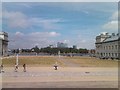
Area Overview for SE10 8NA
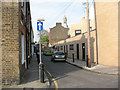
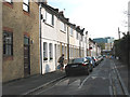
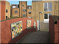
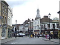
Photos of SE10 8NA


Area Information
Living in SE10 8NA offers a defined residential experience within a postcode area that covers 3,031 square metres. This small residential cluster supports a population of 1,866 people, creating a tightly knit environment. Residents here inhabit flats, which dominate the local accommodation type for this specific location. The area measures roughly 0.003 square kilometres based on its total size, meaning the neighbourhood operates on a micro-scale compared to wider boroughs. Despite the minute physical footprint, the density reaches an extreme high of 615,537 people per square kilometre according to recorded metrics, suggesting a very compact arrangement of housing. Daily life in SE10 8NA is characterised by proximity to larger infrastructure, as the postcode sits close to multiple transport hubs including Greenwich Station and the Cutty Sark DLR Station. You can access London City Airport within practical reach, allowing for easy commuting or travel. While the area functions as a self-contained cluster, its identity is partially defined by its adjacency to popular landmarks like Greenwich Pier and Island Gardens. The community enjoys a straightforward layout without the constraints of protected nature reserves or AONB status, simplifying planning considerations for future residents. This density ensures you are never far from work, education, or leisure, yet the small square metre count gives the place a distinct, localised character separate from the broader Greenwich landscape.
- Area Type
- Postcode
- Area Size
- 3031 m²
- Population
- 1866
- Population Density
- 5024 people/km²
The property market in SE10 8NA is defined by a significant rental component, as only 40% of residents own their homes. This implies that a majority of the housing stock operates within the private rental sector. Flats comprise the predominant accommodation type, confirming that the area is built for compact urban living rather than detached family homes. You are looking at a market where investment landlords likely hold substantial sway alongside owner-occupiers. The physical space available is limited, with the entire postcode covering just 3,031 square metres. This constraint reinforces the flat-heavy approach to housing delivery. For buyers considering homes in SE10 8NA, the high density of 615,537 people per square kilometre suggests properties will command premium prices relative to their size due to location advantages. The small residential cluster nature means supply is fixed by geography, making new developments impossible within the current boundary. Instead, growth depends on the optimisation of existing structures. This reality applies to both the immediate postcode and its immediate surroundings in Greenwich. You should expect a market driven by demand for central London connectivity rather than space or garden views. The concentration of flats also means service charges and building maintenance fees will be standard considerations for any leasehold property you examine. Understanding this 40% ownership split is vital for anyone evaluating long-term living costs in this specific micro-area.
House Prices in SE10 8NA
Showing 2 properties
| Address | Type | Beds | Baths | Last Sale Price | Last Sale Date | |
|---|---|---|---|---|---|---|
| 291A Greenwich High Road, Greenwich, SE10 8NA | Flat | - | - | - | - | |
| The Mitre Hotel, 2 Roan Street, Greenwich, SE10 8NA | hotel | - | - | - | - |
Energy Efficiency in SE10 8NA
The lifestyle in SE10 8NA is anchored by immediate access to a wide array of amenities within practical reach. You have five retail outlets nearby, including Aldi Greenwich, Tesco Cutty, and Sainsburys Greenwich, ensuring daily grocery needs are met without long drives. Transport convenience is high, with five metro stations, five rail stations, and five ferry ports operating at your doorstep. Notable stops include Greenwich Station, Maze Hill Railway Station, and Greenwich Pier for waterborne travel. If you travel frequently, London City Airport is just one stand away, offering a fast link to Europe. For longer journeys, five bus stations provide connections to London Victoria Coach Station and the Green Line Coach Station. Leisure residents can visit Island Gardens or explore the maritime heritage at Cutty Sark for Maritime Greenwich. These amenities remove the need to travel far from your home to find variety in shopping or recreation. The concentration of five facilities for each category – retail, metro, rail, ferry, and bus – creates a highly efficient urban environment. You do not need a car to navigate daily life, as the density of options is substantial. This setup supports a walkable and transit-oriented lifestyle where your flat in SE10 8NA places you centrally between commercial hubs and cultural sites. The proximity to Greenwich Pier and Maritime Greenwich adds a scenic element to your daily routine beyond mere utility.
Amenities
Schools
Families living in SE10 8NA have access to two primary educational institutions located near their homes. James Wolfe Junior School serves as a secondary provision for younger children within the primary framework, while James Wolfe Infant School covers the earliest years of education. Both schools operate as primary institutions, forming the main local option for schooling in this postcode area. There are no secondary schools or sixth form colleges listed in the immediate vicinity of this specific residential cluster. This arrangement means older students from SE10 8NA must commute to schools outside the boundary for their secondary education. The presence of two primary schools suggests a coordinated educational pathway for children up to age 11. You will find that these facilities cater to the needs of the 30 to 64-year-old demographic that makes up the majority of residents. However, the absence of data on Ofsted ratings for these specific schools means you must check directly with the schools or the Department for Education for current inspection grades. The mix of only primary options indicates that the residential zone is not a final destination for secondary school families but rather a transit point for younger learners. Parents should factor in travel time when selecting accommodation, given that secondary education falls outside the local offerings provided by James Wolfe Infant and Junior Schools.
| Rank | School | Type | Entry gender | Ages |
|---|
Explore more schools in this area
Go to Schools tabDemographics
The community in SE10 8NA reflects a mature demographic profile where the median age sits at 47 years. Adults between 30 and 64 years constitute the most common age range among residents, indicating a population dominated by working professionals and established families. Home ownership stands at 40%, meaning that 60% of the population likely rents their properties. Flats represent the predominant accommodation type, which aligns with the high-density nature of the postcode area. The ethnic composition is primarily White, forming the largest group within this residential cluster. This age profile suggests the area attracts buyers who have settled down but maintain access to the job market. You will find fewer young children or teenagers in the immediate vicinity compared to areas with a younger median age. The high density of 615,537 people per square kilometre further reinforces the urban character of the living environment. With only 1,866 residents spread across a tiny 3,031 square metre footprint, the social fabric is concentrated. This makes for a quiet yet efficient neighbourhood where privacy is managed within shared flat block environments. The mix of renters and owners creates a dynamic where investment properties and long-term tenancies coexist alongside private households. This demographic structure supports a stable community yet necessitates sound quality-of-life planning due to the sheer volume of people in such a small geographical space.
Household Size
Accommodation Type
Tenure
Ethnic Group
Religion
Household Composition
Age
Household Deprivation
NS-SEC
Explore more demographic insights in this area
Go to Demographics tabPlanning
Planning Constraints
- Flood RiskPremium
- Ramsar Wetland SitesPremium
- Area of Outstanding Natural BeautyPremium
- Protected Nature ReservePremium
- Protected WoodlandPremium