Area Overview for SE10 8LB
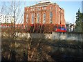
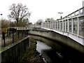
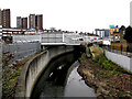
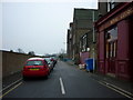
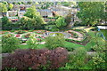
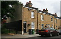
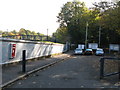
Photos of SE10 8LB

Area Information
Living in SE10 8LB means residing within a compact residential cluster that covers just over 2 hectares. This postcode area houses 2,629 people in a space sized at 2,264 square metres, creating an environment where neighbours are inevitably close. The location sits firmly in greater London, offering residents a position that balances urban convenience with a defined residential character. Life here is shaped by high population density, resulting in a community where the pace of daily life moves quickly and local interactions are frequent. You will experience a neighbourhood where every blade of litter is noticed swiftly, and local updates travel faster than in most other UK postcodes. The area functions as a self-contained pocket of London life rather than a sprawling suburb. Your daily commute likely involves navigating busy local streets that serve thousands of residents in a very small footprint. This high concentration of people defines the rhythm of the area, particularly during morning and evening rush hours when the small residential cluster comes alive with foot traffic. You are part of a community where boundaries between homes feel porous due to the sheer number of people sharing the space. The limited square footage means that infrastructure and public facilities are used intensively, contrasting sharply with the relaxed pace of the country.
- Area Type
- Postcode
- Area Size
- 2264 m²
- Population
- 2629
- Population Density
- 13764 people/km²
The housing stock in SE10 8LB is defined by a prevalence of flats, which suits the high-density nature of this specific postcode. With only 45 per cent of homes occupied by owners, the market retains a strong element of tenancy compared to many suburban districts. This balance indicates that you are stepping into an area where either buying a flat or securing a leasehold option is common, rather than purchasing a detached house. The accommodation type dictates the layout of many buildings, with residents living in vertically stacked communities rather than sprawling gardens. For buyers looking at homes in SE10 8LB, the market is distinct from greenfield developments. The concentration of flats means that shared structures dominate the skyline of this small 2,264-square-metre area. This housing style often appeals to those who value proximity to transport and amenities over private outdoor space. You may also find that maintenance costs differ due to the nature of flat living, where shared gardens and communal areas require collective management. The lower ownership percentage suggests a flexible rental market remains robust alongside the sales market. When you view properties, expect to see layouts designed for maximum use of limited space, reflecting the need to accommodate 2,629 people in such a restricted footprint.
House Prices in SE10 8LB
Showing 21 properties
| Address | Type | Beds | Baths | Last Sale Price | Last Sale Date | |
|---|---|---|---|---|---|---|
| 6, Peabody Close, 41 Devonshire Drive, Greenwich, SE10 8LB | Flat | - | - | £332,500 | Nov 2021 | |
| 4, Peabody Close, 41 Devonshire Drive, Greenwich, SE10 8LB | Flat | 1 | 1 | £353,500 | Aug 2019 | |
| 11, Peabody Close, 41 Devonshire Drive, Greenwich, SE10 8LB | Flat | - | - | £344,950 | Mar 2016 | |
| 1, Peabody Close, 41 Devonshire Drive, Greenwich, SE10 8LB | Flat | - | - | £200,050 | Sep 2011 | |
| 13, Peabody Close, 41 Devonshire Drive, Greenwich, SE10 8LB | Flat | 1 | 1 | £225,000 | Aug 2009 | |
| 20, Peabody Close, 41 Devonshire Drive, Greenwich, SE10 8LB | Flat | 1 | 1 | £180,000 | Aug 2006 | |
| 17, Peabody Close, 41 Devonshire Drive, Greenwich, SE10 8LB | Flat | 2 | 1 | - | - | |
| Peabody Close, 41 Devonshire Drive, Greenwich, SE10 8LB | Flat | 1 | 1 | - | - | |
| 15, Peabody Close, 41 Devonshire Drive, Greenwich, SE10 8LB | commercial | - | - | - | - | |
| 14, Peabody Close, 41 Devonshire Drive, Greenwich, SE10 8LB | Flat | - | - | - | - |
Energy Efficiency in SE10 8LB
Your daily life in SE10 8LB is enhanced by a wide array of amenities located within practical reach. Retail options are plentiful with five key supermarkets including Tesco Deptford, Co-op London, and Sainsburys Greenwich ensuring you have fresh food and essentials nearby. If you prefer convenience stores, the Co-op locations offer quick stops for top-up shopping. Transport diversity is remarkable, with five metro stops and five rail stations ensuring you can choose the fastest route to work or leisure. The five nearby ferry piers, such as Greenwich Pier and Masthouse Terrace Pier, add a unique travel dimension that is rare in dense urban postcodes. Beyond retail and rail, three major bus services including the Green Line Coach Station and Victoria Coach Station provide national and regional connectivity. Having London City Airport nearby also means last-minute flights or international connections are closer than most residents assume. This density of transport modes gives you the freedom to travel by car, train, or bus depending on your schedule or weather. The presence of multiple station names like Greenwich and Deptford indicates that even within this small residential cluster, a vast network of global transport hubs operates. You can walk to a ferry, a major tube station, or a supermarket without needing a car.
Amenities
Schools
Families residing in SE10 8LB have access to notable educational institutions within their immediate vicinity. One key option is Mayflower Independent School, which offers an independent education for students in the area. This school provides a private education alternative to the state system, catering to families who seek a curriculum tailored to specific needs or philosophical approaches. While independent schools represent a specific cost and selection, they form part of the educational landscape for the 47-year-old median resident. The presence of this single named independent school highlights the variety available to parents choosing schools near SE10 8LB. Independent education often allows for smaller class sizes and specialised teaching methods compared to larger state comprehensive schools. When you consider where to send your children, Mayflower Independant School stands out as a formal option close to your doorstep. The school type influences the morning routines of many households in the 8LB postcode, with pick-up times and uniform requirements shaping the daily schedule for parents and students alike. Families in this dense residential cluster often weigh the benefits of local independent education against the convenience of the shorter commute for children.
| Rank | School | Type | Entry gender | Ages |
|---|
Explore more schools in this area
Go to Schools tabDemographics
The community in SE10 8LB reflects a mature demographic profile with a median age of 47 years. Most residents fall into the adult age range between 30 and 64 years, indicating a population that has likely established careers and families. With a home ownership rate of 45 per cent, there is a significant split between owners and renters, suggesting a dynamic market where some families have settled long-term while others rent for stability or flexibility. The predominant ethnic group is White, though the area's small population size means the community is relatively tight-knit. This age profile suggests a neighbourhood where professionals and empty nesters may influence local demands, potentially increasing the need for quality services and safe streets. The fact that flats are the primary accommodation type aligns with the high population density, offering residents a specific housing style suited to urban living. You will find neighbours who are likely seeking a mix of convenience and community within this specific postcode. The demographic data paints a picture of an area defined by stability, with a large portion of adults in their working and prime family-raising years. This consistency often creates a predictable environment where long-term residents know their neighbours well.
Household Size
Accommodation Type
Tenure
Ethnic Group
Religion
Household Composition
Age
Household Deprivation
NS-SEC
Explore more demographic insights in this area
Go to Demographics tabPlanning
Planning Constraints
- Flood RiskPremium
- Ramsar Wetland SitesPremium
- Area of Outstanding Natural BeautyPremium
- Protected Nature ReservePremium
- Protected WoodlandPremium