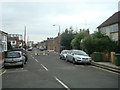
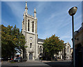
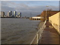
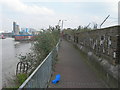
Area Overview for SE10 0HX
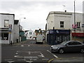
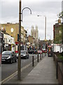
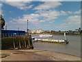
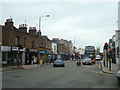
Photos of SE10 0HX
Area Information
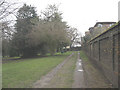
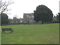
SE10 0HX is a distinct residential cluster covering just over two and a half hectares, home to 1,686 people. The community is tightly knit due to its small footprint, which averages approximately 59,000 residents per square kilometre within the postcode boundary. This density creates a residential atmosphere where neighbours are likely to know one another, offering a contrast to the broader sprawl of surrounding London boroughs. Life in this area revolves around proximity to key transport hubs, as the location sits within walking distance of multiple train and DLR stations. You will find yourself surrounded by options for commutes to Canary Wharf, the City, and central London without the need for a car. The postcode serves as a gateway to Greenwich and the wider peninsula, positioning you at the intersection of transport infrastructure and residential quiet. Your daily routine will benefit from the concentration of services nearby, ensuring that essential errands take place within a short journey. The area functions as a practical commuter base, yet it retains a local identity defined by its specific cluster of homes and immediate access to major travel nodes.
- Area Type
- Postcode
- Area Size
- 2852 m²
- Population
- 1686
- Population Density
- 6685 people/km²
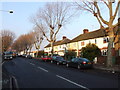
Homes in SE10 0HX are defined by the dominance of flats, which make up the majority of the accommodation type within this postcode. Only 22% of residents own their homes, while more than four in five individuals live in rental properties. This statistic indicates a market driven by investment or private letting rather than traditional owner-occupation. Potential buyers should understand that the local housing stock is largely composed of dwellings designed for tenants seeking flexibility in this high-concentration area. The small size of the postcode, measuring 2,852 square metres, limits the availability of detached or semi-detached houses compared to larger suburban areas. If you are looking to move here, you are likely entering a competitive rental market or a niche sector for flat purchases. The prevalence of flats aligns with the high population density, where 591,218 people share the land area within the boundary. This structure prioritises efficient use of space in a location bounded by major transport arteries. You will find fewer traditional family homes compared to the volume of multi-unit buildings, shaping the typical look and feel of the streets within this specific grid.
House Prices in SE10 0HX
Showing 17 properties
| Address | Type | Beds | Baths | Last Sale Price | Last Sale Date | |
|---|---|---|---|---|---|---|
| 15 Williamson Close, Greenwich, SE10 0HX | Terraced | 2 | 1 | £340,000 | Mar 2019 | |
| 21 Williamson Close, Greenwich, SE10 0HX | Terraced | 2 | 1 | £334,000 | Jun 2015 | |
| 5 Williamson Close, Greenwich, SE10 0HX | house | - | - | £205,000 | Dec 2005 | |
| 6 Williamson Close, Greenwich, SE10 0HX | Terraced | 4 | 2 | - | - | |
| 8 Williamson Close, Greenwich, SE10 0HX | Semi-detached | 3 | 1 | - | - | |
| 12 Williamson Close, Greenwich, SE10 0HX | Flat | 2 | 2 | - | - | |
| 2 Williamson Close, Greenwich, SE10 0HX | Semi-detached | - | - | - | - | |
| 9 Williamson Close, Greenwich, SE10 0HX | house | - | - | - | - | |
| 17 Williamson Close, Greenwich, SE10 0HX | house | - | - | - | - | |
| 13 Williamson Close, Greenwich, SE10 0HX | Semi-detached | - | - | - | - |
Energy Efficiency in SE10 0HX
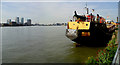
Your daily lifestyle in SE10 0HX is supported by a dense network of amenities within practical reach. You have immediate access to Sainsburys Greenwich, Iceland Trafalgar, and Co-op Greenwich for your shopping needs. These retailers are located nearby, ensuring you do not need to travel far for groceries or household essentials. Local transport links include rail services at Westcombe Park, Maze Hill Railway Station, and Charlton Station. You can also utilise the Docklands Light Railway at IFS Cloud Greenwich Peninsula, North Greenwich, and Island Gardens. Water connectivity is equally strong, with ferries departing from Royal Wharf Pier, Greenwich Pier, and North Greenwich Pier. You could reach London City Airport for short travel requirements from your doorstep. Five rail stations and five DLR stops nearby provide unparalleled flexibility for your commute. The presence of five ferry piers offers an alternative mode of transport for weekend trips or leisurely days out. Living here means you can practically walk to supermarkets or wait for a train in minutes, blending urban convenience with local community living.
Amenities
Schools
| Rank | School | Type | Entry gender | Ages |
|---|
Explore more schools in this area
Go to Schools tabDemographics
The population of SE10 0HX comprises 1,686 residents with a median age of 47 years. Most commonly, you will find adults between the ages of 30 and 64 living in this postcode. This age profile indicates a settled community of established households rather than young professionals or families in infancy. Home ownership accounts for just 22% of residents, meaning the vast majority live in rented properties. Flats are the predominant accommodation type, reflecting the urban density and housing stock typical of this part of London. The ethnic composition is predominantly White, contributing to a community with established residential patterns over time. With fewer than one in five residents owning their home, the market dynamics here differ from typical suburban areas where equity building is the norm. This concentration of renters suggests a location where flexibility is valued alongside lifestyle choices. The demographic makeup reflects a stable, mature population that has chosen this specific cluster for living, whether through long-term tenancy or purchase. Understanding these figures helps clarify the day-to-day character of the neighbourhood and the expectations of your potential neighbours.
Household Size
Accommodation Type
Tenure
Ethnic Group
Religion
Household Composition
Age
Household Deprivation
NS-SEC
Explore more demographic insights in this area
Go to Demographics tabPlanning
Planning Constraints
- Flood RiskPremium
- Ramsar Wetland SitesPremium
- Area of Outstanding Natural BeautyPremium
- Protected Nature ReservePremium
- Protected WoodlandPremium