Area Overview for SE10 0HW
Photos of SE10 0HW
Area Information
SE10 0HW is a compact residential cluster covering 6127 square metres in south-east London. This specific postcode serves a population of 1686 people, creating a dense living environment where neighbours are rarely far away. The area's small footprint means daily routines often revolve on foot, with essential services and transit hubs within immediate reach. Living in SE10 0HW involves navigating a high-density neighbourhood where space is at a premium. The proximity to major transport links defines the daily rhythm for residents, who commute to central London or take leisure trips with ease. For those seeking a ground-level existence close to the action, this postcode offers direct access to the amenities of Greenwich and beyond. The community functions as a tight-knit pocket within a larger urban fabric, balancing the convenience of city living with the intensity of a populated zone. Homebuyers here appreciate the straightforward geography that eliminates long detours for daily necessities. The area remains a significant residential hub, catering to individuals and families who prioritise connectivity and central location over sprawling green spaces.
- Area Type
- Postcode
- Area Size
- 6127 m²
- Population
- 1686
- Population Density
- 6685 people/km²
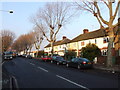
Homes in SE10 0HW consist primarily of flats, which aligns with the area's classification as a small residential cluster. The data shows that just 22% of residents in this postcode are homeowners. Consequently, the market is heavily weighted towards renting, with 78% of occupants likely living in tenanted properties. This high rental penetration means that many selling listings from landlords or sellers who have recently rented out their units. Buyers looking at this area must consider the fluid nature of the housing stock, where properties turnover frequently. The dominance of flats suggests a design focused on vertical living rather than spreading out horizontally. For investors, the high rental ratio implies consistent demand from the broader market. Existing homeowners make up a minority of the population, meaning the community features a mix of long-term renters and short-term leases. Purchasing a home here requires navigating a market where inventory availability fluctuates based on landlord decisions rather than a stable pool of owner-occupiers.
House Prices in SE10 0HW
Showing 45 properties
| Address | Type | Beds | Baths | Last Sale Price | Last Sale Date | |
|---|---|---|---|---|---|---|
| 24 Caletock Way, Greenwich, SE10 0HW | Detached | 2 | 1 | £500,000 | Jun 2025 | |
| 30 Caletock Way, Greenwich, SE10 0HW | Terraced | 2 | 1 | £393,000 | Jun 2024 | |
| 18 Caletock Way, Greenwich, SE10 0HW | house | - | - | £500,000 | Dec 2021 | |
| 21 Caletock Way, Greenwich, SE10 0HW | Terraced | 3 | 1 | £470,000 | Jun 2021 | |
| 32 Caletock Way, Greenwich, SE10 0HW | Semi-detached | - | - | £405,000 | Feb 2018 | |
| 23 Caletock Way, Greenwich, SE10 0HW | house | - | - | £360,000 | Sep 2015 | |
| 1 Caletock Way, Greenwich, SE10 0HW | house | 5 | - | £310,000 | Feb 2012 | |
| 26 Caletock Way, Greenwich, SE10 0HW | Terraced | - | - | £285,000 | Sep 2007 | |
| 44 Caletock Way, Greenwich, SE10 0HW | Terraced | 2 | 1 | £198,000 | Jul 2006 | |
| 16 Caletock Way, Greenwich, SE10 0HW | Terraced | 4 | 2 | £200,000 | Sep 2005 |
Energy Efficiency in SE10 0HW
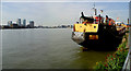
Daily life in SE10 0HW revolves around practical convenience with five key retail locations within easy reach. Sainsburys Greenwich, Iceland Trafalgar, and Co-op Greenwich serve as the primary shopping destinations for residents. Dining and grocery needs are met without requiring a car trip beyond the immediate vicinity. Leisure activities are equally accessible, with five nearby metro stations offering links to cultural attractions. Residents can access the IFS Cloud Greenwich Peninsula, Island Gardens, and North Greenwich via public transport. Water-based recreation is supported by five ferry terminals, including Greenwich Pier, Royal Wharf Pier, and North Greenwich Pier, which provide views and pathways along the Thames. For air travel, London City Airport is one stop away, making business trips or leisure flights convenient. The proximity to these specific venues means residents do not need to travel far for shops, parks, or transport hubs. Living in SE10 0HW means having a compact toolkit of amenities that cover food, culture, and travel. The layout of nearby stations ensures that a short walk to a rail or metro stop is a standard part of the daily routine.
Amenities
Schools
| Rank | School | Type | Entry gender | Ages |
|---|
Explore more schools in this area
Go to Schools tabDemographics
The community within SE10 0HW has a mature character, with a median age of 47 years. Adults aged between 30 and 64 years form the most common age range, suggesting a neighbourhood dominated by families or professionals later in their careers. Only 22% of residents own their homes outright, indicating that the vast majority rent their properties. This rental profile shapes the local market dynamics and tenancy expectations. Flats constitute the predominant accommodation type, reflecting the area's high-density planning and limited building land. The population is predominantly White, forming the core of the demographic make-up. With a population density of 275173 people per square kilometre, living in SE10 0HW means residing in one of the most intensely populated postcodes in England. One individual effectively occupies less than 20 square metres of land on average, highlighting the紧凑 nature of the housing stock. This data confirms that the area appeals to those comfortable with high-rise living and shared communal spaces rather than detached houses on private grounds.
Household Size
Accommodation Type
Tenure
Ethnic Group
Religion
Household Composition
Age
Household Deprivation
NS-SEC
Explore more demographic insights in this area
Go to Demographics tabPlanning
Planning Constraints
- Flood RiskPremium
- Ramsar Wetland SitesPremium
- Area of Outstanding Natural BeautyPremium
- Protected Nature ReservePremium
- Protected WoodlandPremium