Area Overview for SE10 0GZ
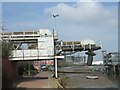
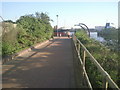
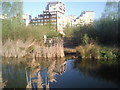
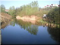
Photos of SE10 0GZ


Area Information
Living in SE10 0GZ means residing within a defined residential cluster covering just 2,225 square metres. This postcode area serves 1,280 people, creating a dense living environment compared to the wider region. The high population density of 575,347 people per square kilometre reflects the compact nature of this postcodes' footprint. You will find a distinct residential character rather than sprawling suburbs. The area functions as a concentrated hub of habitation within the broader Greenwich landscape. Daily life here revolves around the immediate proximity of major transport links and urban amenities. Despite its small physical size, the location provides access to vast opportunities through nearby rail, metro, and river crossing points. The community is tightly knit given the limited square footage of the zone. Prospective buyers must consider the intensity of living in such a confined yet well-connected space. The area attracts those who prioritise accessibility over extensive private grounds. The social fabric is shaped by the concentration of households in a very small geographic radius. You can easily navigate to work, leisure, and shopping without significant travel time. The distinct identity of SE10 0GZ comes from its role as a specific point of reference in the transport-rich borough. Residents benefit from a location that balances urban convenience with a managed population size.
- Area Type
- Postcode
- Area Size
- 2225 m²
- Population
- 1280
- Population Density
- 8040 people/km²
The property market in SE10 0GZ is heavily skewed towards leasehold arrangements. With home ownership standing at just 36%, you encounter a neighbourhood where rentals vastly outnumber owned properties. This imbalance defines the housing stock as primarily consisting of flats designed for urban living. The high density of the 2,225 square metre area supports this vertical rather than horizontal construction. Buyers considering this area must weigh the implications of a 64% tenancy rate against the security of ownership. The prevalence of flats means you will likely compete with both local tenants and external investors for available units. This dynamic can influence pricing and rental yield potential for landlords. Conversely, for those seeking to buy, the market may offer entry points at a lower threshold compared to owner-occupied districts. The limited number of freehold homes creates a specific type of marketplace. Most transactions involve lease renewals, new tenancy agreements, or sales within a block of flats. The area does not feature extensive detached housing or large family homes. Your search should focus on flats that meet your needs within the constraints of this dense cluster. Understanding the 36% ownership figure is crucial for assessing competition and future resale options in SE10 0GZ.
House Prices in SE10 0GZ
Showing 11 properties
Energy Efficiency in SE10 0GZ
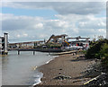
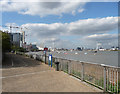
Your lifestyle in SE10 0GZ benefits from immediate access to a wide array of practical amenities. Retail needs are met by candidates such as the Co-op Greenwich, Aldi Charlton, and Asda Charlton, ensuring daily shopping is convenient for flats in the area. You can reach five ferry terminals including Barrier Gardens Pier for river cruises or sea travel. Transport hubs like Westcombe Park and Maze Hill Railway Station integrate seamlessly into your daily commute. leisure and airport access are equally accessible. Five metro stations including the IFS Cloud Greenwich Peninsula location provide direct links to entertainment district. London City Airport sits nearby, offering quick access for business travellers or holidaymakers. Five rail options reinforce the centrality of this postcode for travel-bound residents. The concentration of amenities creates a self-sufficient environment within short reach. Daily life involves navigating a cluster of commercial and transport facilities that serve the 1,280 local population efficiently. You do not need to travel far for groceries, waterways, or train tickets. The proximity of five ferry stops and five rail stations means waterfront and rail journeys are equally viable. Your routine will involve these named venues for both essential errands and recreational trips. The area supports a functional urban lifestyle without requiring extensive outward travel.
Amenities
Schools
| Rank | School | Type | Entry gender | Ages |
|---|
Explore more schools in this area
Go to Schools tabDemographics
The community in SE10 0GZ reflects a mature demographic profile with a median age of 47 years. Most residents fall within the 30 to 64-year-old range, indicating a population in their working or retirement years. Home ownership sits at 36%, suggesting that a majority of households operate under rental tenancies. This statistic informs the local market dynamics and tenant expectations significantly. Accommodation types are predominantly flats, aligning with the high density and urban setting of the postcode. The predominant ethnic group is White, which defines the current cultural makeup of the neighbourhood. You are engaging with a settled population that has matured within this specific 2,225 square metre zone. The age distribution suggests stability rather than a influx of young families or students. Local life is influenced by the established nature of the residents. The lower rate of ownership may point towards leasehold properties or rental blocks common in dense London locations. Demographic consistency helps form predictable community patterns. Age-related factors may influence local demand for specific services or amenities. The data paints a picture of a stable, middle-aged population living primarily in flat accommodation.
Household Size
Accommodation Type
Tenure
Ethnic Group
Religion
Household Composition
Age
Household Deprivation
NS-SEC
Explore more demographic insights in this area
Go to Demographics tabPlanning
Planning Constraints
- Flood RiskPremium
- Ramsar Wetland SitesPremium
- Area of Outstanding Natural BeautyPremium
- Protected Nature ReservePremium
- Protected WoodlandPremium