Area Overview for SE10 0GU
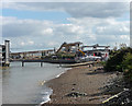
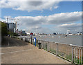
Photos of SE10 0GU


Area Information
SE10 0GU encompasses a specific postcode area covering a small residential cluster in south-east London. You are looking at a zone measuring just 3580 square metres, which houses a population of 1280 people. This compact footprint creates a highly concentrated living environment where daily interactions with neighbours feel immediate. The area sits at an extreme population density of 357539 people per square kilometre, indicating a space where every lot is developed and space is at a premium. Residents here navigate a tight-knit community defined by its geographical limitations rather than sprawling expansion. Daily life in SE10 0GU revolves around efficient access to nearby services because physical distances to shops or transport hubs are measured in short walks. The sheer concentration of people within such a small square kilometre means that the local infrastructure must support heavy usage. You experience a setting where urban convenience meets limited ground. This density ensures that you remain close to everything required for a modern routine without needing a car for short trips. The area represents a singular pocket of London life, characterised by its intense residential focus and the practical reality of living in a densely packed neighbourhood.
- Area Type
- Postcode
- Area Size
- 3580 m²
- Population
- 1280
- Population Density
- 8040 people/km²
The property market in SE10 0GU is defined by a heavy reliance on flat-style accommodation. The data confirms that flats constitute the primary accommodation type for residents in this specific postcode. With only 36% home ownership, the area functions largely as a rental hub where tenancies change hands more frequently than in owner-occupied suburbs. This dynamic suggests a high volume of available homes for rent rather than tied-up equity sales. Buyers looking at this small residential cluster face a competition focused on the existing stock of flats rather than new-build family houses. The concentration of flats means you are entering a market where square footage is at a premium and layouts are optimised for urban living. Given the high density and the low ownership percentage, the streets of SE10 0GU are filled with tenants moving between properties. If you are seeking to purchase a home here, you are likely buying into a second-hand or non-new-build market. The 36% ownership figure indicates that capital growth might be driven by rental demand trends rather than owner-occupier spikes. When viewing homes in SE10 0GU, expect to see a vast majority of units designed as apartments or flats within tightly packed buildings.
House Prices in SE10 0GU
Showing 87 properties
Energy Efficiency in SE10 0GU
Your daily life in SE10 0GU is anchored by a strong network of amenities located within practical reach. For shopping needs, five key retail options are nearby, including Co-op Greenwich, Aldi Charlton, and Asda Charlton. These supermarkets ensure you can stock your weekly provisions with minimal travel. Beyond groceries, you have access to five ferry crossings from locations like Royal Wharf Pier, North Greenwich Pier, and Barrier Gardens Pier. This ferry network offers direct links to destinations such as the Greenwich Peninsula and Canary Wharf, providing a unique alternative to bus or train travel. Transport links are further reinforced by five rail stations, including Westcombe Park, Charlton Station, and Maze Hill Railway Station. Additionally, five metro stations serve the area, featuring IFS Cloud Greenwich Peninsula, West Silvertown DLR Station, and North Greenwich. You also have one bus interchange, Whipps Cross Bus Interchange, and one airport, London City Airport, in close proximity. For residents there is a comprehensive suite of daily services. Whether you prefer a train, a driverless metro pod, or a scenic boat ride, you can reach your destination quickly.
Amenities
Schools
| Rank | School | Type | Entry gender | Ages |
|---|
Explore more schools in this area
Go to Schools tabDemographics
The community profile of SE10 0GU reflects a predominantly adult population with a median age of 47 years. Most residents fall into the age range between 30 and 64 years, suggesting a neighbourhood populated by established adults rather than young professionals or families with pre-school children. This age skew often correlates with a stable, settled lifestyle within the local clusters. Only 36% of the population own their homes outright, meaning the majority rely on the rental market or are in stages of purchasing plans. The dominant accommodation type is flats, which aligns perfectly with the high-density urban nature of this small postcode. The population is predominantly White, mirroring the broader ethnic makeup of south-east London. You should note that the very high population density means you will interact closely with this specific demographic mix daily. Living in SE10 0GU involves sharing a vibrant local landscape primarily with working-age adults. The lack of significant youth or elderly concentration means schools and care facilities may be accessed primarily for external needs rather than proximity. Your neighbours are likely career-focused individuals who value the flat-living convenience offered by this specific postcode cluster.
Household Size
Accommodation Type
Tenure
Ethnic Group
Religion
Household Composition
Age
Household Deprivation
NS-SEC
Explore more demographic insights in this area
Go to Demographics tabPlanning
Planning Constraints
- Flood RiskPremium
- Ramsar Wetland SitesPremium
- Area of Outstanding Natural BeautyPremium
- Protected Nature ReservePremium
- Protected WoodlandPremium