Area Overview for RM9 6NH
Photos of RM9 6NH
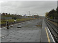
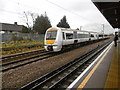
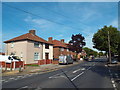
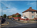

44 photos from this area
Area Information
Key information about the RM9 6NH including its size, population, and administrative classification.
- Area Type
- Postcode
- Area Size
- 1.6 hectares
- Population
- 1449
- Population Density
- 10343 people/km²
House Prices in RM9 6NH
51
Properties
£213,730
Average Sold Price
£60,000
Lowest Price
£365,000
Highest Price
Showing 51 properties
| Address | Type | Beds | Baths | Last Sale Price | Last Sale Date | |
|---|---|---|---|---|---|---|
| 117 Rowdowns Road, Dagenham, RM9 6NH | Terraced | 2 | 1 | £336,000 | Apr 2023 | |
| 107 Rowdowns Road, Dagenham, RM9 6NH | Terraced | 2 | 1 | £325,000 | Mar 2023 | |
| 93 Rowdowns Road, Dagenham, RM9 6NH | Terraced | 2 | 1 | £365,000 | Dec 2022 | |
| 85 Rowdowns Road, Dagenham, RM9 6NH | Terraced | 1 | 1 | £320,000 | Sep 2022 | |
| 103 Rowdowns Road, Dagenham, RM9 6NH | house | - | - | £342,500 | Jun 2022 | |
| 90 Rowdowns Road, Dagenham, RM9 6NH | Terraced | 2 | - | £346,500 | Dec 2021 | |
| 118 Rowdowns Road, Dagenham, RM9 6NH | house | - | - | £298,000 | Mar 2020 | |
| 116 Rowdowns Road, Dagenham, RM9 6NH | Terraced | 2 | 1 | £309,000 | Feb 2020 | |
| 110 Rowdowns Road, Dagenham, RM9 6NH | Terraced | 2 | 1 | £296,000 | May 2017 | |
| 114 Rowdowns Road, Dagenham, RM9 6NH | house | 1 | 1 | £260,000 | Nov 2015 |
Page 1 of 6
Energy Efficiency in RM9 6NH
Amenities
Schools
| Rank | School | Type | Entry gender | Ages |
|---|
Explore more schools in this area
Go to Schools tabDemographics
Household Size
Family (3-5 people)
most common
Accommodation Type
Houses
most common
Tenure
44
majority
Ethnic Group
White
most common
Religion
N/A
most common
Household Composition
N/A
most common
Age
47
median
Adults (30-64 years)
most common
Household Deprivation
N/A
with no deprivation
NS-SEC
20
in Lower managerial occupations
Explore more demographic insights in this area
Go to Demographics tabPlanning
Planning Constraints
- Flood RiskPremium
- Ramsar Wetland SitesPremium
- Area of Outstanding Natural BeautyPremium
- Protected Nature ReservePremium
- Protected WoodlandPremium