Area Overview for RM9 6BX
Photos of RM9 6BX
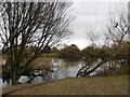
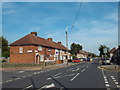
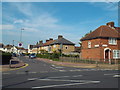
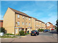
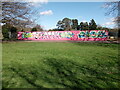

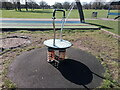
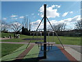
64 photos from this area
Area Information
Key information about the RM9 6BX including its size, population, and administrative classification.
- Area Type
- Postcode
- Area Size
- 1.7 hectares
- Population
- 2135
- Population Density
- 11718 people/km²
House Prices in RM9 6BX
62
Properties
£233,294
Average Sold Price
£48,000
Lowest Price
£425,000
Highest Price
Showing 62 properties
| Address | Type | Beds | Baths | Last Sale Price | Last Sale Date | |
|---|---|---|---|---|---|---|
| 352 Hedgemans Road, Dagenham, RM9 6BX | Terraced | 3 | 1 | £425,000 | Sep 2023 | |
| 316 Hedgemans Road, Dagenham, RM9 6BX | Terraced | 2 | 1 | £340,000 | Oct 2022 | |
| 320 Hedgemans Road, Dagenham, RM9 6BX | Terraced | 2 | 1 | £350,000 | May 2022 | |
| 318 Hedgemans Road, Dagenham, RM9 6BX | house | 2 | 1 | £355,000 | May 2022 | |
| 285 Hedgemans Road, Dagenham, RM9 6BX | house | - | - | £305,000 | Jun 2021 | |
| 273 Hedgemans Road, Dagenham, RM9 6BX | house | 3 | - | £380,000 | May 2021 | |
| 378 Hedgemans Road, Dagenham, RM9 6BX | house | 2 | 1 | £318,000 | Mar 2019 | |
| 289 Hedgemans Road, Dagenham, RM9 6BX | Terraced | 3 | 1 | £365,000 | Sep 2018 | |
| 267 Hedgemans Road, Dagenham, RM9 6BX | Terraced | 3 | 2 | £345,000 | Feb 2018 | |
| 372 Hedgemans Road, Dagenham, RM9 6BX | Terraced | 2 | 2 | £315,000 | May 2017 |
Page 1 of 7
Energy Efficiency in RM9 6BX
Amenities
Schools
| Rank | School | Type | Entry gender | Ages |
|---|
Explore more schools in this area
Go to Schools tabDemographics
Household Size
Family (3-5 people)
most common
Accommodation Type
Houses
most common
Tenure
42
majority
Ethnic Group
White
most common
Religion
N/A
most common
Household Composition
N/A
most common
Age
47
median
Adults (30-64 years)
most common
Household Deprivation
N/A
with no deprivation
NS-SEC
21
in Lower managerial occupations
Explore more demographic insights in this area
Go to Demographics tabPlanning
Planning Constraints
- Flood RiskPremium
- Ramsar Wetland SitesPremium
- Area of Outstanding Natural BeautyPremium
- Protected Nature ReservePremium
- Protected WoodlandPremium